  |
The Scottish HighlandsMeall na Meoig
|
  |
| |
The Scottish HighlandsMeall na Meoig
|
|
Photographs of an ascent of the Corbett Meall na Meoig
above Rannoch Moor in the Central Highlands of Scotland
With views of Ben Nevis, Ben Alder, Beinn Bheoil,
Loch Ericht, Buachaille Etive Mor
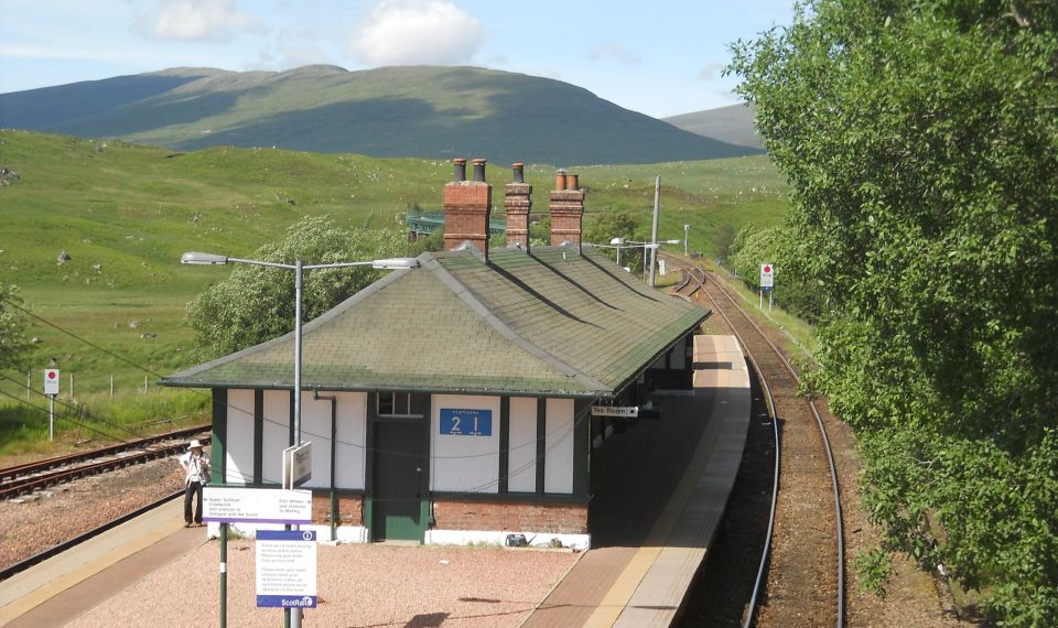
Railway station at Rannoch The West
Highland Line (
"Iron Road to the Isles" )
links the ports of Mallaig and Oban to Glasgow. The line has been voted the top rail journey in the world by readers of Wanderlust. The ScotRail website has reported that the line has been voted the most scenic railway line in the world. |
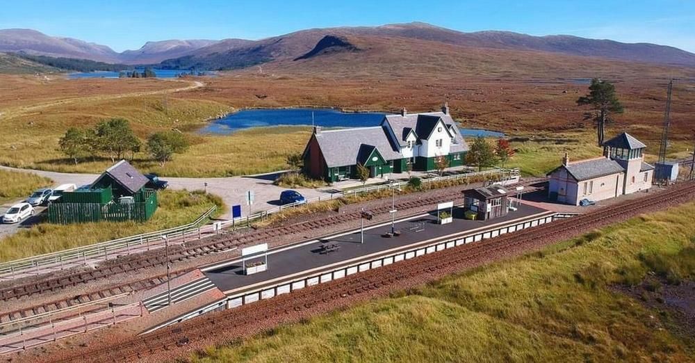
Railway station at Rannoch |
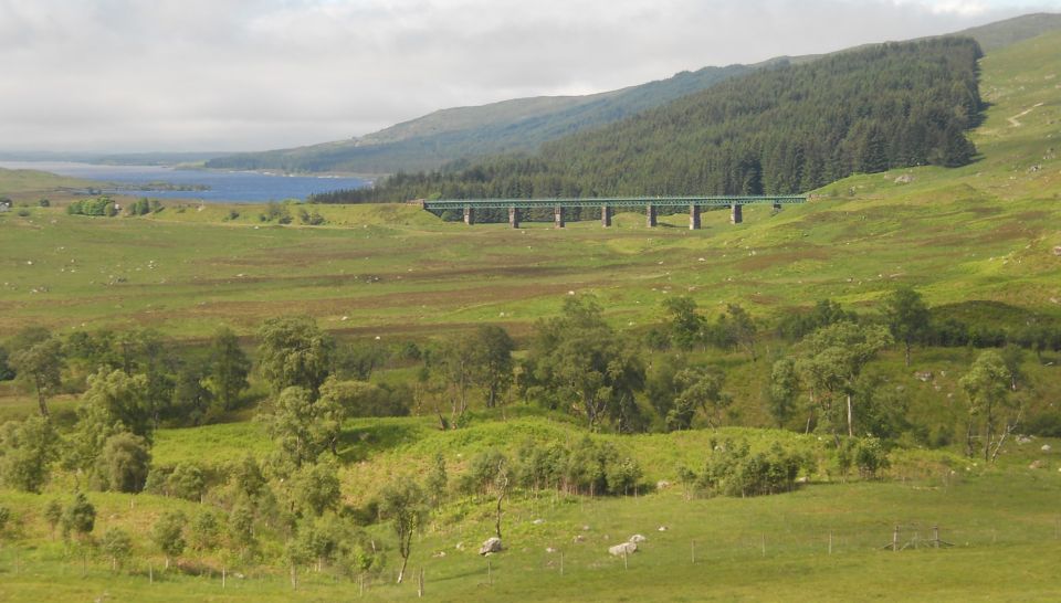
Loch Laidon and railway viaduct at Rannoch |
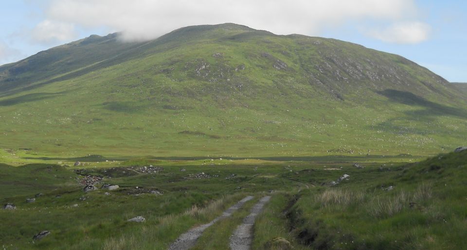
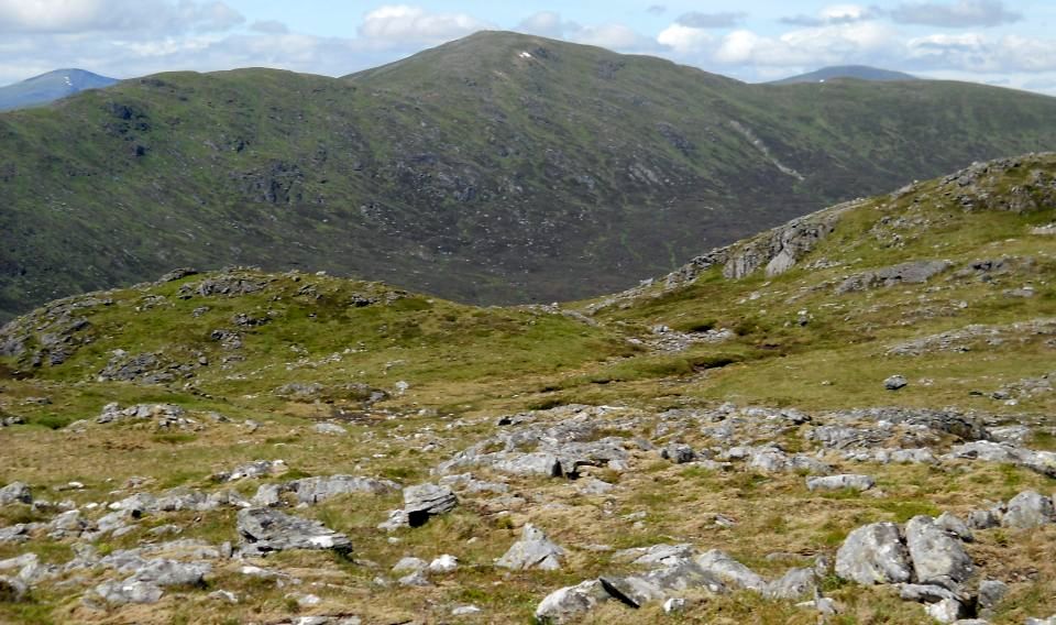
Meall na
Meoig from the "Road to the Isle" |
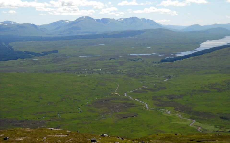
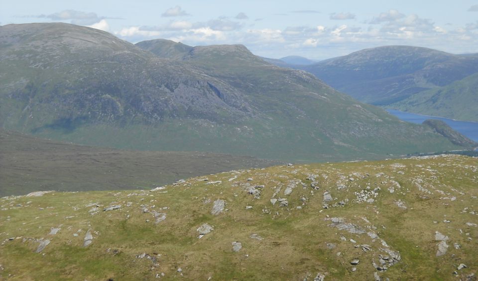
Rannoch
Moor
and the "Road to the Isle" on the ascent of Meall na Meoig Rannoch
Moor is a large expanse of around
50 square miles (130 km² )
of boggy moorland to the west of Loch Rannoch Rannoch Moor is designated a Site
of Special Scientific Interest (
SSSI )
and a Special Area of Conservation |
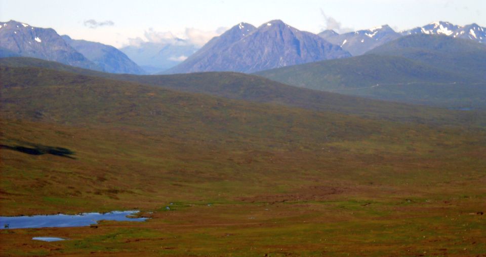
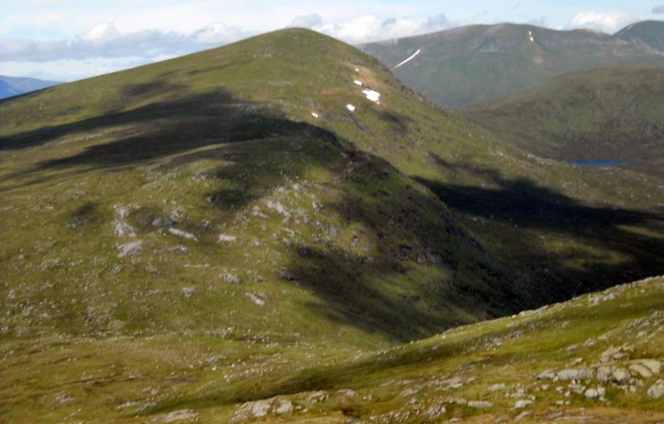
Buachaille Etive Mor in Glencoe from Meall na Meoig |
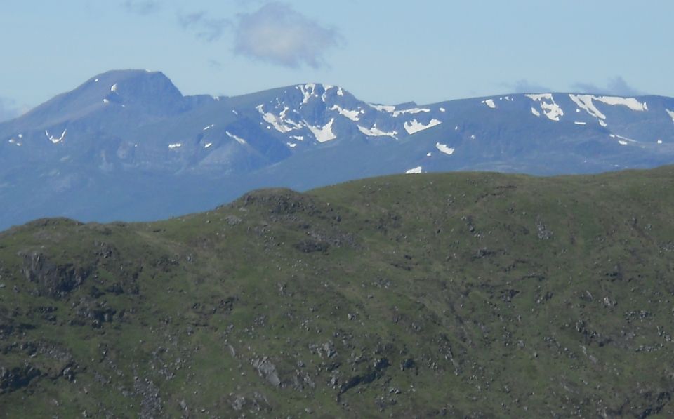
from Meall na Meoig |
and Loch Erich from Meall na Meoig |
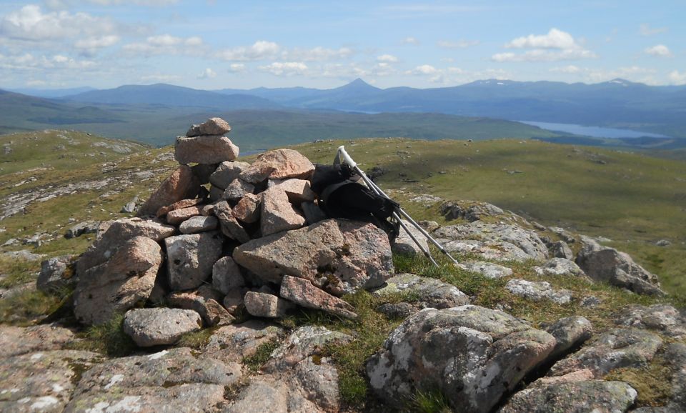
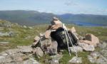
Schiehallion and Loch Rannoch from summit of Meall na Meoig ( 2848ft, 868m ) Meall na Meoig is the highest
of the summits of Beinn Pharlagain |
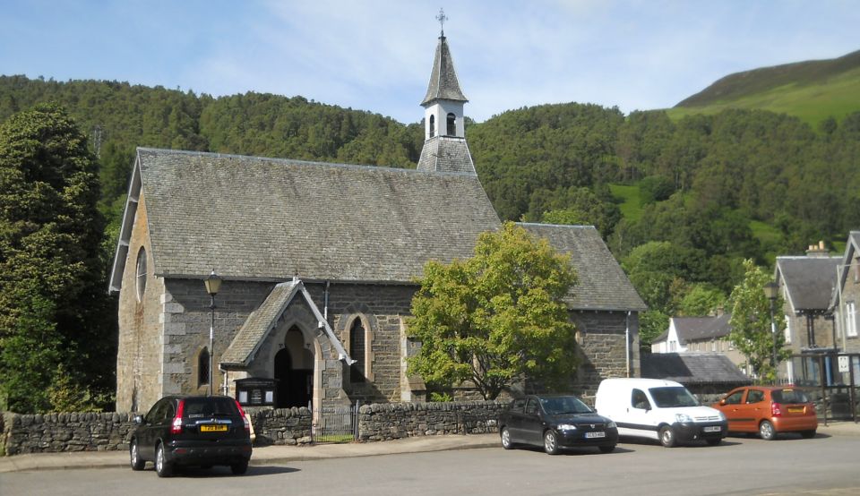
Church in Kinloch Rannoch |
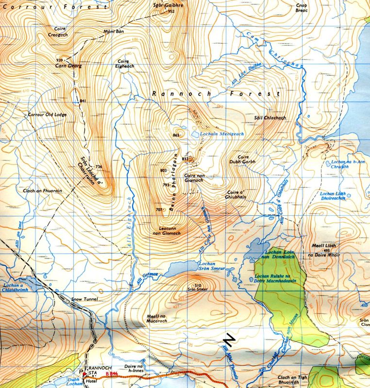
Map of Meall na Meoig ( Note: Click here or on above for larger format copy ) |
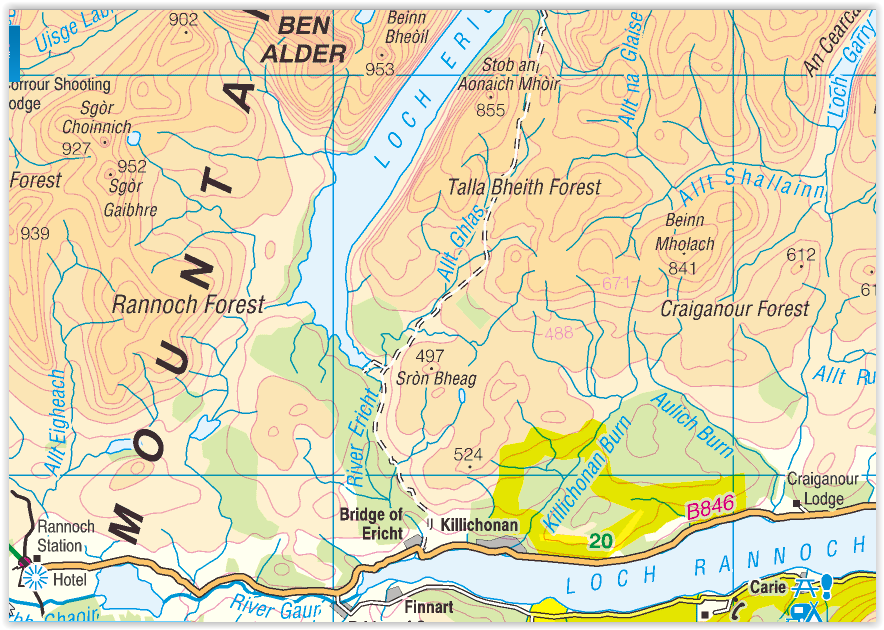
Map of Rannoch Region |
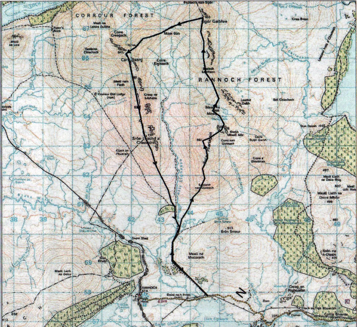
Route Map of Meall na Meoig |
The Road to the Isles,
Grade: Moderate mountain walk
Distance: 15 miles/25km
Time: 7-9 hours
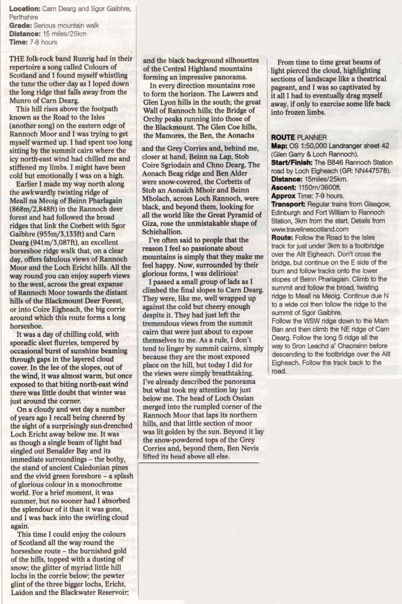
It was one of those moments that can turn a dour day into a memorable one, as though someone has drawn the curtains apart to allow daylight into a darkened room. With cloud down to about a thousand feet I had been navigating by map and compass for much of the morning, a worthy exercise in itself but hardly one that leads to transcendental mountain experiences.
I had made my way north along the rather awkwardly twisting ridge of Meall na Meoig of Beinn Pharlagain in the Rannoch deer forest and had more or less resigned myself to a dark day in the clouds. But as I dropped down towards the broad col that lies below Meall na Meoig’s northern neighbour, the Munro of Sgor Gaibhre, the clouds were suddenly swept aside and I gazed down on a surprisingly sun-drenched Loch Ericht. It was as though a single beam of light had singled out Benalder Bay and its immediate surroundings - the bothy, the stand of ancient Caledonian pines and the vivid green foreshore — a splash of glorious colour in a monochrome world. For a brief moment, spring didn’t seem so far away. It was like a promise of things to come and you’ve no idea how it cheered me up. Almost inevitably the cloud soon ‘wrapped itself around me again and I tramped on over the two Munros of Sgor Gaibhre and Carn Dearg. Now and again holes in the clouds offered tantalising glimpses ofsomething other than my compass dial, reminding me of the fabulous position of these hills that lie between the eastern edges of the brooding Rannoch Moor and the foot of Loch Ericht.
Many walkers travel to these hills by train, as the West Highland line has handy stations at Rannoch and Corrour. With a whole bunch of other Munros in the area, either stop makes a terrific place for a weekend away, staying perhaps in the bunkhouse at Corrour or the SYHA hostel at lovely Loch Ossian. I can personally recommend both the tearoom at Rannoch Station and the one at Corrour.
Alternatively, Sgor Gaibhre (3133ft/955m) and Carn Dearg (3087ft) can be climbed from the south along with the Corbett of Meall na Meoig (2848ft) in an excellent horseshoe ridge walk that, on a clear day, offers fabulous views of both the Rannoch Moor and the Loch Ericht hills. All the way round you can enjoy great views to the west, across the great expanse of the Rannoch Moor towards the distant hills of the Blackmount Deer Forest, or into Coire Eigheach, the big corrie around which this route forms a great horseshoe.
The advantage of this route is that you’re not dependent on train times —you can drive there. Park to the north of Loch Eigheach and take the Road to the Isles track to the footbridge over the Allt Eigheach. Just north of the bridge you start climbing the Leacann nan Giomach slopes of Beinn Pharlagain. to reach the twisty ridge that leads to the Corbett. Both Munros can then be linked by high, broad ridges. A number of years ago I enjoyed a longer trip in this area, taking in both Carn Dearg and Sgor Gaibhre.
ROUTE PLANNER
Map: OS 1:50,000 Landranger sheet 42 (Glen Garry & Loch Rannoch)
Start/finish: B846 Rannoch Station" road by Loch Eigheach (GR: NN447578)
Distance: 15miles/25km
Time: 7-9 hours
Route:
Route Description for Carn Dearg and Sgor Gaibhre |
Ben Nevis | Knoydart | Isle of Skye | Isle of Arran | The West Highland Way
The Eastern Highlands | The Central Highlands | The Southern Highlands | The NW Highlands