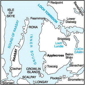
Munros Tables SMC The Munros - Scotland's Highest Mountains

  The Scottish Highlands


 Stac Pollaidh & Ben More Coigach
The High Mountains of Britain & Ireland Guide to Walks in NW Highlands


Stac Pollaidh in Wester Ross in the NW Highlands of Scotland

Stac Pollaidh

Stac Pollaidh rises near Assynt

in the NW Highlands of Scotland.

Its name means "peak of peat moss"

and it consists of Torridonian sandstone

more than 500 million years old.

Hillwalkers call it "Stack Polly".

The rugged top of Stac Pollaidh

suggests that the glaciers of Ice Age Scotland

never covered this peak


Stac Pollaidh in Wester Ross in the NW Highlands of Scotland

Stac Pollaidh


Stac Pollaidh in Wester Ross in the NW Highlands of Scotland

Stac Pollaidh


Stac Pollaidh in Wester Ross in the NW Highlands of Scotland

Stac Pollaidh


Stac Pollaidh in Wester Ross in the NW Highlands of Scotland

Stac Pollaidh


Stac Pollaidh in Wester Ross in the NW Highlands of Scotland

Stac Pollaidh


Stac Pollaidh in Wester Ross in the NW Highlands of Scotland

Stac Pollaidh


Stac Pollaidh in Wester Ross in the NW Highlands of Scotland

Stac Pollaidh


Stac Pollaidh in Wester Ross in the NW Highlands of Scotland

Stac Pollaidh


Stac Pollaidh in Wester Ross in the NW Highlands of Scotland

Stac Pollaidh


Stac Pollaidh in Wester Ross in the NW Highlands of Scotland

Stac Pollaidh


Stac Pollaidh in Wester Ross in the NW Highlands of Scotland

Stac Pollaidh


Stac Pollaidh in Wester Ross in the NW Highlands of Scotland

Stac Pollaidh


Stac Pollaidh in Wester Ross in the NW Highlands of Scotland

Stac Pollaidh


Lobster Claw on Stac Pollaidh in Wester Ross in the NW Highlands of Scotland

"Lobster Claw"

on Stac Pollaidh


Lobster Claw on Stac Pollaidh in Wester Ross in the NW Highlands of Scotland

"Lobster Claw"

on Stac Pollaidh


Stac Pollaidh in Wester Ross in the NW Highlands of Scotland

Stac Pollaidh


Stac Pollaidh in Wester Ross in the NW Highlands of Scotland

Stac Pollaidh


Stac Pollaidh in Wester Ross in the NW Highlands of Scotland

Stac Pollaidh


Stac Pollaidh in Wester Ross in the NW Highlands of Scotland

Stac Pollaidh


Stac Pollaidh in Wester Ross in the NW Highlands of Scotland

Stac Pollaidh


Cul Beag from Stac Pollaidh in Wester Ross in the NW Highlands of Scotland

Cul Beag

from Stac Pollaidh


Cul Beag from Stac Pollaidh in Wester Ross in the NW Highlands of Scotland

Cul Beag

from Stac Pollaidh


Cul Beag from Stac Pollaidh in Wester Ross in the NW Highlands of Scotland

Cul Beag

from Stac Pollaidh


View from Stac Pollaidh in Wester Ross in the NW Highlands of Scotland

View

from Stac Pollaidh


View from Stac Pollaidh in Wester Ross in the NW Highlands of Scotland

View

from Stac Pollaidh


Cul Beag in Wester Ross in the NW Highlands of Scotland

Cul Beag


Location Map for Stac Pollaidh and Cul Beag in Wester Ross in the NW Highlands of Scotland

Location Map for Stac Pollaidh

and Cul Beag


Ben More Coigach in the NW Highlands of Scotland

Ben More Coigach


Ben More Coigach in the NW Highlands of Scotland

Ben More Coigach


Ben More Coigach in the NW Highlands of Scotland

Ben More Coigach


Route Map for Ben More Coigach in the NW Highlands of Scotland

Route Map

for Ben More Coigach


Route Map for Ben More Coigach in the NW Highlands of Scotland

Route Map

for Ben More Coigach


BEN MORE COIGACH - ROUTE DESCRIPTION:


Location: Coigach and The Fiddler,
Wester Ross
Grade: Serious mountain walk
Distance: 10 miles/16km
Time: 67 hours

It was the ancient Norse who gave Ullapool its name. Ulli’s Steading was then, as it is now, a gentle oasis amid a harsh, mountainous landscape, but drive north from the town, over the spine of the Rhue peninsula, and you enter another world.
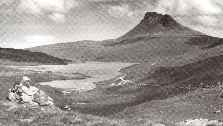
Ardmair is a magnificent spot. From the campsite a spit of white shingle curves gracefully out into the bay pointing towards the sanctuary of Isle Martin. Beyond, protecting the bay from the Minch gales, the Summer Isles float alluringly on their sea of green.
Flocks of dunlin and ringed plover feed on the salt flats, gulls wheel overhead and brightly coloured fishing boats bob and dip on the water, but for all these attractions of sea and shore it is a mountain which dominates the scene.
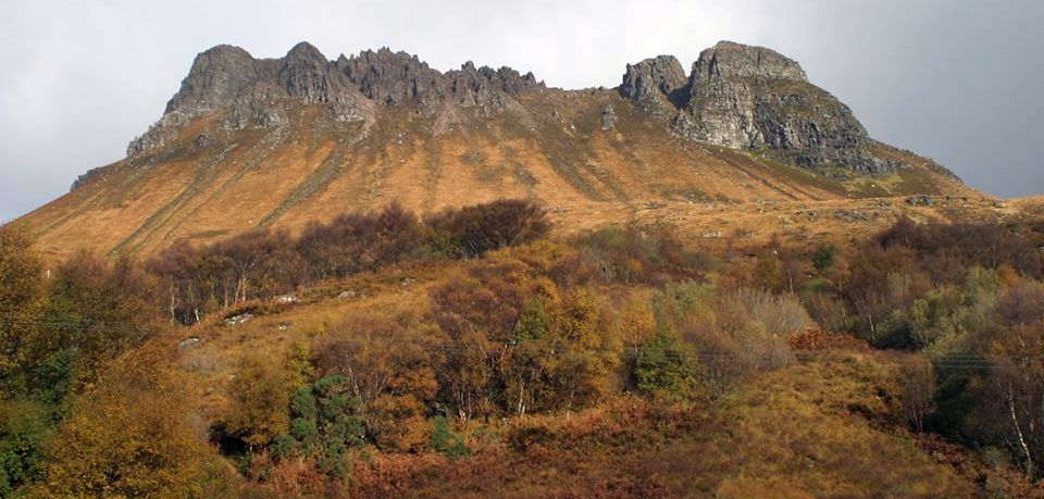
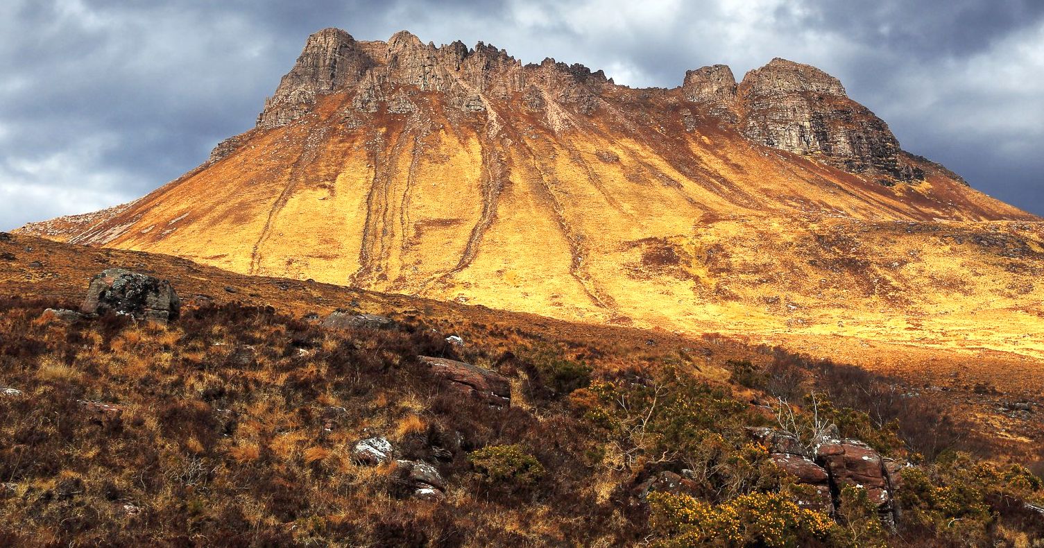
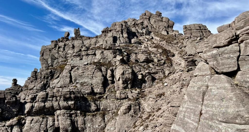
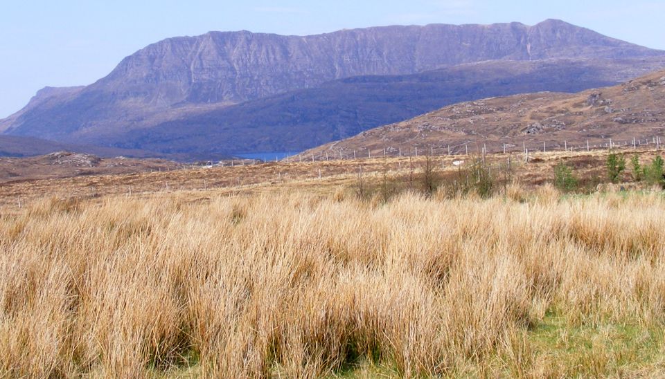
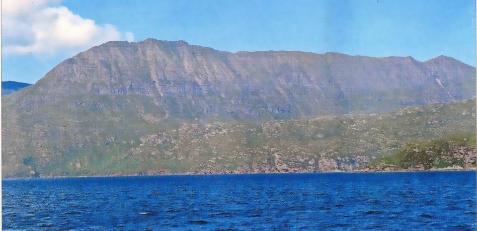
An extensive wall of weathered Torridonian sandstone commands the northern shore of the bay, an ancient relic of one of the oldest land masses in the world. The long sandstone barrier runs from Garbh Choireachain to Speicin Coinnich and is collectively known as Ben Mor Coigach. The hill's protective cap of Cambrian quartzite has long since gone, but the bare bones of this venerable relic still rise straight from the sea to nearly 750 metres, a wall of seamed buttresses, gullies and cliffs. While that seaward wall is impressive, it’s really only a front, hiding an intricate, complex system of peaks, ridges, corries and lochans. This area of Coigach is a gem. Unspoiled and challenging, it begins to reveal itself more fully as you drive further north. Ben Mor Coigach, 
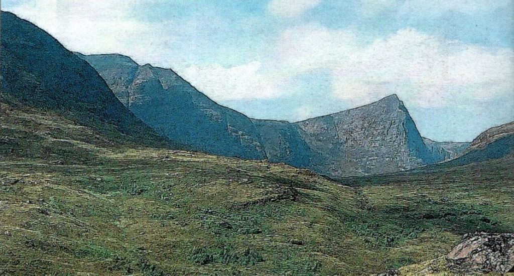
at 743m, is the highest summit, but the other main peak of the area, 
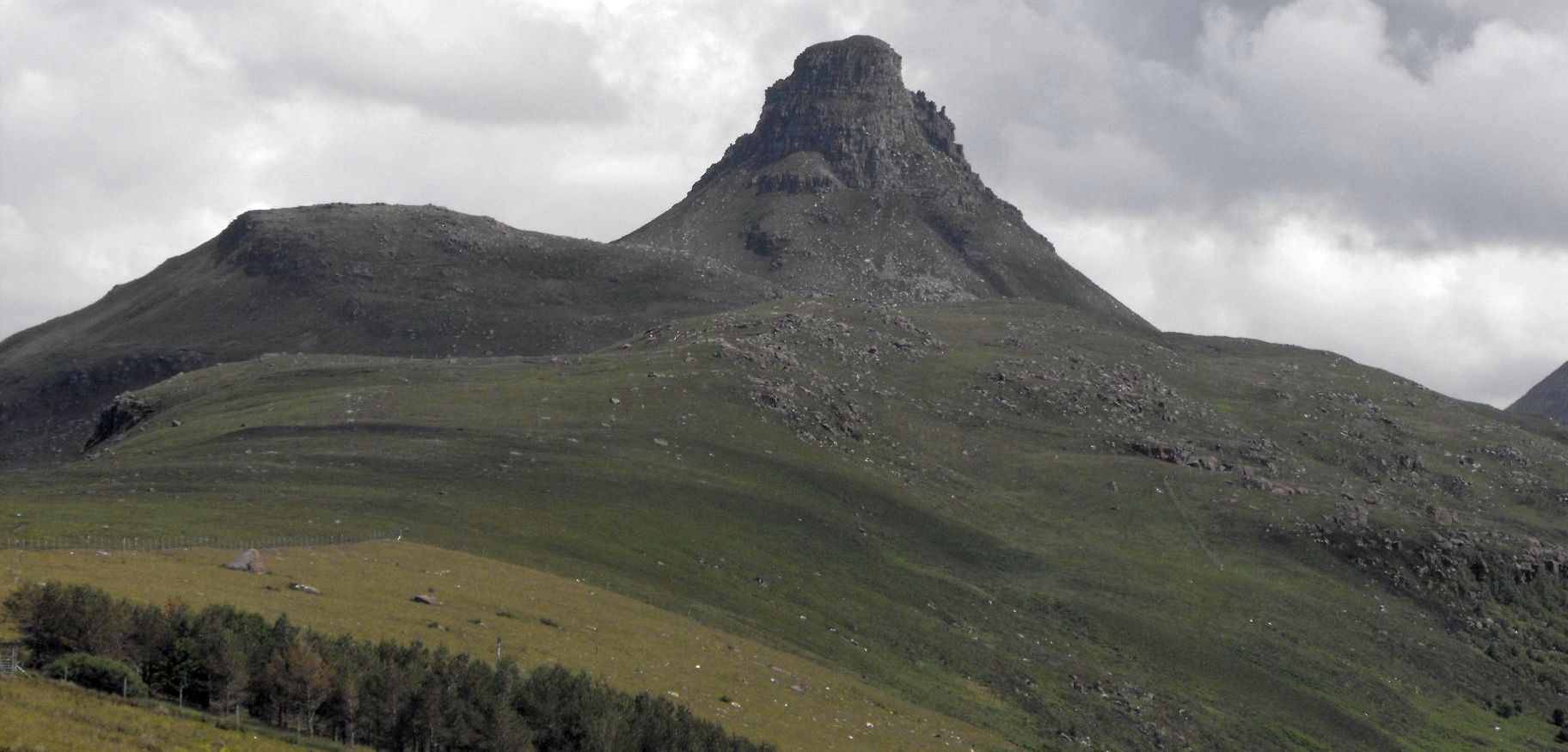
Sgurr an Fhidhleir, rises to a sharp and dramatic point. it’s a high eyrie of a summit, the culmination of a huge blade of rock that rises 
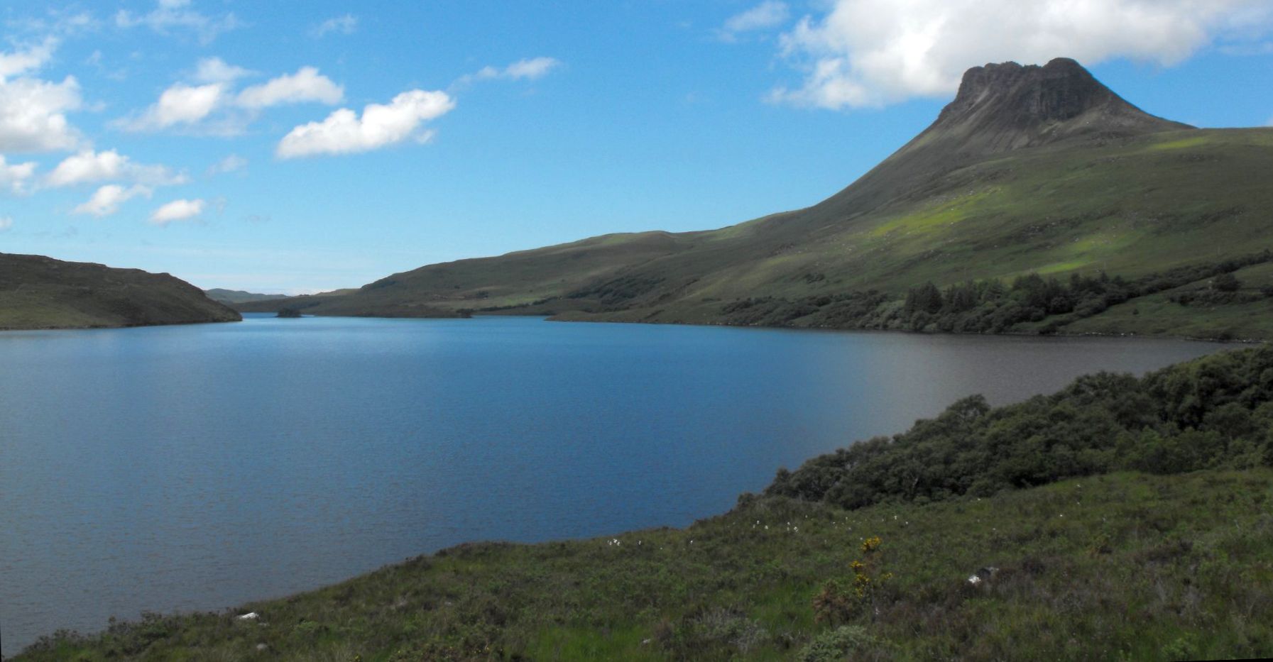
from the bare moorland close to the reflective waters of Lochan Tuath.
The traverse of these two hills brings together all the best characteristics of a walk which blends sea and mountain in that distinctive combination that you find only on Scotland’s westen seaboard. There's a peculiar quality to the blend here in Coigach, as though the spaciousness of the vast seascape emphasises the height of the hill, and you catch a notion you’re mounting a staircase to the heavens. Indeed, it’s perhaps not too fanciful to imagine the traverse of Ben Mor Coigach’s long south-west ridge beyond Ardmair Bay as a high-level promenade to Tir nan Og, the fabled Land of the Blest beyond the shimmering ocean of the Celtic twilight.
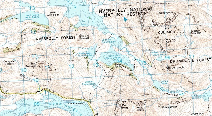
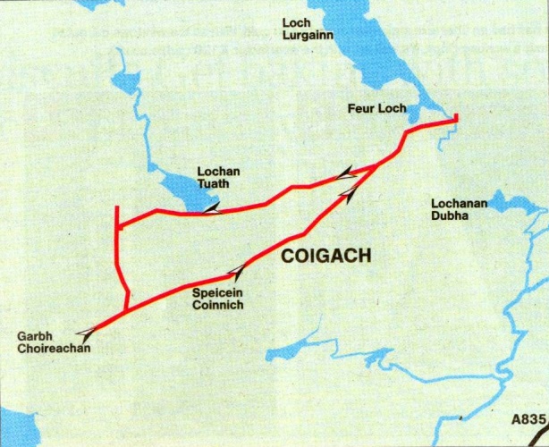
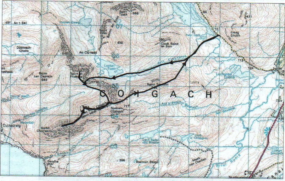
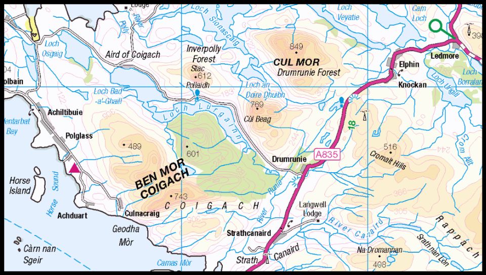
At Drumrunie junction on the A835 a minor road runs west towards Achiltibuie. As everyone else heads off to climb Stac Pollaidh, or fester on the pale yellow sands of Achnahaird Bay, park your vehicle and cross the river just east of Loch Lurgainn. A faint path, rising steadily on the 
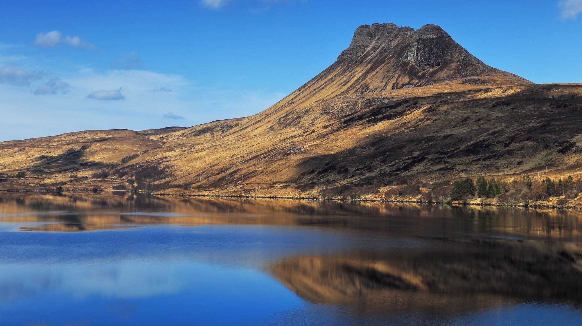
right bank of the Allt Claonaidh, will take you as far as Lochan Tuath, which 
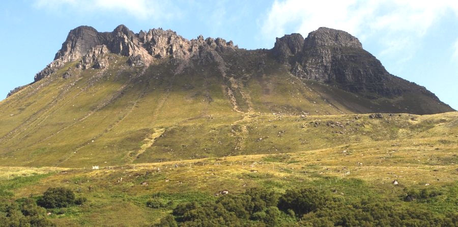
mirrors the mighty north-west prow of Sgurr an Fhidhleir — the peak of the fiddler.
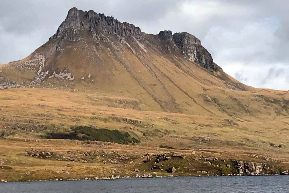
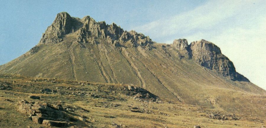
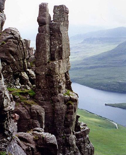
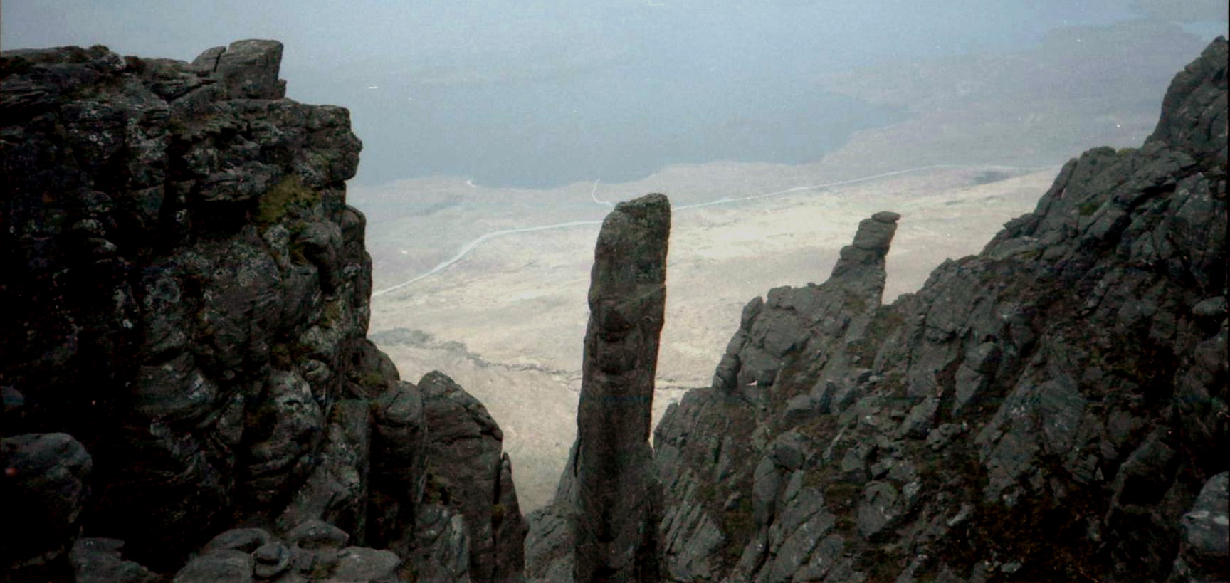
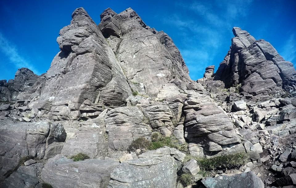
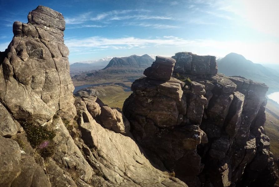
Walkers don’t follow the prow: that’s the domain of rock climbers who'll find a long and exposed climb of Very Severe standard.
South of the prow, a prominent heather-filled gully climbs steeply up to the bealach between The Fiddler and Ben Mor Coigach and from there easy 
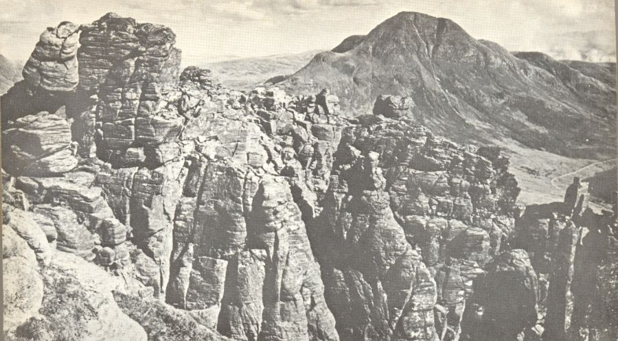
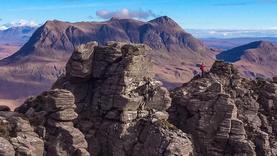
slopes lead to the summit of Sgurr an Fhidhleir, a stunning place 
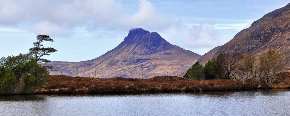
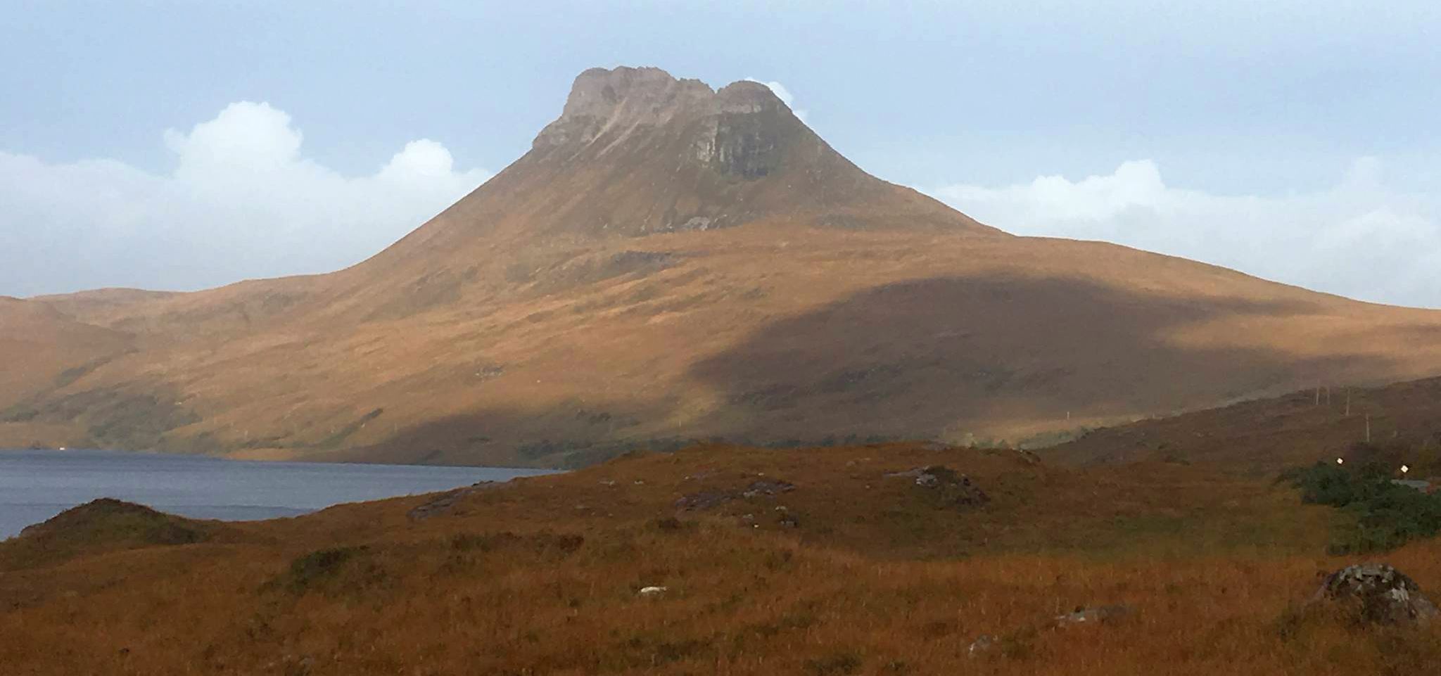
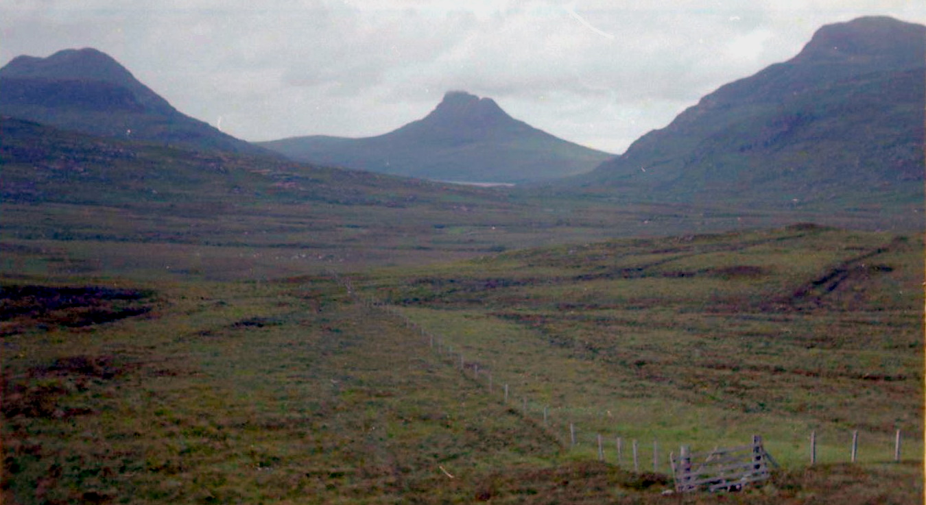
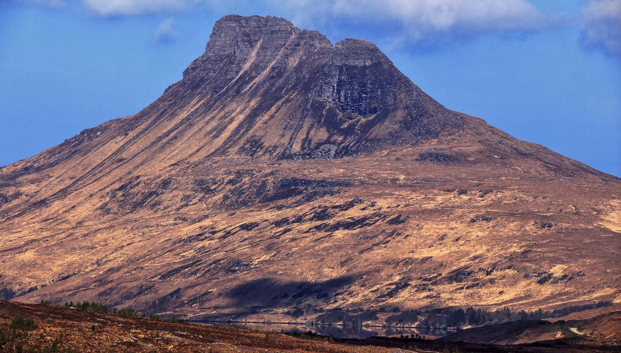
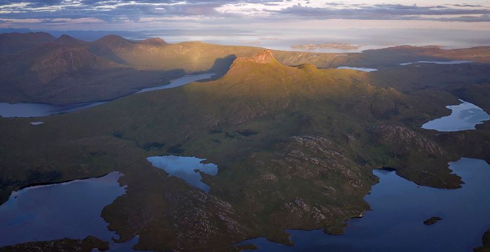
with magnificent views over the Inverpolly peaks - Cul Mor, Cul Beag and the 
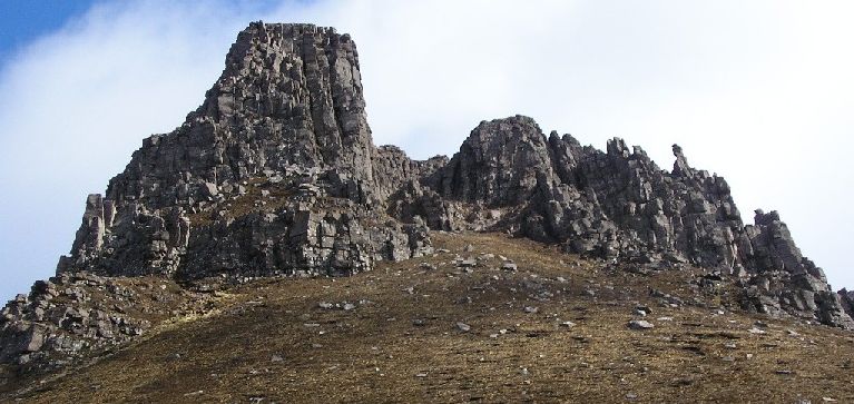
improbable outline of Stac Pollaidh. This hill has been described as a “mountain straight out of a fairy tale”, with a ragged and spiky crest looking for all the world like some primeval stegosaurus.
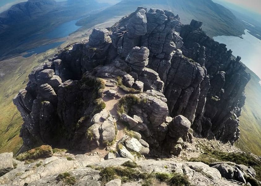
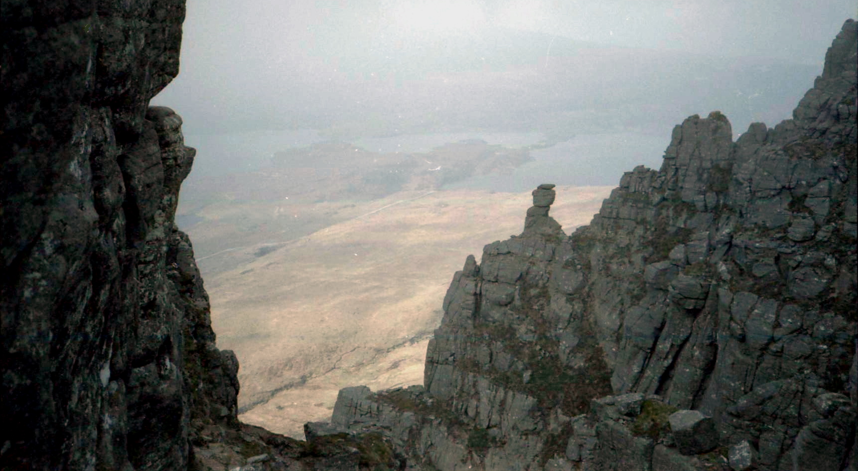
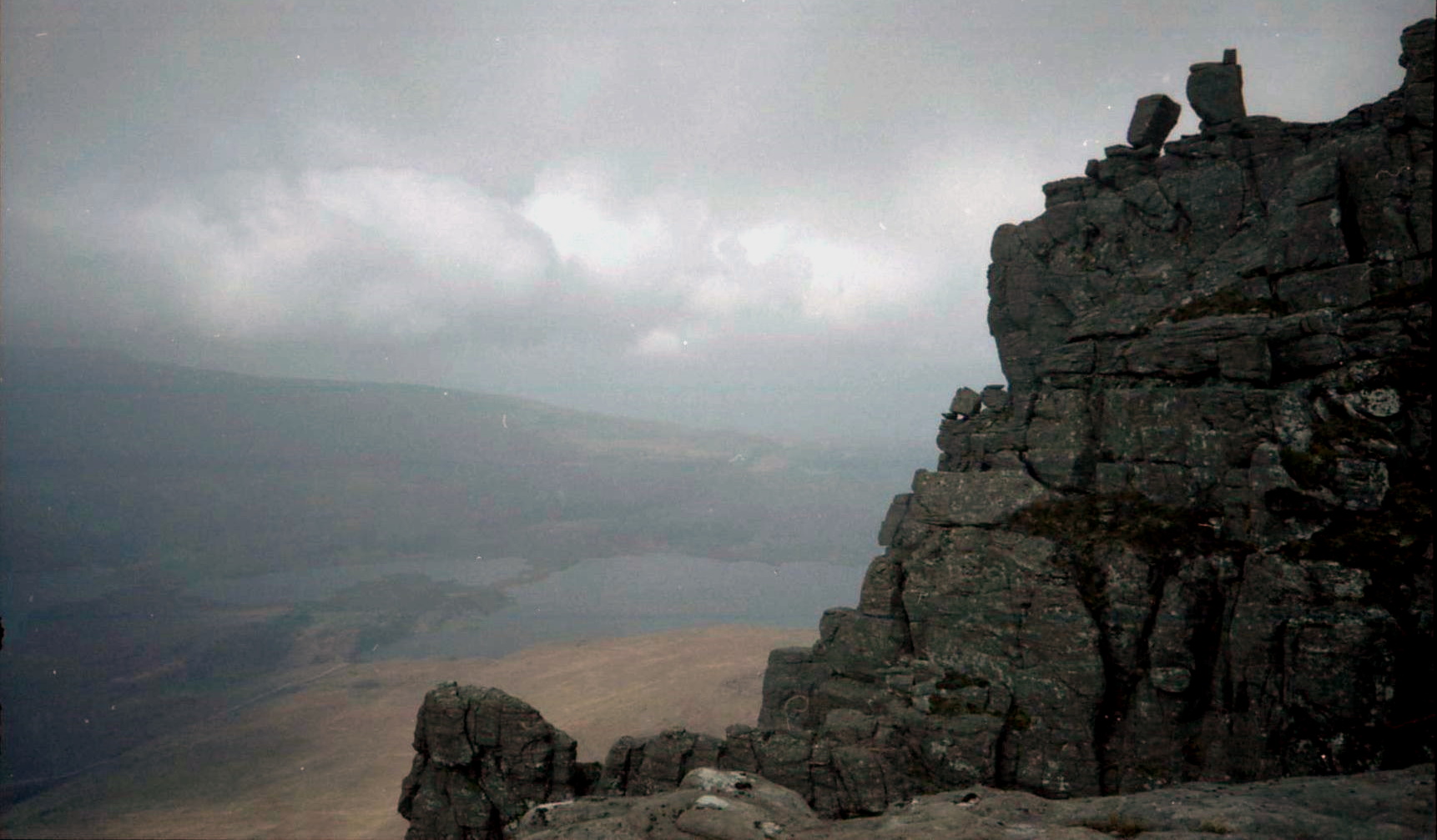
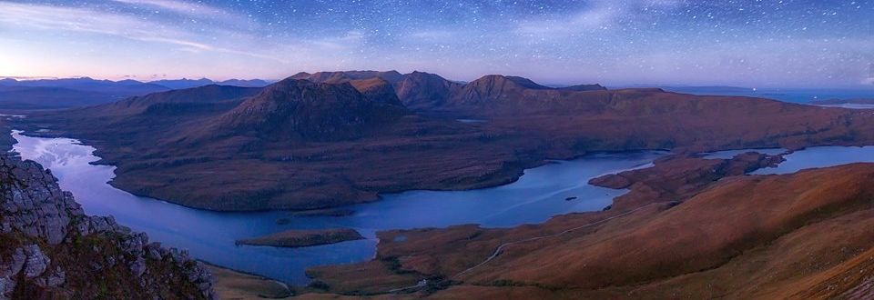
Retrace your steps to the broad bealach and climb the easy, grassy slopes to Ben Mor Coigach. The long south-west ridge towards Garbh Choireachan is the highlight of this glorious walk. Enjoy the succession of rocky towers and sandy paths which make this ridge such a delight and take time to enjoy the views out over the Summer Isles and, on a good day, across the Minch to Harris and Lewis.
Given reasonably clear weather, you’ll see the Cuillin of Skye, the Torridons, An Teallach, the Beinn Dearg hills and ‘ the magnificent spread of northern hills from Inverpollaidh to Assynt. Immediately below your feet lies Isle Martin, which was recently gifted to the locally based Isle Martin Trust by the RSPB in the spirit of “land reform and devolution”. This little nature reserve is the first land the RSPB has transferred to community ownership. It’s well worth while scrambling out to the end of the ridge before making your way back to the summit of Ben Mor Coigach, and eventually over Beinn Tarsuinn and back to the start at the end of a glorious walk.

ROUTE PLANNER

Map: OS 1:50,000 Landranger sheet 15
(Loch Assynt).
Distance: 10 miles / 16km
Time: 6-7 hours.
Start/finish: Minor road to Achiltibuie, at GR: NC140068.
Information: Ullapool TIC, 01854 612486.

Route:
Cross the river with care and follow the right bank of the Allt Clonaidh to Lochan Tuath.
Climb a heathery gully to the bealach between the Fiddler and Ben Mor Coigach and walk up to the summit of Sgurr an Fhidleir.
Walk back to the bealach and continue to Ben Mor Coigach.
Follow the south—west ridge to Garbh Choireachan.
Walk back again to Ben Mor Coigach and on to the small bealach below Speicin Coinnich, and then, on steepening slopes, down to the long ridge of Beinn Tarsuinn.
Make your way along the ridge, continue over the summit and down steep, heathery slopes to the Allt Claonaidh and the boggy path back to the road.


Route Description for Ben More Coigach in the NW Highlands of Scotland

Route Description

for Ben More Coigach


Route Description for Ben More Coigach in the NW Highlands of Scotland

Route Description

for Ben More Coigach


Location Map for Stac Pollaidh and Ben More Coigach in the NW Highlands of Scotland

Location Map for Stac Pollaidh

and Ben More Coigach

<< Back : NW HighlandsNext >>


Scotland Index :: Scotland Index

Ben Nevis | Knoydart | Isle of Skye | Isle of Arran | The West Highland Way

The Eastern Highlands | The Central Highlands | The Southern Highlands | The NW Highlands


Adventure Travel : Worldwide Mountaineering : Site Index

fb icon  google+ icon Linkedin icon  twitter


Guide Books & Maps - Scotland:-


Torridon - Ben Eighe & Liathach - OS Explorer MapLandranger Map 0024: Raasay, Applecross & Loch Torridon & Plockton


The Munros Map Torridon Map Kintail, Glen Shiel - Map Torridon - Beinn Eighe & Liathach An Teallach & Slioch - OS Explorer Map Applecross & Loch Torridon - OS Landranger Map Gairloch, Ullapool & Loch Maree OS Map Western Scotland & the Western Isles OS Road Map Northern Scotland OS Road MapSouthern Scotland OS Road Map


The High Mountains of Britain & Ireland  Munros Tables SMC  The Munros - Scotland's Highest Mountains  Scotland - Lonely Planet  NW Highlands - SMC Guide  Exploring the Far NW of Scotland  Guide to Walks in NW Highlands

Walking in Scotland - Lonely Planet Mountain: Exploring Britain's High Places  National 3 Peaks Walk Scottish Highlands Hillwalking Guide The Scottish Islands Bouldering in Scotland

Pathfinder Guide: Skye and NW Highlands WalksNW Highlands SMC Torridon: A Walkers Guide Torridon - Life & Wildlife in the Scottish Highlands The Munros: Scottish Mountaineering Club Scotland's Far NorthNorthern Highlands Northern Highlands, Volume 1 - SMC Northern Highlands, Volume 2 - SMC

Highland Outcrops Scottish Winter ClimbsWest Highlands 50 Walks in the Scottish Highlands & Islands Scotland's Highlands & Islands - Lonley Planet Scottish Highlands & Islands - Rough Guide The Munros and Tops Call of the Corbetts The Corbetts - SMC

Ben Nevis - Scotland's Highest Mountain Ben Nevis: Rock & Ice Climbs The High Mountains of Britain and Ireland Rambler's Guide: Ben Nevis and Glen CoeWinter Climbs: Ben Nevis and Glencoe Ben Nevis Rock & Ice Climbs Great Snow & Ice Climbs of the British IslesPathfinder Guide: Fort William and Glen Coe Walks Scrambles in Lochaber

Rock Climbing in Scotland Classic Mountain Scrambles in Scotland Scotland - Lonely PlanetScotland's Highlands & Islands - Lonley Planet Scotland's Highlands & Islands - Rough Guide Highlands & Islands of Scotland - Hidden Places Scotlands 100 Best WalksCentral Highlands: Six Long Distance Walks Rough Guide Scotland

Scottish Highlands & Islands - Rough Guide The Munros - Scotland's highest mountains My Scotland by Hamish MacInnes Scottish Mountains - 50 Classic Routes The CuillinsScottish Mountains - 100 Best Routes

Munro Almanac The Munros Map The Munros: Scottish Mountaineering Club The Isle of Skye The Isle of Arran Wilderness Walks Ski Mountaineering in Scotland Classic Walks in Britain & Ireland

More Wilderness Walks 50 Best Routes on Skye and Raasay Skye - W.A.PoucherMagic of the Munros Mountaineering in Scotland and Undiscovered Scotland by W.H.MurrayA Long Walk on the Isle of Skye

Classic Climbs - Central & Southern Highlands The Isle of Arran Lonely Planet, Walking in ScotlandPathfinder Guide: Skye and NW Highlands Walks 50 Best Routes on Skye and Raasay - Chris Townsend 100 Best Routes on Scottish Mountains Scrambles in Skye Mountain Days & Bothy Nights

Walking in the Hebrides Torridon: A Walkers Guide Ski Touring in ScotlandRough Guide: Scotland A Mountaineer's Tale - W.H.Murray Dougal Haston: Philosophy of RiskOne Man's Mountains - Tom Patey Big Walks of Great Britain

The Glens of Rannoch Cairngorm Glens Glens of Trossach Knoydart to Morven Scottish Glens: The Atholl Glens Southern Highlands - Map Northern Highlands The Munro Show 1 & 2 - Muriel Gray

The Cairngorms Cairngorms Walks Cairngorm - Map Walks in the Cairngorms Lochnagar & Glenshee - Map The Cairngorms of Scotland Cairngorms - Mountain Bike GuideWinter Climbs in the Caingorms

West Highland Way: Official Guide West Highland Way: Rucksac ReadersWest Highland Way: TrailblazerThe West Highland WayWest Highland Way: Footprint MapWest Highland Way - Map West Highland Way - Map 100 Hillwalks around Glasgow

50 Walks in Glasgow & SW Scotland 50 Walks in the Scottish Highlands & Islands 50 Walks in Edinburgh & Eastern Scotland 100 Walks in ScotlandVisit Scotland - Touring Guide Scotland: Where to Stay - Hotels & Guest Houses Scotland: Where to Stay - Bed & Breakfast Walking the Munros Vol 2: Northern Highlands & CairngormsWalking the Munros Vol 1: Southern, Central & Western Highlands

Hillwalker: The MunrosHillwalker: The CorbettsWeather for Hillwakers & Climbers Mountain Weather Guide to the Weather Weather: Collins Gem Hillwalking Handbook for Mountain Leaders First Aid on Mountains

All Mountain Skier Off Piste World's most significant ClimbsMountain Travellers Handbook Mountaineering: The Freedom of the HillsHillwalkers Guide to Mountaineering 200 Challenging Walks in Britain & Ireland

Ice & Mixed Climbing How to Ice Climb Complete Climbers Handbook Mountain Skills Training Handbook Autumn Road to the IslesDiscovering Scotland - Atlas & Guide Scotland Travel Guide Lonely Planet Scotland - The Wild Places - Colin Prior


Google Analytics


Google Analytics 

extremetracking
 eXTReMe Tracker


extremetracking
Sitelock caingram.com
SiteLock
Sitelock
Sitelock caingram.info
SiteLock
Sitelock