 |
The Scottish HighlandsIsland of Mull
|
  |
| |
The Scottish HighlandsIsland of Mull
|
|
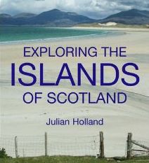
Photographs of The Isle of Mull
in the Inner Hebrides
off the West Coast of Scotland
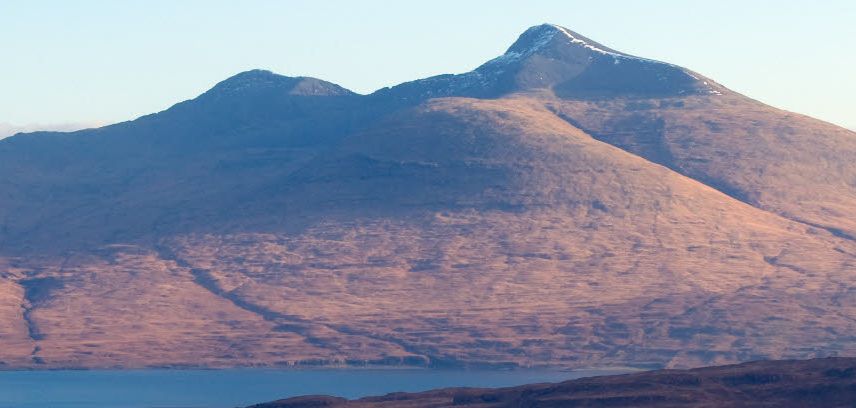
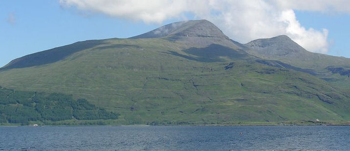 Ben
More ( 3169ft, 966m ) on the
Island of Mull.
Beinn Mhòr ( "big mountain" ) is the highest mountain and the only Munro on Mull. It is the highest peak in the Inner Hebrides outwith the Isle of Skye. |
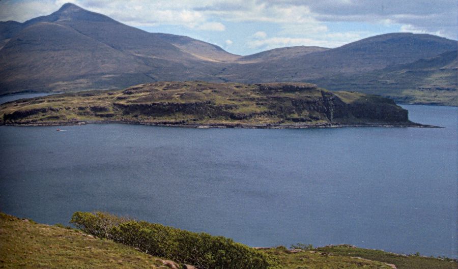 Ben
More ( 3169ft, 966m )
on the Island of Mull. |
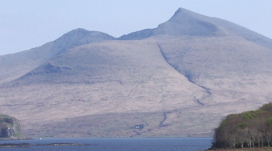 Ben
More ( 3169ft, 966m ) on the Island of Mull
Beinn Mhòr ( " great mountain ") is the highest mountain and only Munro on the Isle of Mull. It is the highest peak in the Inner Hebrides outwith the Isle of Skye. |
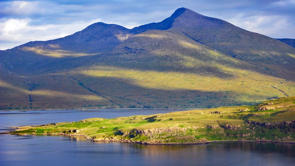 Ben
More ( 3169ft, 966m )
on the Island of Mull |
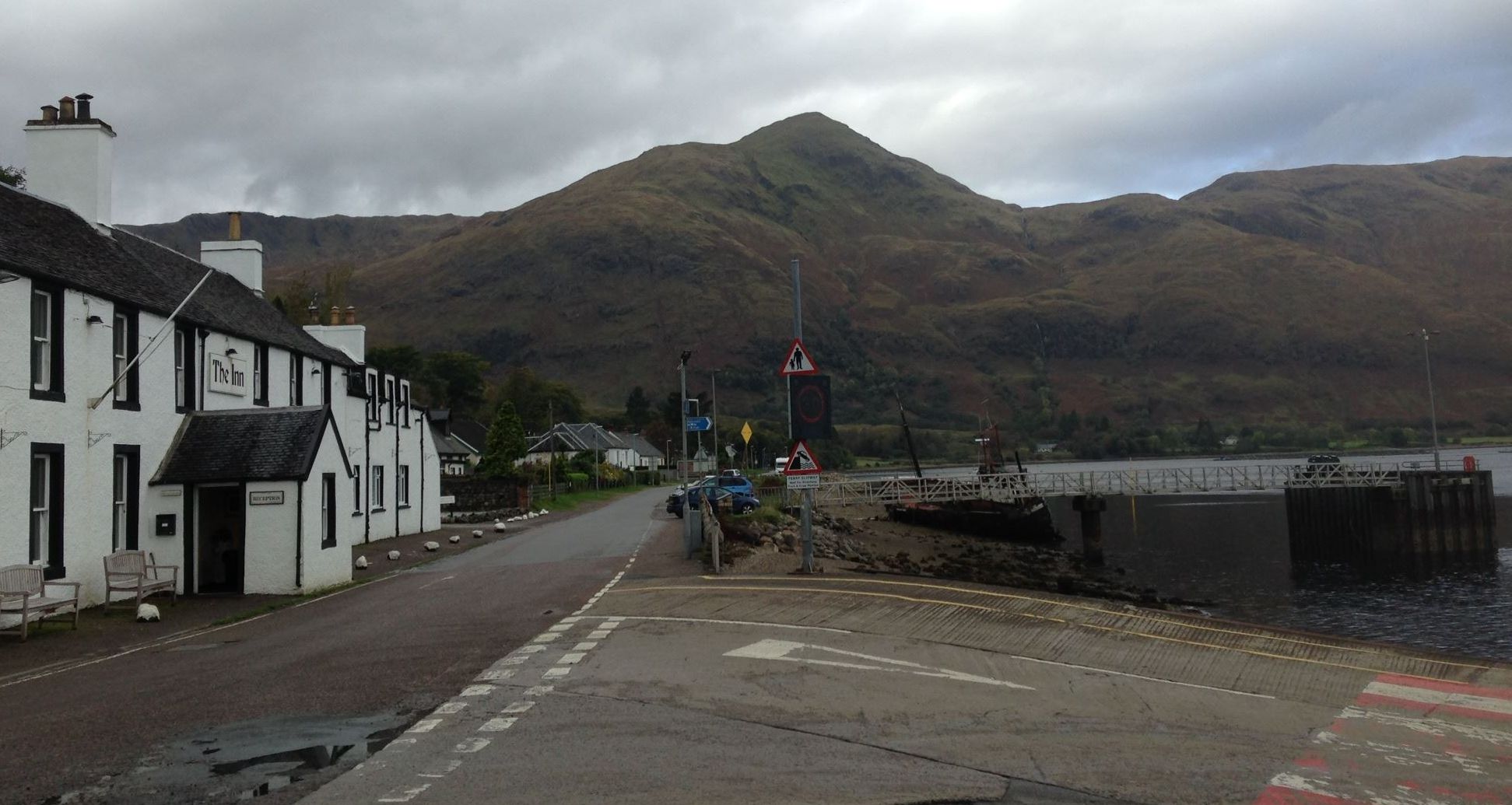
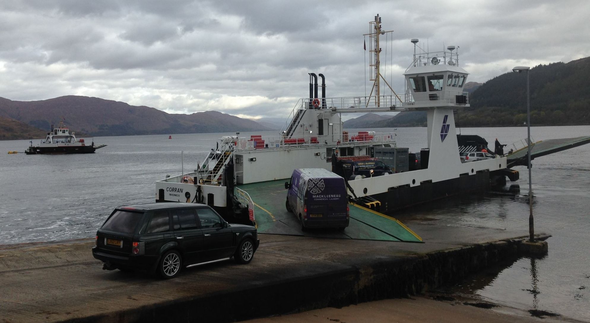
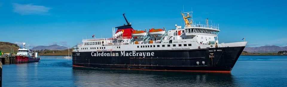 "Isle of
Mull" ferry
|
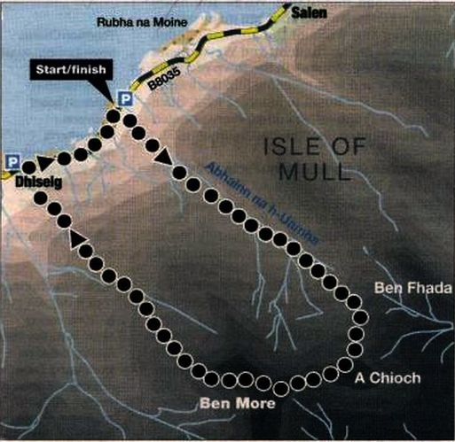 Route
Map
for ascent of Ben More |
BEN MORE - ASCENT ROUTE DESCRIPTION:-
Ben More is the highest hill on the lsle of Mull and the only island Munro outwith Skye.
The ascent provides a memorable day out amid magnificent west-coast scenery.
Most of those who climb Ben More do so from Dhisieg following a clear path up its north-west ridge then returning the same way.
However a more satisfying route to its summit starts a little further along the coast in the north-east, climbing over the fine subsidiary peak
of A' Chioch then returning via the so-called tourist route to Dhiseig.
Start from the grass parking area on the snuth side of the bridge over the burn which runs down the glen between Ben Fheda and
Ben More; not to be confused with the bridge over the Scarisdale River one kilometre to the north-east.
Follow a vague path up the right side of the burn and continue up the glen to gain the ridge just above the col at its head.
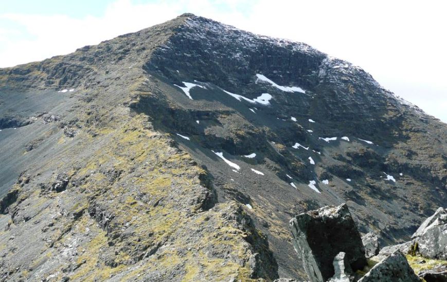
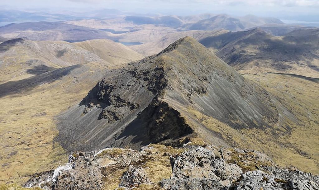
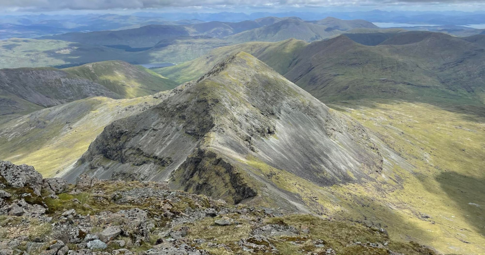
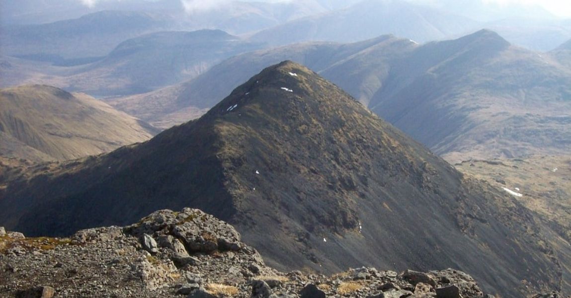
With the views opening up all around climb this fine, narrowing ridge to reach the airy summit of A' Chioch ( 867m ).
The pyramidal summit cone of Ben More lies ahead and after descending from A' Chioch the ascent starts with a narrow
ridge where any difficulty and exposure can be avoided by a path on the left side.
Thereafter the ground steepens but then zigzags easily up through the rocks on the left side of the ridge to an
abrupt finish on to the summit of Ben More ( 966m ).
Now simply follow the path north-west along the summit crest and descend the ridge to cross the burn and continue to
the cottage at Dhiselg. A track now leads to the road and a
pleasant stroll back to the start.
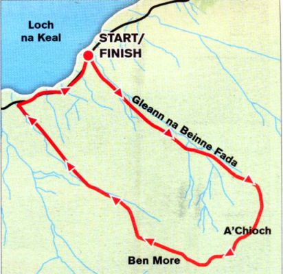 Route
Map for
ascent of Ben More
|
BEN MORE - ASCENT ROUTE DESCRIPTION 2:-
Location: Mull
Map: OS Landranger 48
Distance: 8 miles ( i4km )
Tlme: 5-7 hours
Grade: Serious mountain walk
Ben More is after all the highest of our Hebridean mountains outside Skye — and Britain’s last volcano.
Scientists say that about 35 million years ago, the Hebridean archipelago was dotted with active volcanoes
pouring out masses of molten lava.
What is now Ben More was the last of these volcanoes and its great western lava flows created the wonderful cliffs
of the Ardrneanach peninsula, those of Gribun, the island of Ulva and the amazing columnar rock architecture
of the island of Staffa.
More hillwalkers save Ben More as their final Munro than any other, but their reasons have little to do
with the mountain's volcanic past.
Because of access difficulties you have to make a weekend of Mull’s Ben More and if you’re going to make a
weekend of it you might as well make it a celebratory one. Come to think of it, if you're going to make a weekend
of it you may as well make it a week — there's plenty of other mountain games to play on Mull besides climbing its only Munro.
Positioned near the west of the island, Ben More is a fair distance from the ferry at Craignure.
You can either take a car on the ferry from Oban, and drive to the starting point, or take a bus to Salen from where
you still have a seven-mile walk to the foot of the hill at Loch na Keal. A bike would be useful, and cheaper to transport on the ferry.
As its name suggests, Ben More lords it over the island. This "big hill" can be seen from all points of the
Mull compass and radiates ridges in a number of directions from its summit cone, the best of which is the one that
connects with A'Chioch, a superb rocky highway that involves a steep descent to a rock-girt bealach then
an even steeper, rocky scramble that leads directly to Ben More's summit.
Most walkers tackle Ben More from the B8035, on the south-eastern shores of Loch na Keal. The lovely
Abhainn na h-Uamha, complete with tantalising pools and waterfalls, ambles up the length of Gleann na
Beinne Fada to the obvious saddle in the ridge between Beinn Fhada and A’Chioch. From the saddle steep
and rocky slopes lead to the summit of A'Chioch.
The route to Ben More continues to the south-west as a superb rocky ridge, involving a steep descent to the
bealach. Crags fall away steeply to the north-west and there are a couple of big gaps in the slabby wall which can
be easily avoided. A steeper, rocky scramble leads directly to the summit of Ben More at 966m / 3,169ft.
This final climb to Ben More looks steep and difficult from the bealach but don’t be discouraged, it’s easier than it looks.
You can either return the same way or, more straightforwardly, down the hill's north-west ridge to the road.
Route: start/tinish on the B8035 by Loch na Keel ( GR: NM50B368 ).
Start near the bridge over the Abhainn na h-Uamha
and follow the south bank of the burn up the length of Gleann na Beinne Fhada.
Climb to the obvious saddle between Beinn Fhada and A'Chioch
and from there climb steep and rocky slopes to the S to reach the summit of A'Chioch.
Another tight ridge falls away to the SW to reach a slabby bealach
where a couple ot deep clefts can be avoided on the left.
Climb the steep and rocky ridge directly to the summit of Ben More.
Either return the same way or down the hill’s easy north-west ridge back to the road.
NB: The summit cone of Ben More is magnetic and compass readings can be misleading.
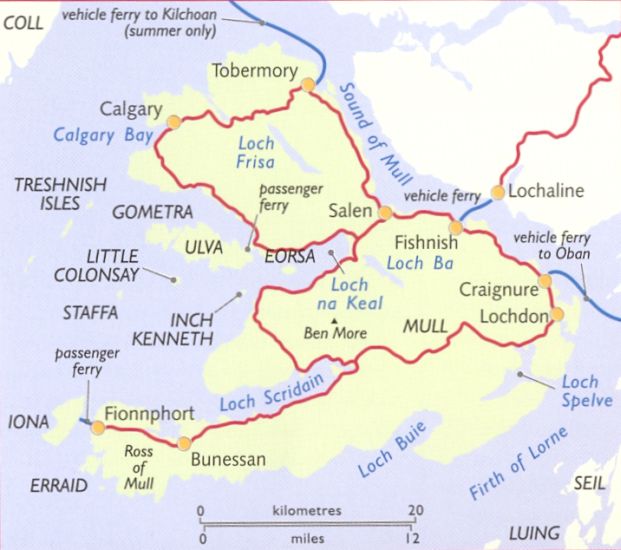 Map of
the Isle of Mull
|
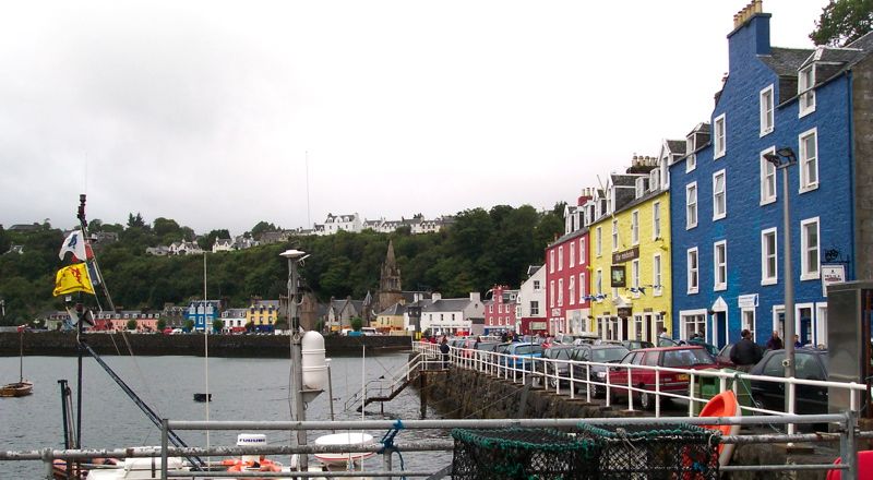 Tobermory
- the largest town on
Mull
|
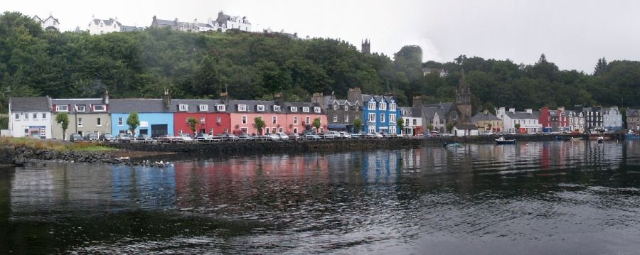 Tobermory on
Mull
|
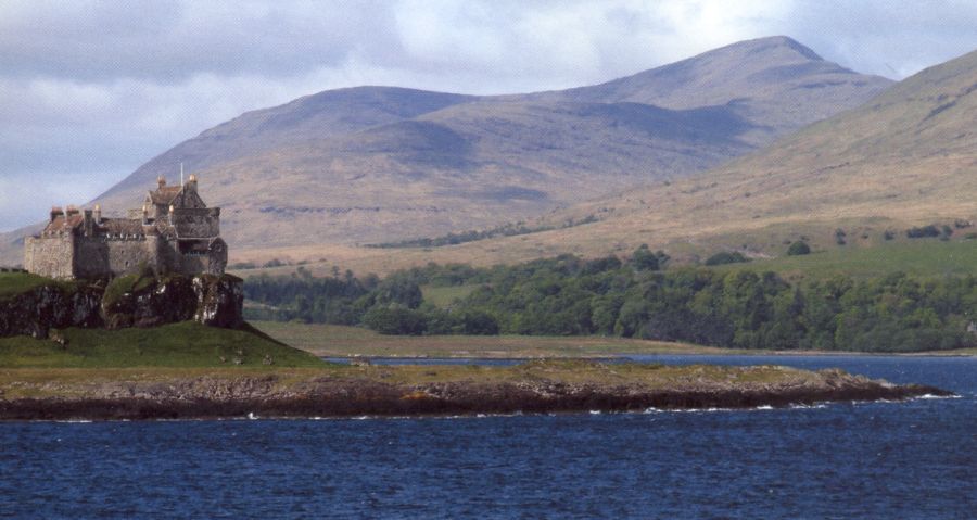
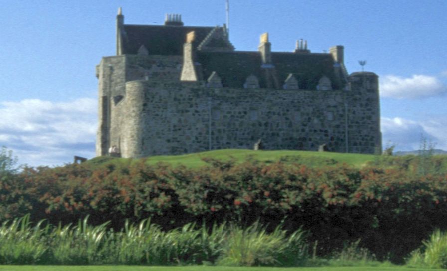
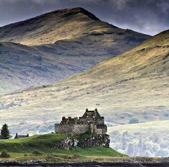
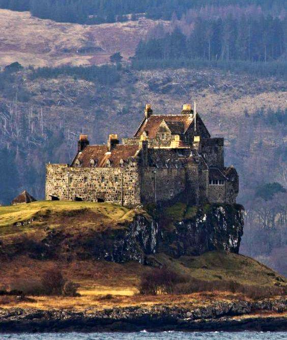
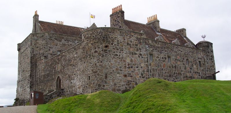 Duart
Castle on Mull
The castle was the seat of Clan MacLean and dates from the 13th century. |
 Duart
Castle on Mull
|
 Duart
Castle on Mull
|
 Duart
Castle on Mull
|
 Duart
Castle on Mull
|
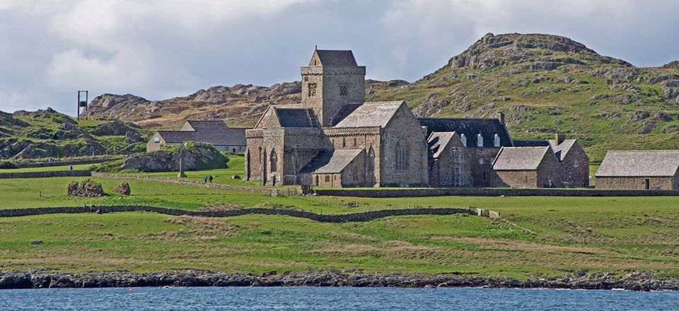
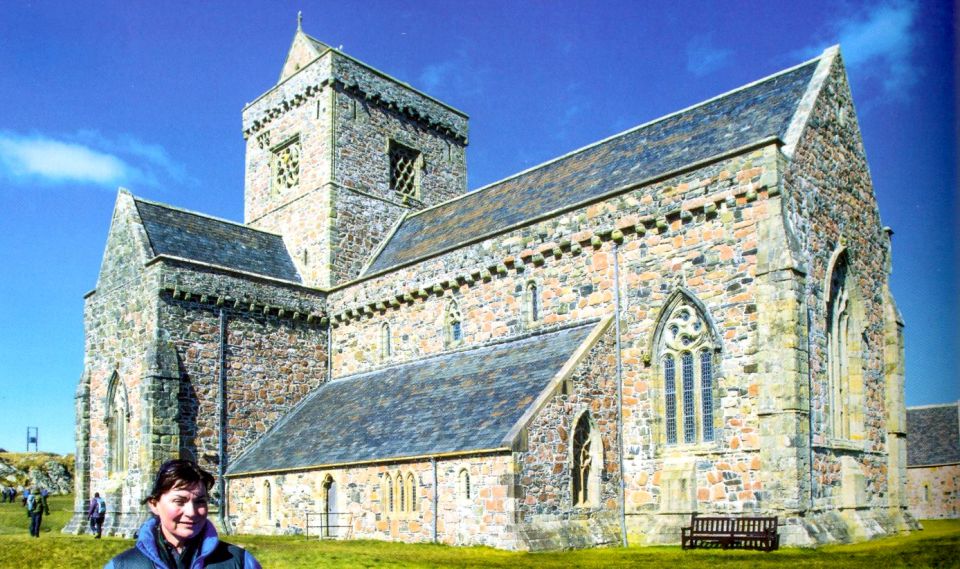 Cathedral
on Iona
This is one of the oldest and most important religious centres in Western Europe. |
 Cathedral
on Iona
This is one of the oldest and most important religious centres in Western Europe. |
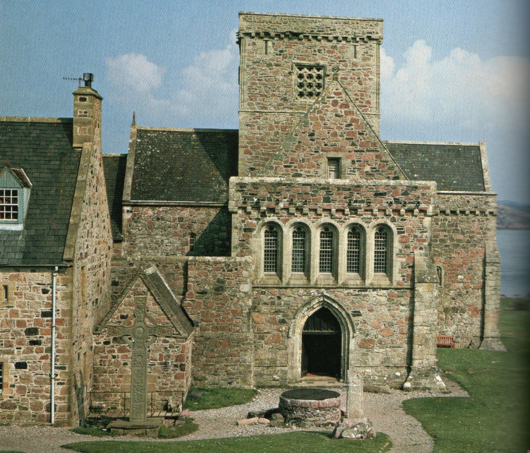 Iona
Abbey
This is one of the oldest and most important religious centres in Western Europe. |