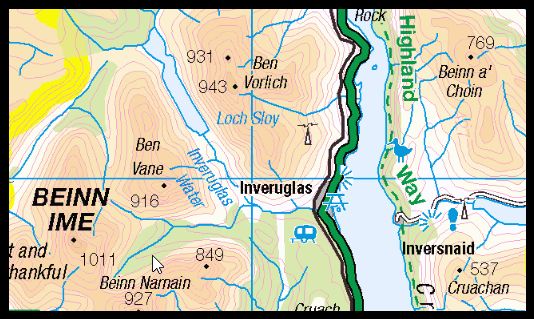
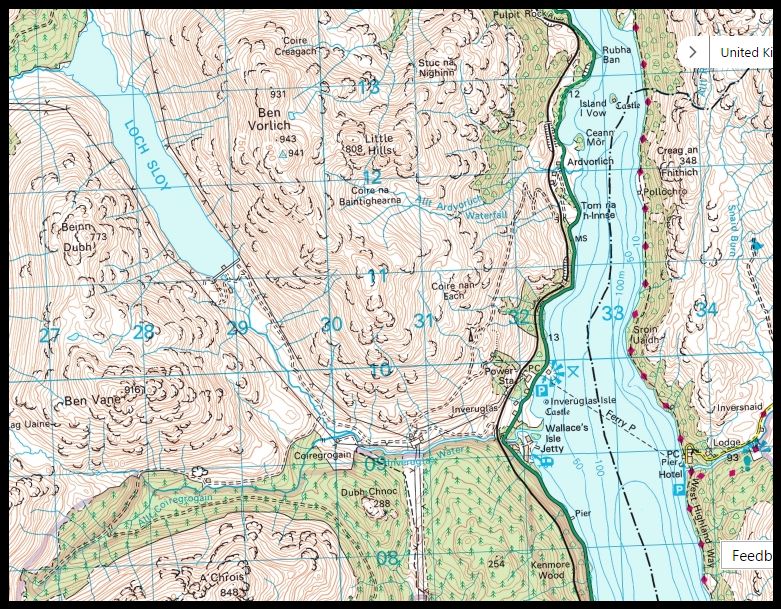
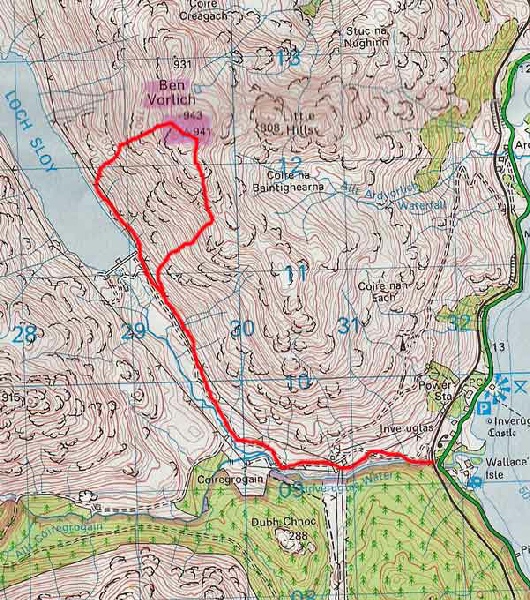
Munros Tables SMC The Corbetts - SMC

 The Scottish Highlands

Ben Vorlich
The High Mountains of Britain & Ireland Southern Highlands - Map

 Photographs of an ascent of the Munro Ben Vorlich,

one of the Arrochar Alps,

above Loch Sloy and Loch Lomond


Ben Vane above Inveruglas

A' Chrois


Ben Lomond above Loch Lomond


A' Chrois and Beinn Narnain


Ben Ledi, Loch Arklet, Loch Katrine and Loch Lomond from Ben Vorlich


Ben Vorlich across Loch Sloy from Ben Vane

Ben Vorlich

across Loch Sloy from Ben Vane


Beinn Narnain, Ben Vane and Beinn Ime from Ben Vorlich

Beinn NarnainBen Vane

and Beinn Ime

from Ben Vorlich


Beinn Ime and Ben Vane from Ben Vorlich

Beinn Ime and Ben Vane

 from Ben Vorlich


Ben Vane and Beinn Ime from Ben Vorlich

Ben Vane and Beinn Ime

 from Ben Vorlich


Trig point on Ben Vorlich

Trig point on Ben Vorlich


Ben Vane and Ben Vorlich from Beinn Narnain

Ben Vane and Ben Vorlich

 from Beinn Narnain


Ben Vane and Ben Vorlich from Beinn Narnain

Ben Vorlich and Ben Vane

from Beinn Ime


Binnein an Fhidhleir across Loch Sloy from Ben Vorlich

Binnein an Fhidhleir

across Loch Sloy

from Ben Vorlich


Beinn Ime from Ben Vane

Ben Lui from Ben Vorlich


Ben Vorlich in winter

Ben Vorlich in winter


Beinn Narnain, Ben Vane and Beinn Ime from Ben Vorlich

Beinn NarnainBen Vane

and Beinn Ime

from Ben Vorlich


Binnein an Fhidhleir from Ben Vane

Loch Lomond

from Ben Vorlich


Binnein an Fhidhleir from Ben Vane

Loch Lomond

from Ben Vorlich


Beinn Dubh above Loch Sloy

Beinn Dubh

above Loch Sloy


Ben Vane


Ascent route for Ben Vorlich

Ascent route for Ben Vorlich


Ben Vorlich from Ben Reoch

Ben Vorlich

 from Ben Reoch


Ben Vorlich from Rob Roy View above Inversnaid

Ben Vorlich

from Rob Roy View

 above
Inversnaid


Ben Vorlich from above Inversnaid

Ben Vorlich

 from above Inversnaid 


Map of Ben Vane and Ben Vorlich

Map of Ben Vane

and Ben Vorlich


Ben Vorlich map

Ben Vorlich map


Map of the Arrochar Alps

Map of the Arrochar Alps


Ben Vorlich - Route Map

Ben Vorlich - Route Map


BEN VORLICH - ROUTE DESCRIPTION:


Location: lnveruglas, Loch Lomond
Map: OS Landranger 56 ( GR 295125 )
Distance: 8 miles /12.5km
Time: 4 hours 30 minutes
Terrain: hill paths

Ben Vorlich is an extensive mountain which can be climbed from several directions. One of the most popular starting points is Ardlui to the east, but Inveruglas to the south offers quicker and easier access, besides an opportunity to ascend the long and less frequented south ridge.
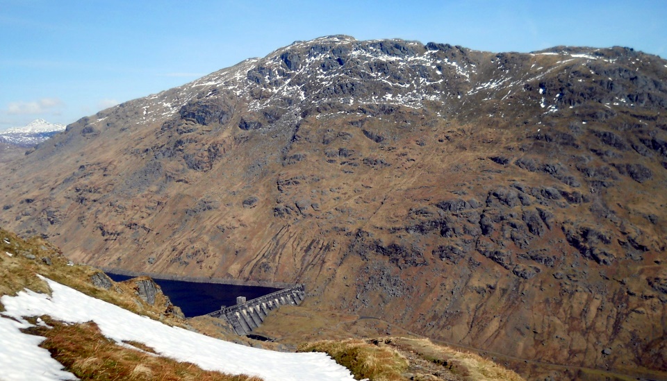
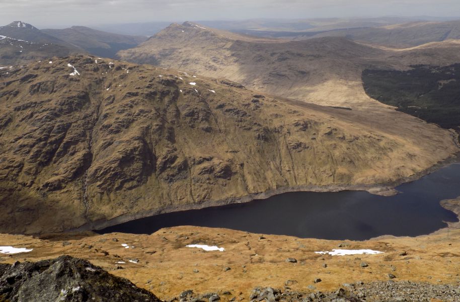
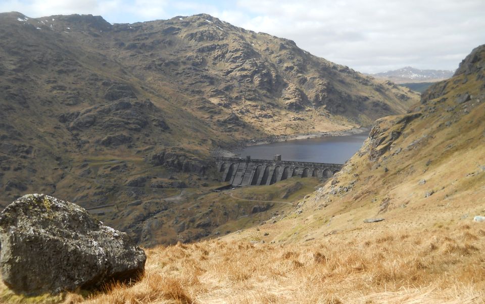
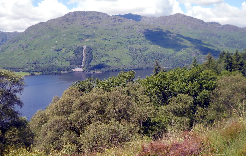
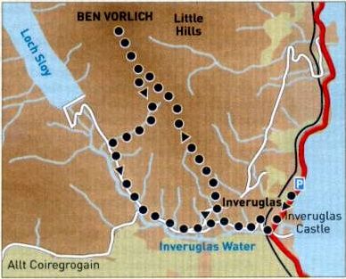
From the large car park at lnveruglas, just north of Sloy Power Station, follow the signposted path past the power plant back to the padlocked access road to Coriegrogain farm and Loch Sloy dam.
Go through the kissing gate and follow the road under the railway bridge.
There's a shortcut on the left almost immediately after the bridge onto a path which ascends beside the Inveruglas Water to meet the access road after the big bend. This passes through pleasant woodland but can be boggy in places.
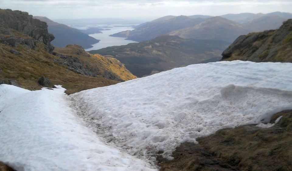
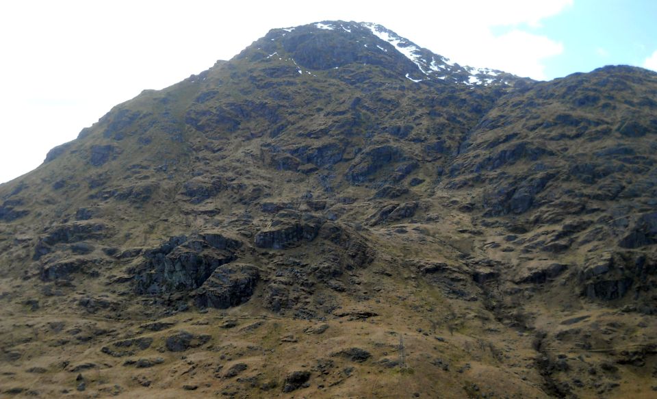
After the initial ascent from Loch Lomond, the access road levels out below the broad frontal face of Ben Vorlich's south ridge.
The route ascends to the right of a burn with scattered trees in its lower reaches in the centre of the face. Although
there are scattered animal paths, there's no established path. It may look steep from below but don't worry, it's not too had.
At the electricity sub-station, turn right on to a subsidiary access road which traverses east across the hillside below the face.
Gain the hillside as soon as possible beyond the burn and ascend steadily up grassy and heathery slopes with some bracken to reach the 
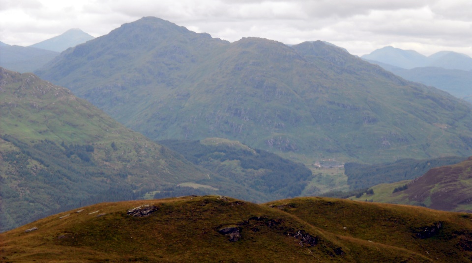
broad upper ridge where the ground levels out. The ascent gives fine 
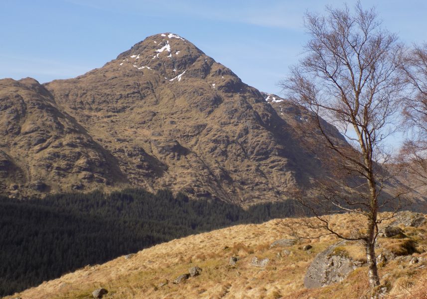
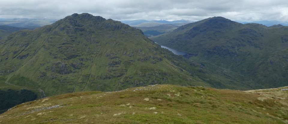
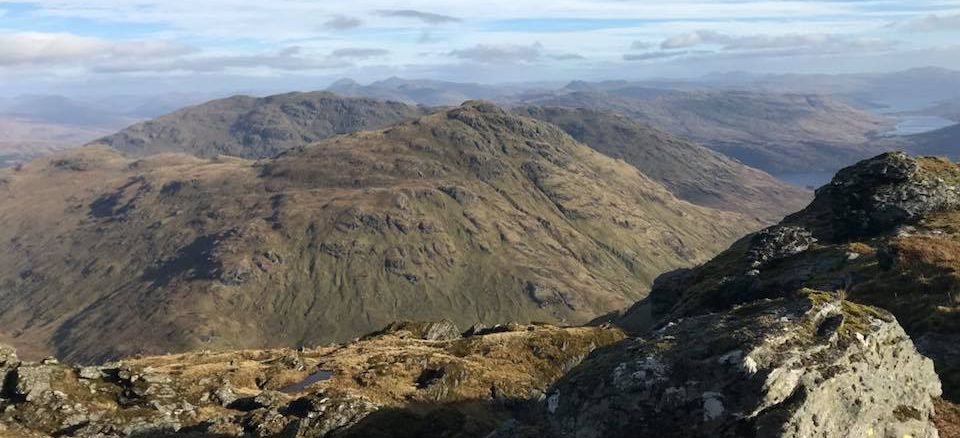
views east to
Loch Lomond, lnversnaid and Ben Ledi beyond and west to Ben Vane and Beinn Ime.
Once you're on the ridge a path leads north over a series of knobbly tops towards the summit. The most enjoyable route takesthe ridge direct although the rockier sections can be bypassed by a path on the right. 
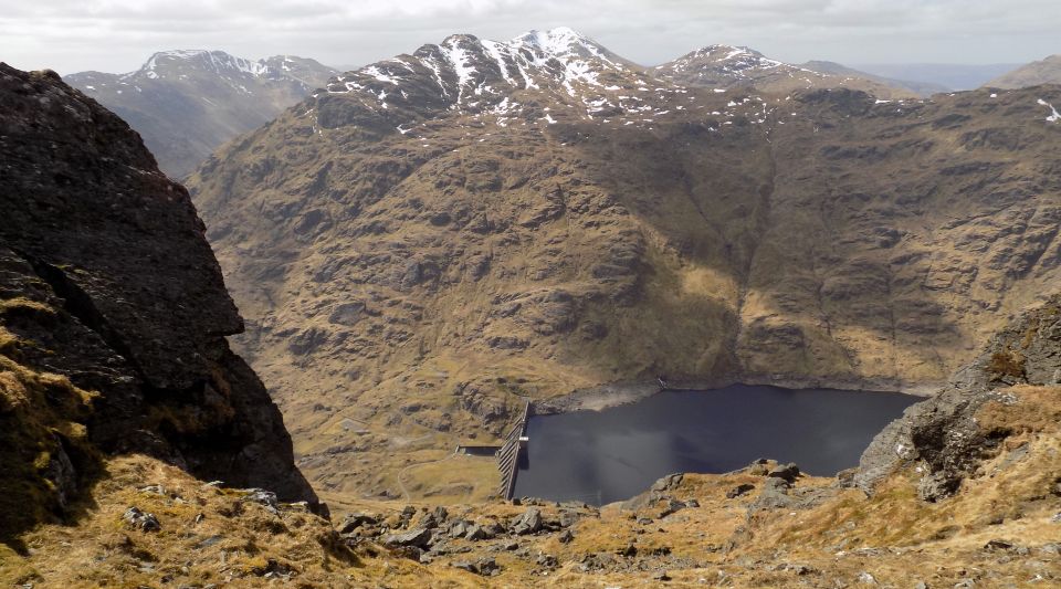
Beyond the second top the route joins the well-worn path ascending from Loch Sloy and becomes much wider, continuing through a broad trough created by a massive landslip on the west face, to arrive at a tiny lochan.
The main path continues to the left, but the most direct and straightforward route is to stick to the high ground further right. Here a lesser path skirts to the right of the small crag gains the ridge and 
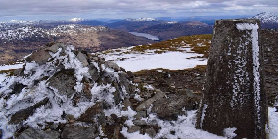
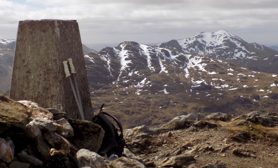
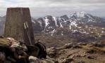
leads directly to the trig point on the south top.
From here. continue along the ridge to the summit, about two metres higher, which is marked by a cairn on a small crag.
Return by reversing the line of ascent or, though a little longer, descending by the Loch Sloy path to the access road. The top of this path is steep and eroded with scrambly sections, while the bottom is quite boggy. From here follow the access road which heads back to the electricity sub-station and Inverugias.
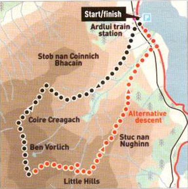
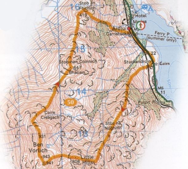


Ben Vorlich - Route map

Ben Vorlich - Route map


BEN VORLICH - ROUTE 2 DESCRIPTION:


Location: Ardlui, Loch Lomond
Map: OS Landranger 56 ( GR 295 125 )
Distance: 8 miles / 13km
Time: 5 hours
Terrain: hill paths


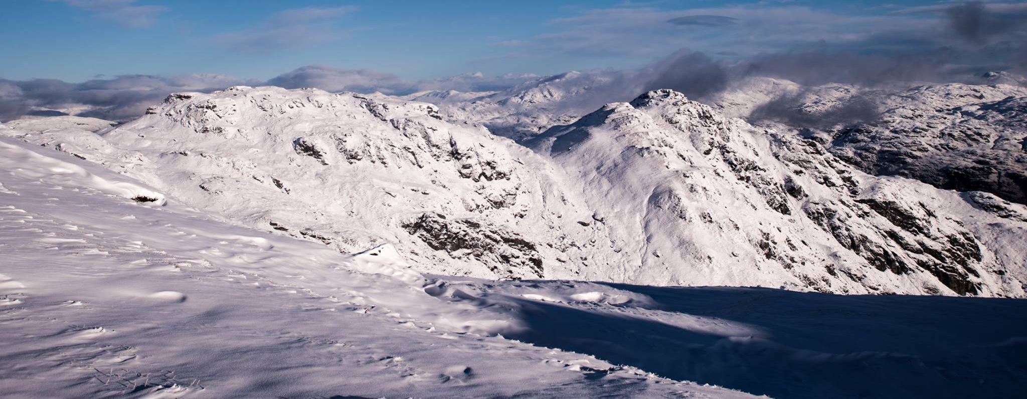
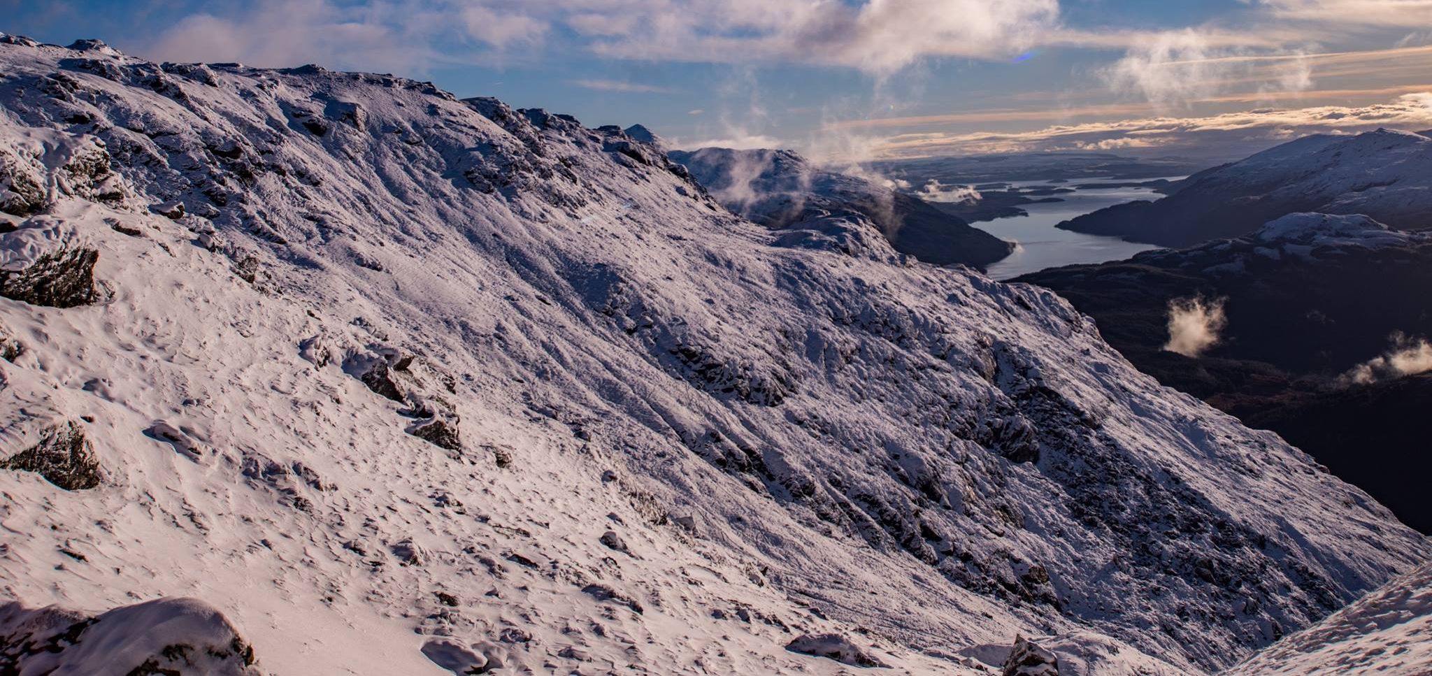
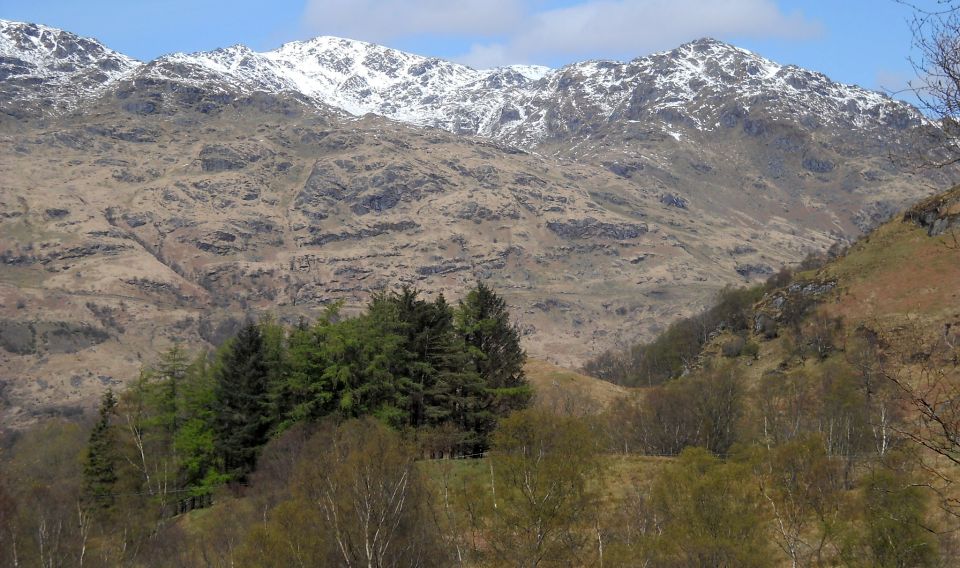
Big Ben Vorlieh dominates the northern end of Loch Lomond and offers a relatively straightforward ascent to a high summit with extensive views. Under snow and ice the mountain is certainly trickier with a couple of rocky steps to be negotiated and full winter gear of ice axe and crampons are essential.
The approach from Ardui via Coire Creagach is a popular route and can he combined with a return over the east-north-east ridge of the Little Hills.
Park in the layby opposite the underpass leading to Ardlui Station and walk south back along the road for about 100 metres. Go through the next underpass under the railway and follow the track to a gate and stile on the left. Cross the burn and head up and right to a further gate giving access to the open hillside. Continue ascending in the same line on a wet and ill-defined path aiming for the wooded base of craggy-crested Stuc na Nughinn, the first of the Little Hills which lies directly ahead to the south-east. This brings you to a stile in a fence on the edge of the prominent
deep-cut burn draining from Coire Creagach from where the path becomes much better defined.
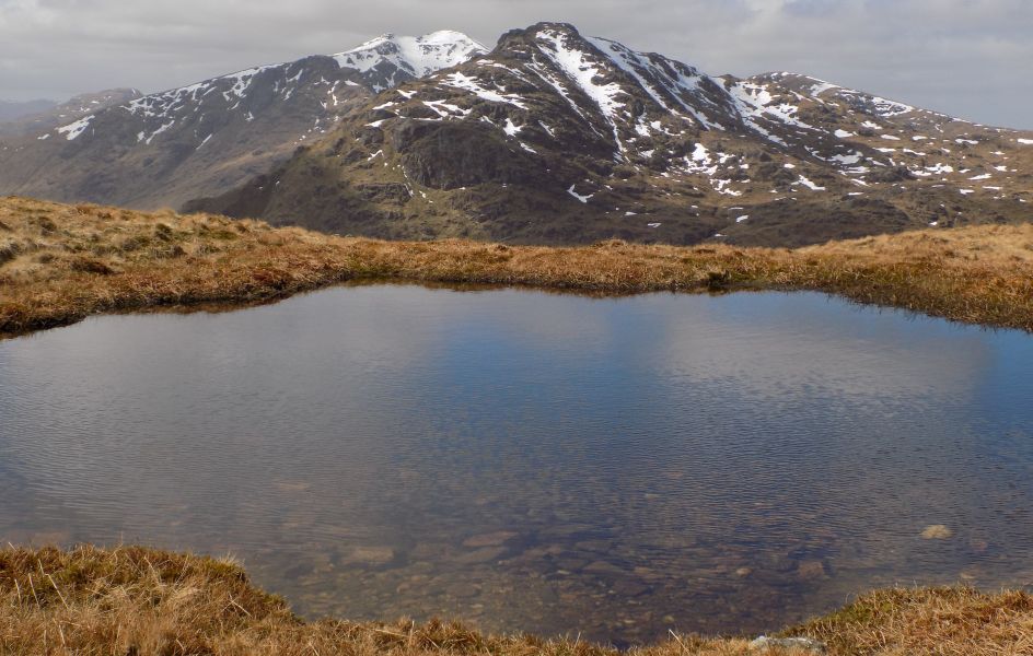
Follow the path to a small dam and pipeline, then ascend directly from a small bridge over the pipeline before a second small dam, to gain an upper corrie, then north-west to the col between Ben Vorlich and Stub nan Coinnich Bhacain. From here the broad north-east ridge leads to the North Top, followed by the summit, capped by a cairn. The trig point just to the south crowns the southern summit, which is two metres 
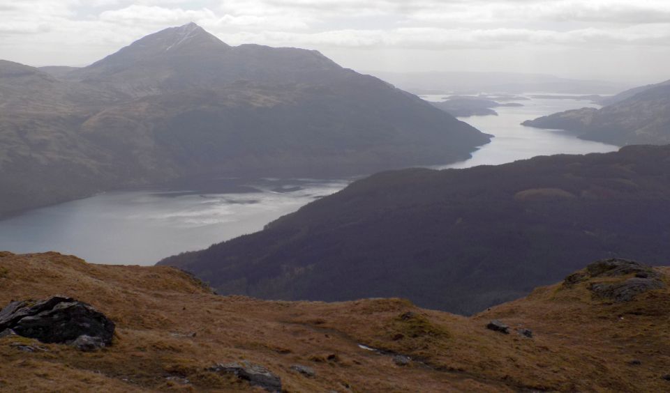
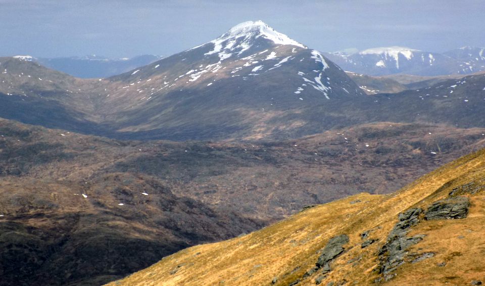
lower. The views are spectacular, with the Paps of Jura and Ben More on Mull visible out west.
For all the extra distanee it is worth continuing south to the trig point topped southern summit for a fine view to Ben Lomond and down Loch Lomond.
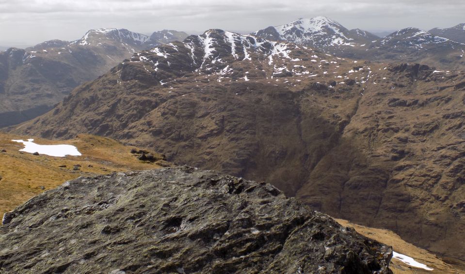
From the summit head north-east to gain the ridge line and follow it east to the col below the first of the Little Hills. Go over this 808m summit and descend its rocky eastem side with care to the next col. Another small top is climbed before the 793m cairned top of the second Little Hill.
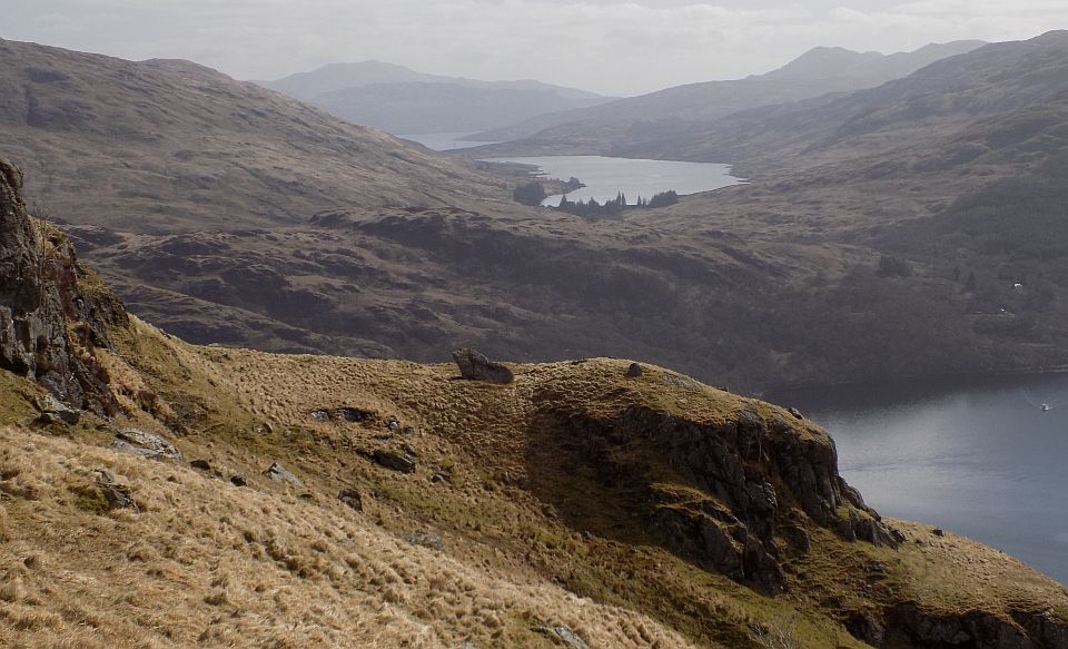
From here turn north and follow the long ridge steadily down towards Ardlui and Loch Lomond, passing over the knobbles of Stnc na Nughinn to the
foot of the ridge, where a steeper descent between crags leads to the treeline and a fence and stile above the prominent deep-cut burn. With care it is possible to follow the fence left and down to the burn, cross over and ascend beside a continuation fence to reach the stile on the ascent route.
Alternatively, go over the stile and continue down the ridge to cross the burn lower down, or continue on to pass under the railway before Stuckendrion farm to gain the main road and follow it back to Ardlui.


Ben Vorlich - Route map

Ben Vorlich - Route map


Ben Vorlich - Route map

Ben Vorlich - Route map


 Ben Vane Gallery Photo Gallery :: Ben Vorlich Gallery Photo Gallery

<< BackSouthern HighlandsNext >>


Scotland Index :: Scottish Peaks :: Scotland Walks

West Highland Way :: Isle of Skye :: Isle of Arran

Knoydart :: Glencoe :: Ben Nevis :: NW Highlands :: Eastern Highlands :: Central Highlands


Worldwide Mountaineering :: Adventure Travel :: Site Index

fb icon  google+ icon Linkedin icon  twitter


Travel & Guide Books & Maps - Scotland:-


Arrochar Alps - Map Glasgow Popular Hills - Map West Highland Way - Map Loch Lomond North - Tyndrum, Crianlarich, Arrochar - OS Explorer Map Loch Lomond and Inverary OS Landranger Map

Isle of Arran OS Explorer Map Isle of Arran OS Landranger Map Arran - Official Tourist MapIona & Mull MapWestern Scotland & the Western Isles OS Road Map Northern Scotland OS Road MapSouthern Scotland OS Road Map


Munros Tables SMC The Munros - Scotland's Highest Mountains  Scotland - Lonely Planet  The High Mountains of Britain & Ireland

Walking in Scotland - Lonely Planet Mountain: Exploring Britain's High Places  National 3 Peaks Walk Scottish Highlands Hillwalking Guide The Scottish Islands Bouldering in Scotland

Central Highlands: Six Long Distance Walks West Highland Way: Official GuideWest Highland Way: Rucksac Readers West Highland Way: TrailblazerThe West Highland WayWest Highland Way: Footprint MapWest Highland Way - Map West Highland Way - Map 100 Hillwalks around Glasgow

Pathfinder Guide: Fort William and Glen Coe Walks Rambler's Guide: Ben Nevis and Glen CoeGlencoe Rock & Ice Climbing The Munros: Scottish Mountaineering Club The Munros and Tops The Corbetts - SMC Munros & Corbetts Chart The High Mountains of Britain and Ireland Munro Almanac

The Munros - Scotland's highest mountains Call of the Corbetts Magic of the Munros Hamish's Mountain WalkThe Munros in Winter My Scotland by Hamish MacInnes

Scottish Mountains - 50 Classic Routes50 More Routes on Scottish Mountains The High Mountains of Britain and Ireland Scotlands 100 Best Walks Scottish Mountains - 100 Best RoutesBig Walks of Great Britain Classic Walks in Britain & Ireland

Scottish Hill & Mountain Names Classic Mountain Scrambles in Scotland Classic Climbs - Central & Southern Highlands Mountaineering in Scotland and Undiscovered Scotland by W.H.MurrayMore Wilderness Walks Wilderness Walks Wilderness Walks 2 - Video Ski Mountaineering in Scotland

Ski Touring in ScotlandScrambles in Lochaber Rock Climbing in Scotland Rock Climbing SkillsThe FACE: Six Great Climbing Adventures Ben Nevis: Rock & Ice ClimbsGreat Snow & Ice Climbs of the British Isles100 Best Routes on Scottish Mountains One Man's Mountains - Tom Patey

A Mountaineer's Tale - W.H.Murray Dougal Haston: Philosophy of RiskThe Glens of Rannoch Southern Highlands - MapNorthern Highlands Central Highlands West Highlands Central Highlands SMCNW Highlands SMC

Scotland - Lonely PlanetScotland's Highlands & Islands - Lonley Planet Scotland's Highlands & Islands - Rough Guide Highlands & Islands of Scotland - Hidden Places Rough Guide Scotland Scottish Highlands & Islands - Rough Guide Rough Guide: Scotland Lonely Planet, Walking in ScotlandLonely Planet - Walking in Britain

50 Walks in the Scottish Highlands & Islands 100 Walks in ScotlandVisit Scotland - Touring Guide Scotland: Where to Stay - Hotels & Guest Houses Scotland: Where to Stay - Bed & Breakfast Hillwalker: The MunrosHillwalker: The Corbetts

Weather for Hillwakers & Climbers Mountain Weather Guide to the Weather Weather: Collins Gem Hillwalking Handbook for Mountain Leaders Hillwalkers Manual Hillwalkers Guide to Mountaineering First Aid on Mountains


extremetracking
 eXTReMe Tracker


extremetracking
Sitelock caingram.com
SiteLock
Sitelock
Sitelock caingram.info
SiteLock
Sitelock