The West Highland Way The Corbetts - SMC

 The Southern Highlands

Doune Hill
The High Mountains of Britain & Ireland West Highland Way: Trailblazer

Photographs of a circular traverse of Beinn Eich

and Doune Hill in the Luss Hills

above Luss Village and Loch Lomond

in the Southern Highlands of Scotland


Glenmollachan Farm

Glenmollachan Farm


Beinn Eich

Beinn Eich


Doune Hill above Glenmollachan

Doune Hill above Glenmollachan 


Luss Village on Loch Lomond

Conic Hill across Loch Lomond

on ascent of Beinn Eich


Loch Lomond from Beinn Eich


Beinn Bheula from Beinn Eich

Beinn Bheula from Beinn Eich


Ben Lomond from Beinn Eich

Ben Lomond from Beinn Eich


Beinn Chaorach from Beinn Eich

 Beinn Chaorach from Beinn Eich


Arrochar Alps ( Ben Arthur, Beinn Ime, Beinn Narnain ) from Beinn Lochain


Ben Lomond from Doune Hill

Ben Lomond

from Doune Hill


Mid Hill and Loch Lomond from Doune Hill

Mid Hill and Loch Lomond

from Doune Hill


Northern Highlands from Doune Hill

Northern Highlands

from Doune Hill


Doune Hill

Doune Hill


The Brack from Doune Hill

The Brack

from Doune Hill


Doune Hill


Route Map for Doune Hill and Beinn Eich in the Luss Hills

Route Map for Doune Hill

 and Beinn Eich

 in the Luss Hills


DOUNE HILL & BEINN EICH - ROUTE DESCRIPTION:


Location: Glen Luss, Argyll
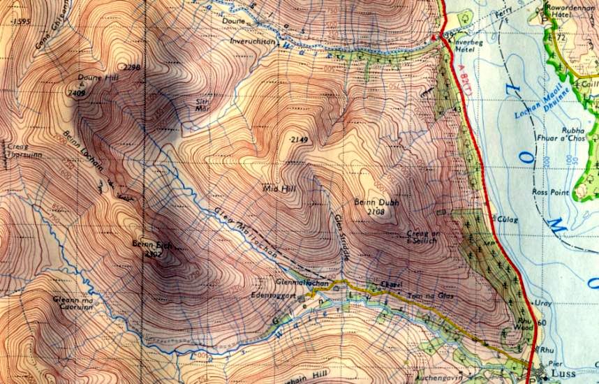
Map: OS Landranger ( GH291971)
|Distance: 12miles ( 19km )
Time: 5hours 30 minutes
Terrain: tracks and paths

While the hills surrounding Glen Luss on the west side of Loch Lomond are relatively modest, they are surprisingly steep-sided. The grassy terrain makes pleasant if sporadically boggy going, and the hills offer excellent exercise when poor weather makes travelling furher afield less desirable.
A variety of combinations are possible, the longest of which takes in six Grahams ( peaks measuring 2000-2500ft ) and many lesser tops in an impressive 36km round.
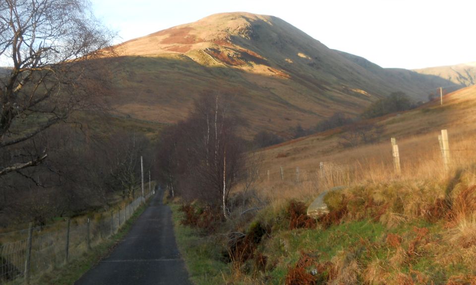
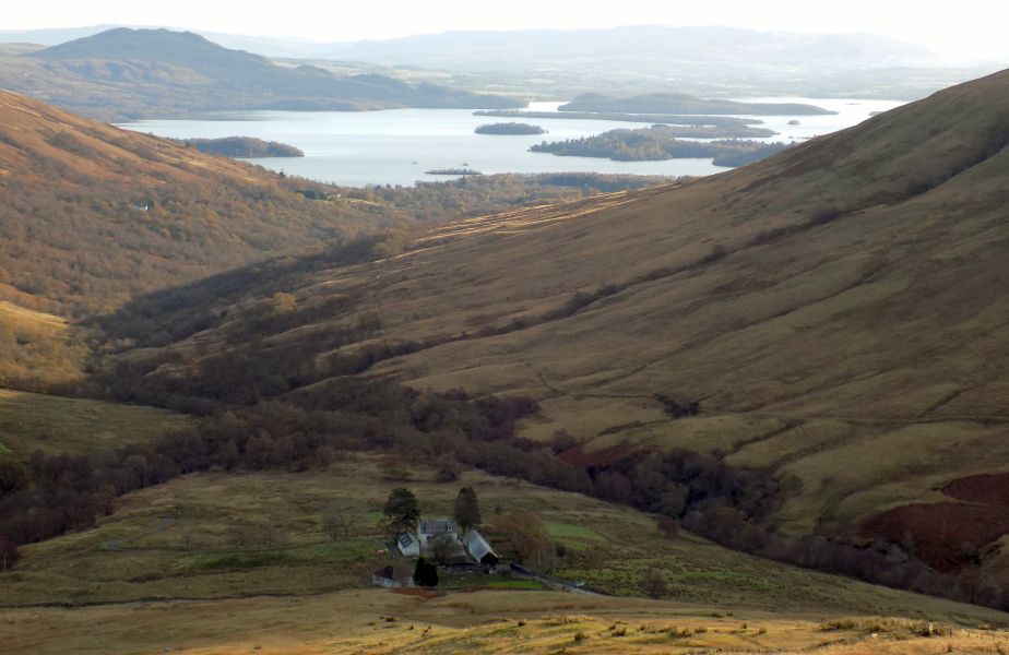
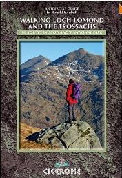
This route combines shapely Beinn Eich ( Horse Hill ) with
Doune Hill, the highest hill in the area, with an optional extension to Cruach an t-Sidhein ( Heap of the Fairies ) on route. The only slight downside is the road used for approach and descent, but using a bike takes the sting out of the slog once over the initial hill above Luss, and the return route is a doddle.
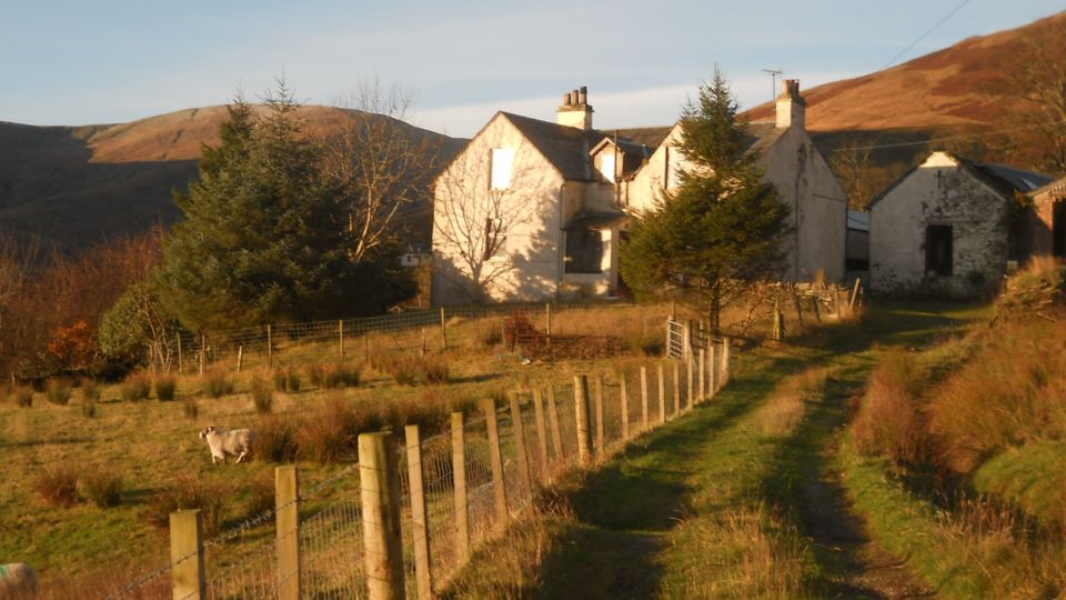
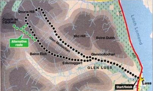
From the main car park in
Luss go south to Luss primary school. Take the access road to the wooden bridge over the A82 and ascend the Glen Luss road to Glenmollochan Farm. Beyond the farm a track branches off the road at a gate and ascends Glen Mollochan towards Doune Hill. Where the track fades halfway along. avoid the boggier sections of the glen floor before the watershed by sticking to the higher ground.
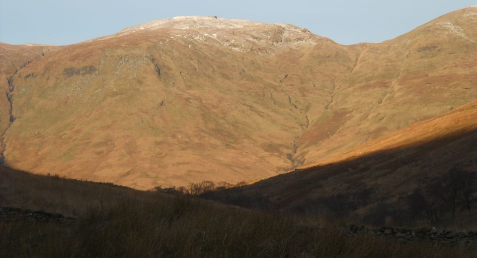
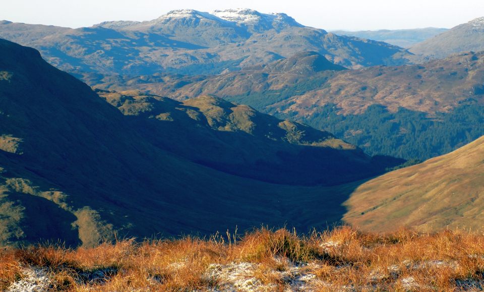
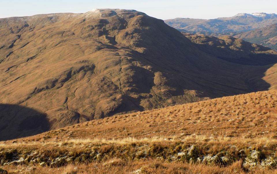
A grassy path follows the right side of the tree-filled burn between the two summits of
Doune 
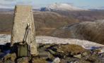
Hill to the steeper upper slopes and the rounded summit of 
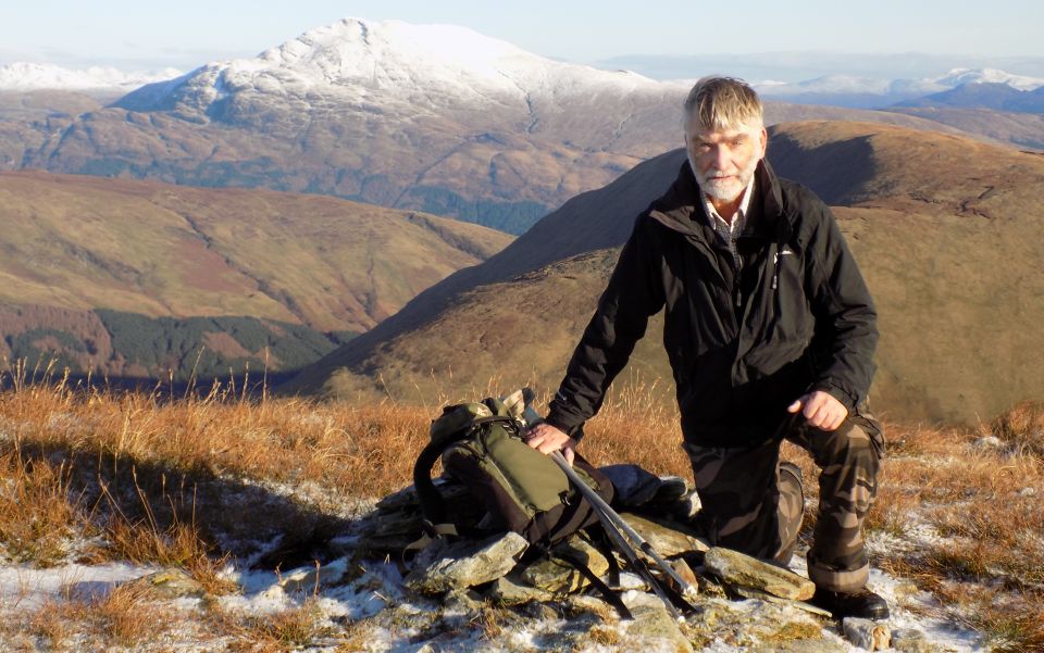
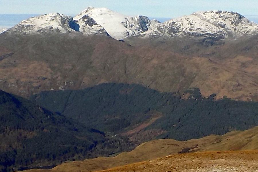
the right-hand top, then the main summit topped by a trig point and 
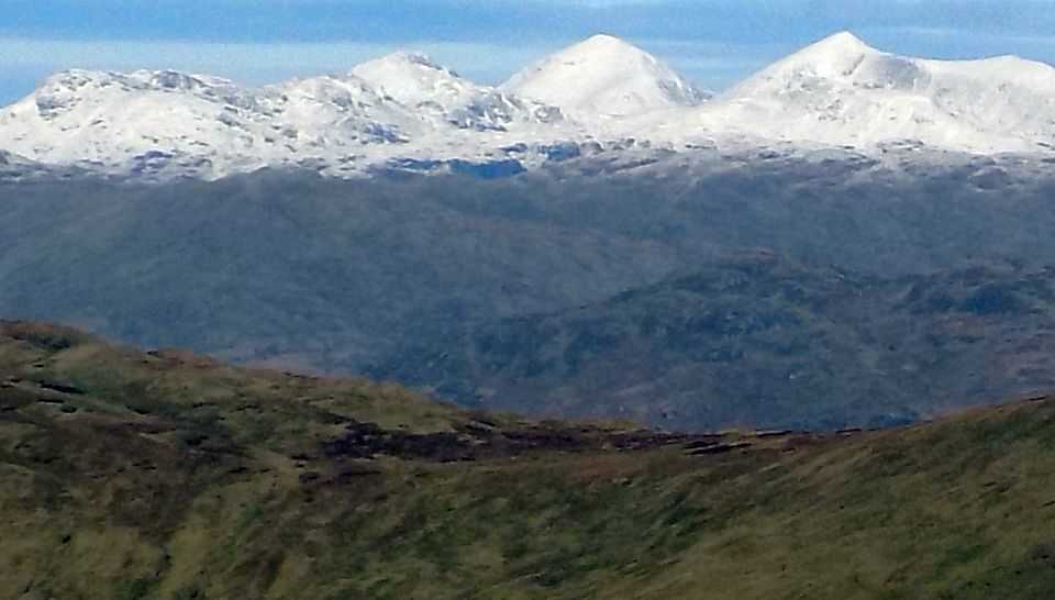
views north to the Arrochar Alps. 
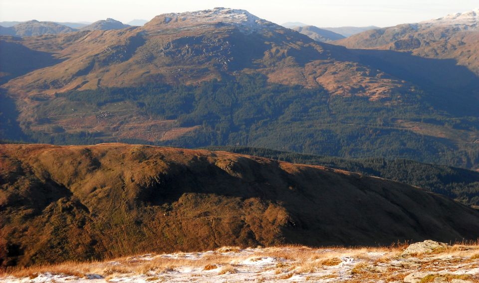
Descend south-west towards Beinn Lochain.
where there is a choice of routes. Cruach an t-Sidhein can be gained via the col to the west, followed by a contouring route back to the ridge leading to Beinn Eich, or a descent of Beinn Lochain's south ridge can be made 
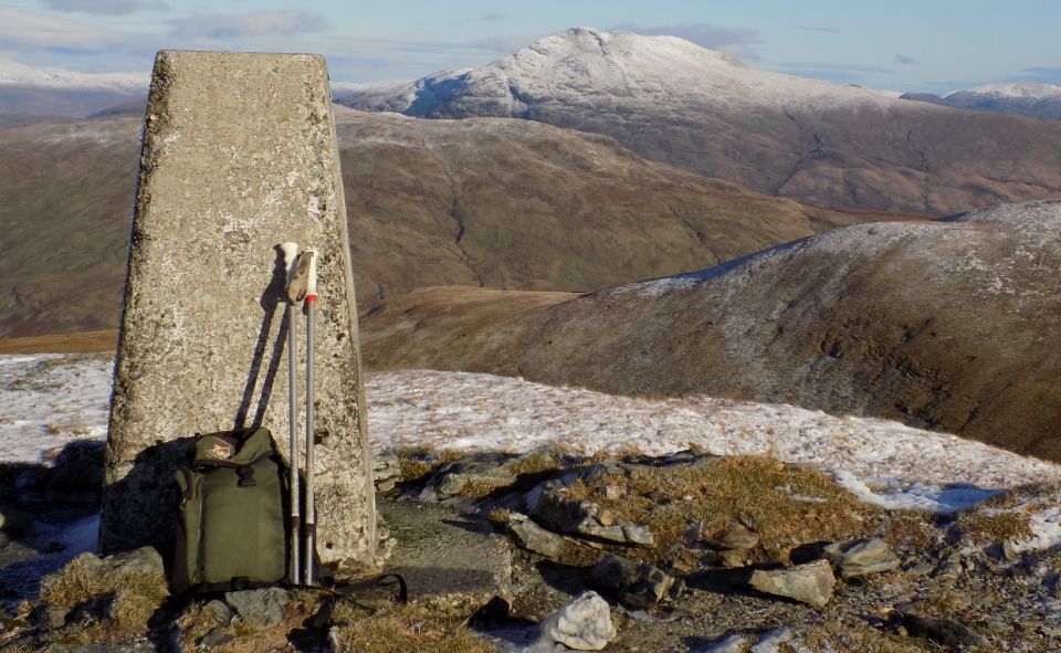
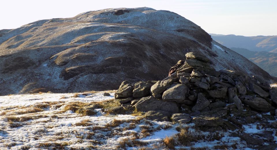
direct to this point. A short ascent leads to a grassy crest and at 
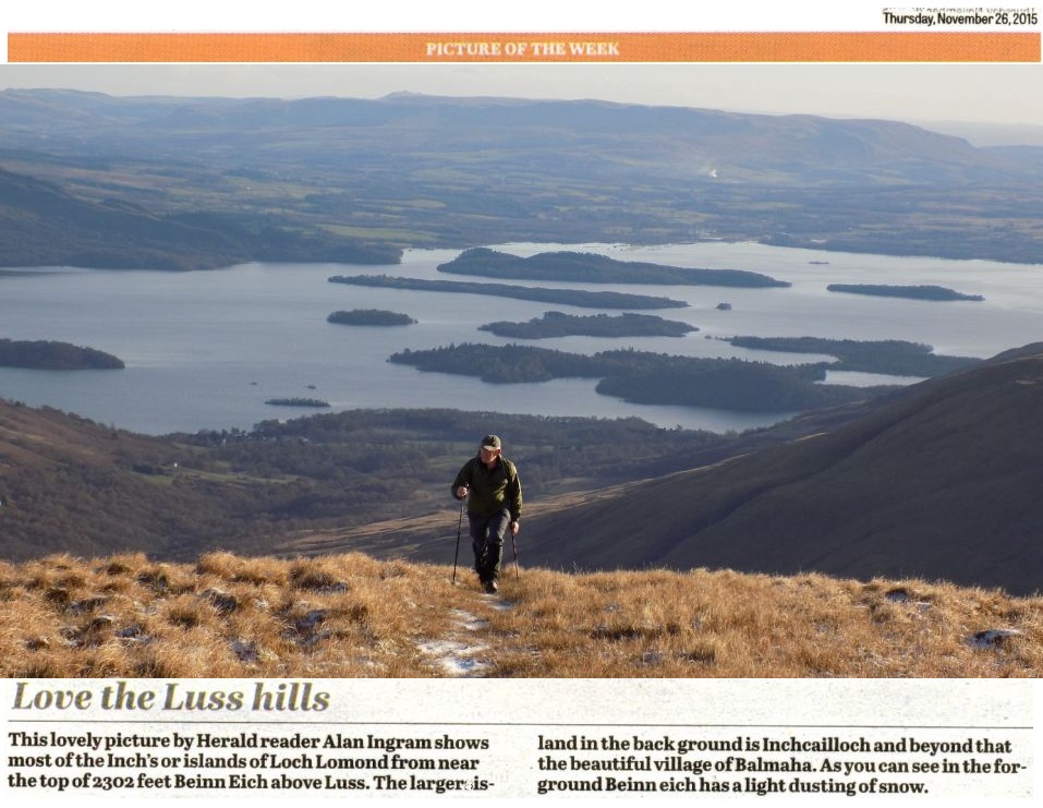
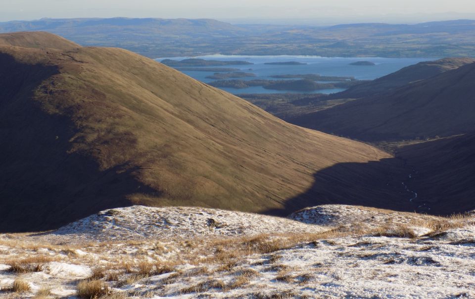
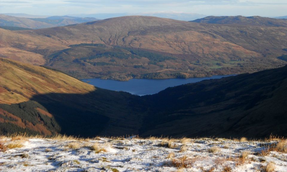
small cairn marking the top of Beinn Eich with views to
Loch Lomond and its islands and south to Tinto Hill, the Clyde, Arran and Ailsa Craig.
Descend more or less directly down the south-east ridge heading for Edentaggart farm in Glen Luss, crossing a wall at a stile and gaining a path skirting the farm to the north. This gains the access track, which you then follow back to the road.


Map for Beinn Eich and Doune Hill in the Luss Hills above Loch Lomond

Map for Beinn Eich and Doune Hill in the Luss Hills above Loch Lomond


 Doune Hill Gallery Photo Gallery

<< Back : Highland Way Index : Next >>


Scotland Index :: Scottish Peaks :: Scotland Walks

Glencoe | Ben Nevis | Knoydart | Isle of Skye | Isle of Arran

The Eastern Highlands | The Central Highlands | The Southern Highlands | The NW Highlands


Adventure Travel : Worldwide Mountaineering : Site Index

fb icon  google+ icon Linkedin icon  twitter


Guide Books & Maps - Scotland:-


West Highland Way: Footprint MapWest Highland Way - Map West Highland Way - Map Western Scotland & the Western Isles OS Road Map Northern Scotland OS Road MapSouthern Scotland OS Road Map Glasgow Popular Hills - Map

Loch Lomond North - Tyndrum, Crianlarich, Arrochar - OS Explorer Map Loch Lomond and Inverary OS Landranger Map  Loch Lomond South OS Explorer Map  Loch Lomond North OS Explorer Map


Loch Lomond & Trossachs - 25 Walks  Loch Lomond & Trossachs NP - Vol 1 - West  Loch Lomond & Trossachs NP - Vol 2 - East  Scottish Hill Tracks  Central & Southern Scotland - Backpackers Britain  Walking Loch Lomond and the Trossachs

The High Mountains of Britain & Ireland  Munros Tables SMC  The Munros - Scotland's Highest Mountains  Scotland - Lonely Planet  NW Highlands - SMC Guide  Exploring the Far NW of Scotland  Guide to Walks in NW Highlands

Walking in Scotland - Lonely Planet Mountain: Exploring Britain's High Places  National 3 Peaks Walk Scottish Highlands Hillwalking Guide The Scottish Islands Bouldering in Scotland

Glasgow Visitor Guide - Colin Baxter Itchy Insider's Guide to Glasgow Glasgow Footprint Pocket Guide Glasgow Insight Pocket Guide Glasgow Guide Pub Companion Glasgow Scotland's Highlands & Islands - Rough Guide Scotland - Rough Guide

Glasgow Insight Pocket GuideCollins Street Map of GlasgowGlasgow: Then & NowThey belonged to Glasgow Phillips Street Atlas of Glasgow & West Central Scotland Glasgow: The Photographic Atlas100 Hillwalks around Glasgow 50 Walks in Glasgow & SW Scotland

Visit Scotland - Touring Guide Scotland: Where to Stay - Hotels & Guest Houses Scotland: Where to Stay - Bed & Breakfast Rough Guide ScotlandScottish Highlands & Islands - Rough Guide Scotland - Lonely PlanetScotland's Highlands & Islands - Lonley Planet Great Glasgow StoriesGlasgow & Surroundings - Insight Guide

West Highland Way: Official GuideWest Highland Way: Rucksac ReadersWest Highland Way: TrailblazerThe West Highland WayWest Highland Way: Footprint MapWest Highland Way - Map West Highland Way - Map West Highland Way Wet Highland Way - Official Guide

Munro Almanac The High Mountains of Britain and Ireland The Munros: Scottish Mountaineering Club The Isle of Skye The Isle of Arran Wilderness Walks Ski Mountaineering in Scotland

More Wilderness Walks 50 Best Routes on Skye and Raasay Skye - W.A.PoucherMagic of the Munros Mountaineering in Scotland and Undiscovered Scotland by W.H.MurrayA Long Walk on the Isle of Skye

Classic Climbs - Central & Southern Highlands The Isle of Arran Lonely Planet, Walking in ScotlandPathfinder Guide: Skye and NW Highlands WalksPathfinder Guide: Fort William and Glen Coe Walks Rambler's Guide: Ben Nevis and Glen Coe50 Best Routes on Skye and Raasay - Chris Townsend


Google Analytics


Google Analytics

extremetracking
 eXTReMe Tracker


extremetracking
Sitelock caingram.com
SiteLock
Sitelock
Sitelock caingram.info
SiteLock
Sitelock