  |
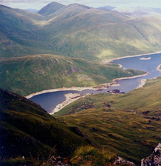
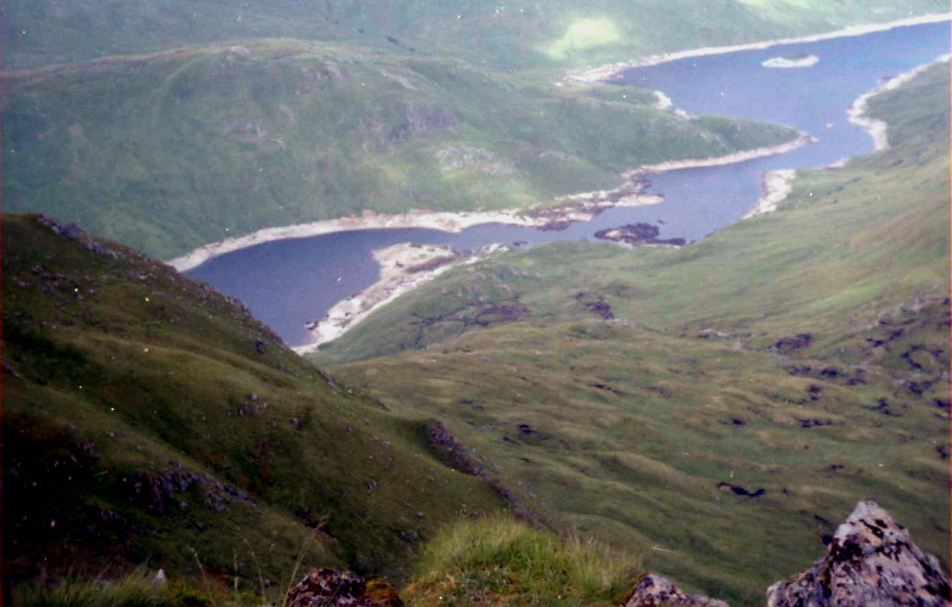
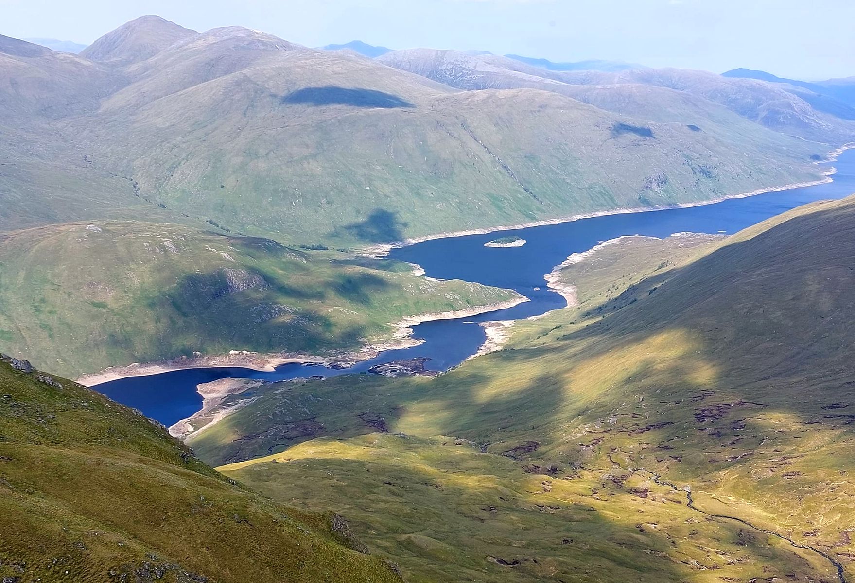
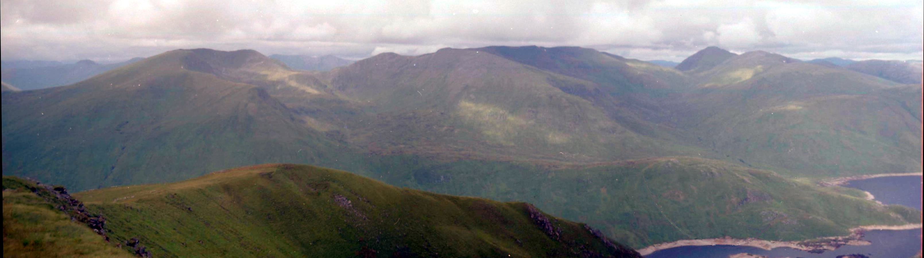
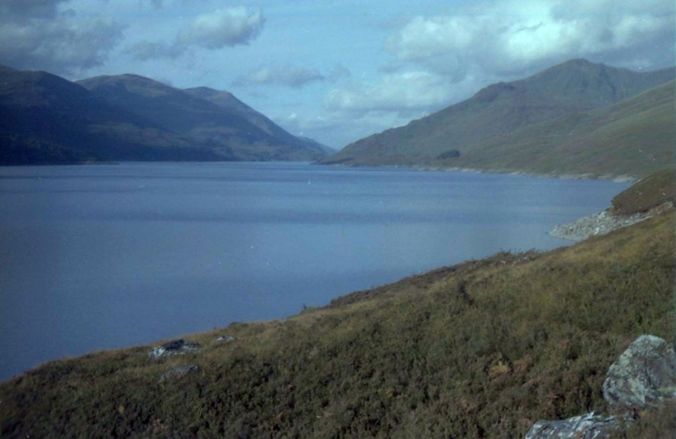
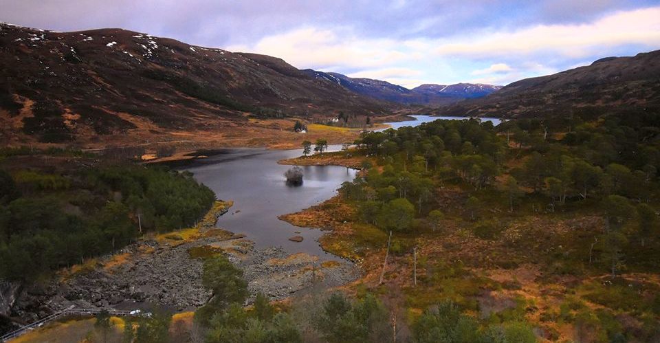
The Scottish HighlandsLoch Mullardoch
|
  |
| |
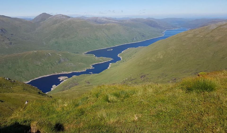
The Scottish HighlandsLoch Mullardoch
|
|
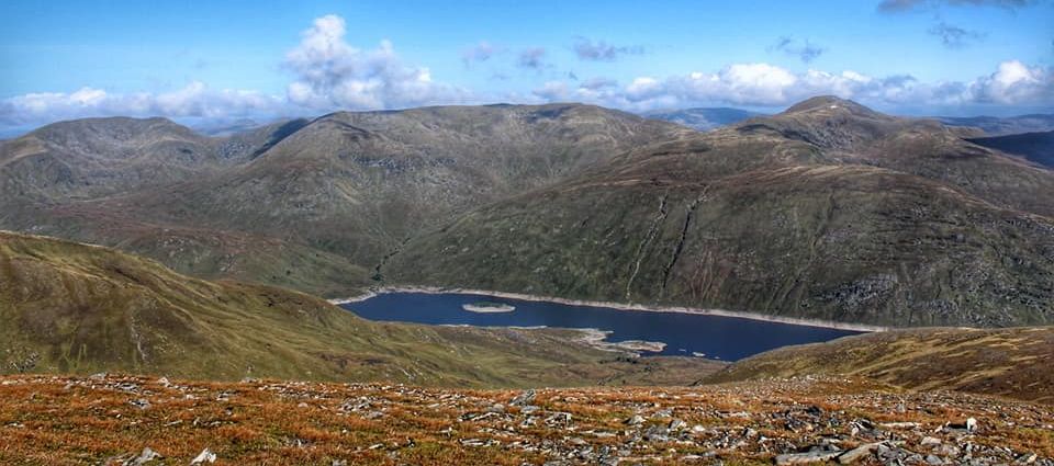
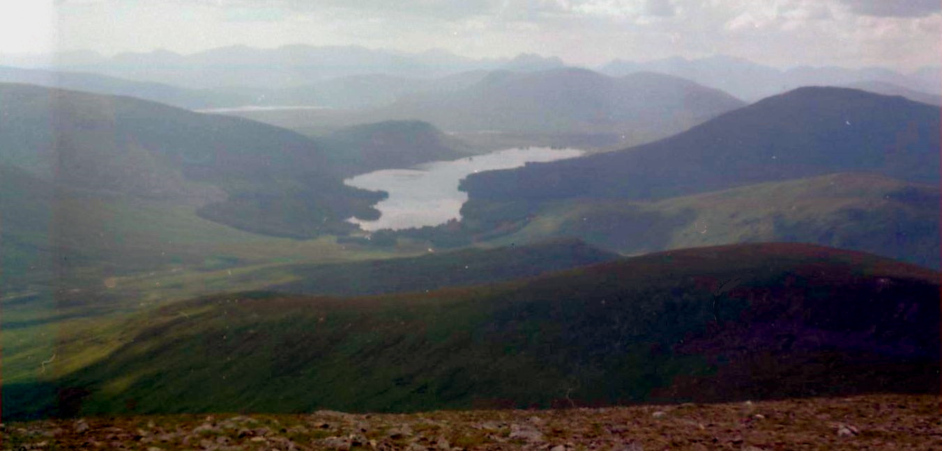
 Sgurr na Lapaich and Loch Mullardoch on ascent of Beinn Fhionnnlaidh |
 Loch
Mullardoch
on ascent of Beinn Fhionnlaidh |
 Sgurr
na Lapaich and Loch
Mullardoch
on ascent of Beinn Fhionnlaidh |
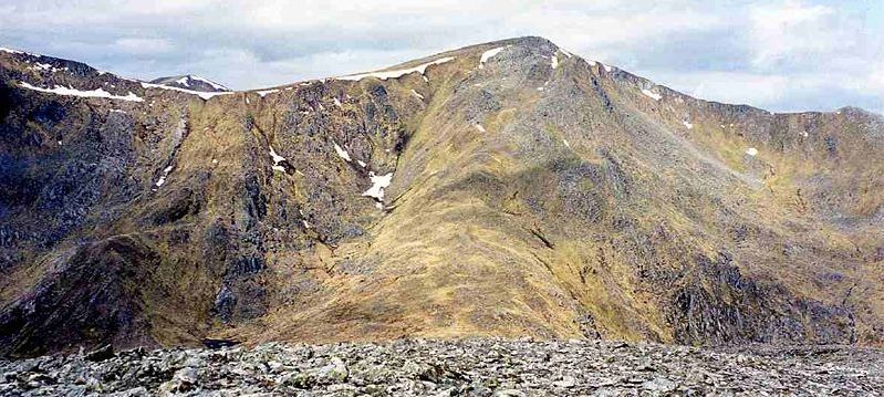
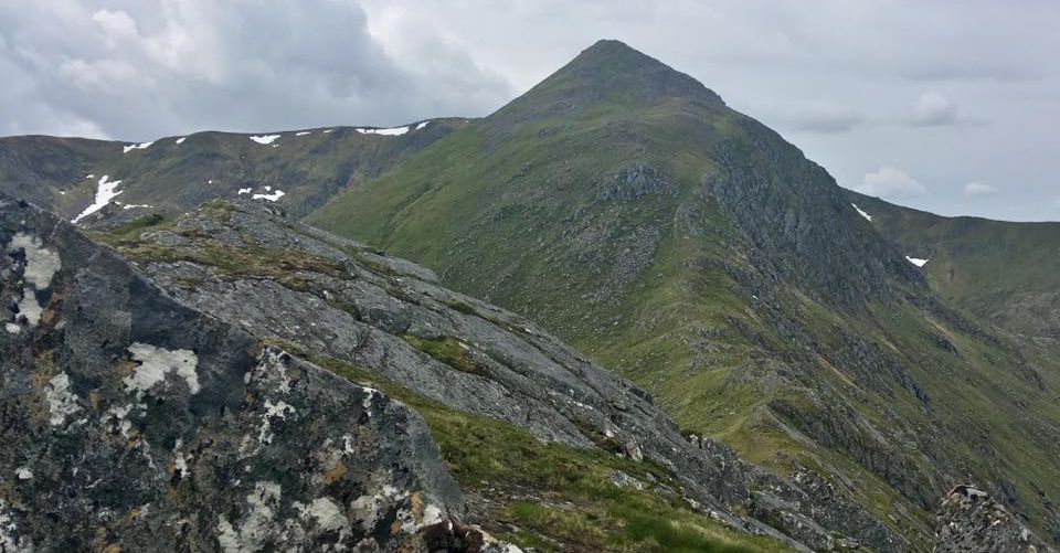
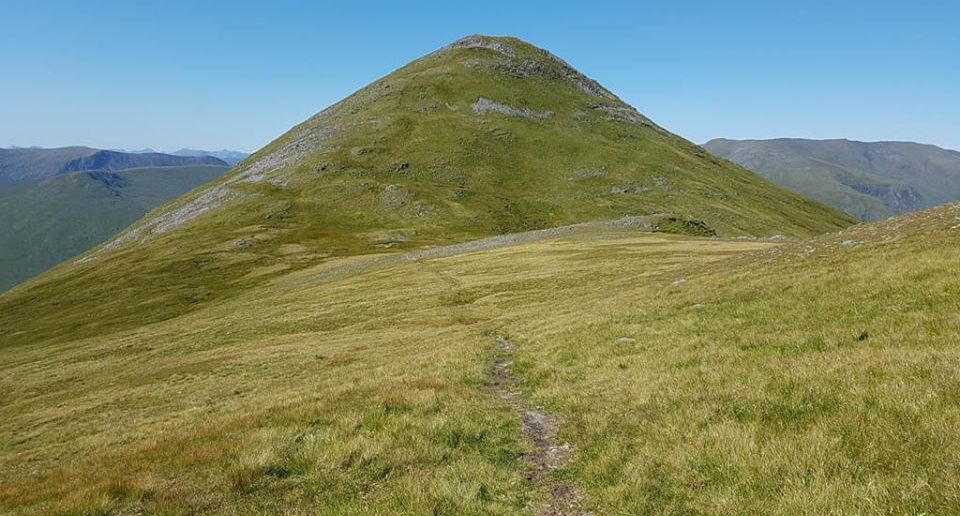
 Sgurr
na Lapaich
above Loch Mullardoch |
 Sgurr
na Lapaich
above Loch Mullardoch |
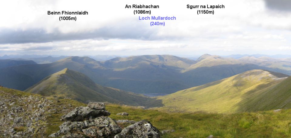
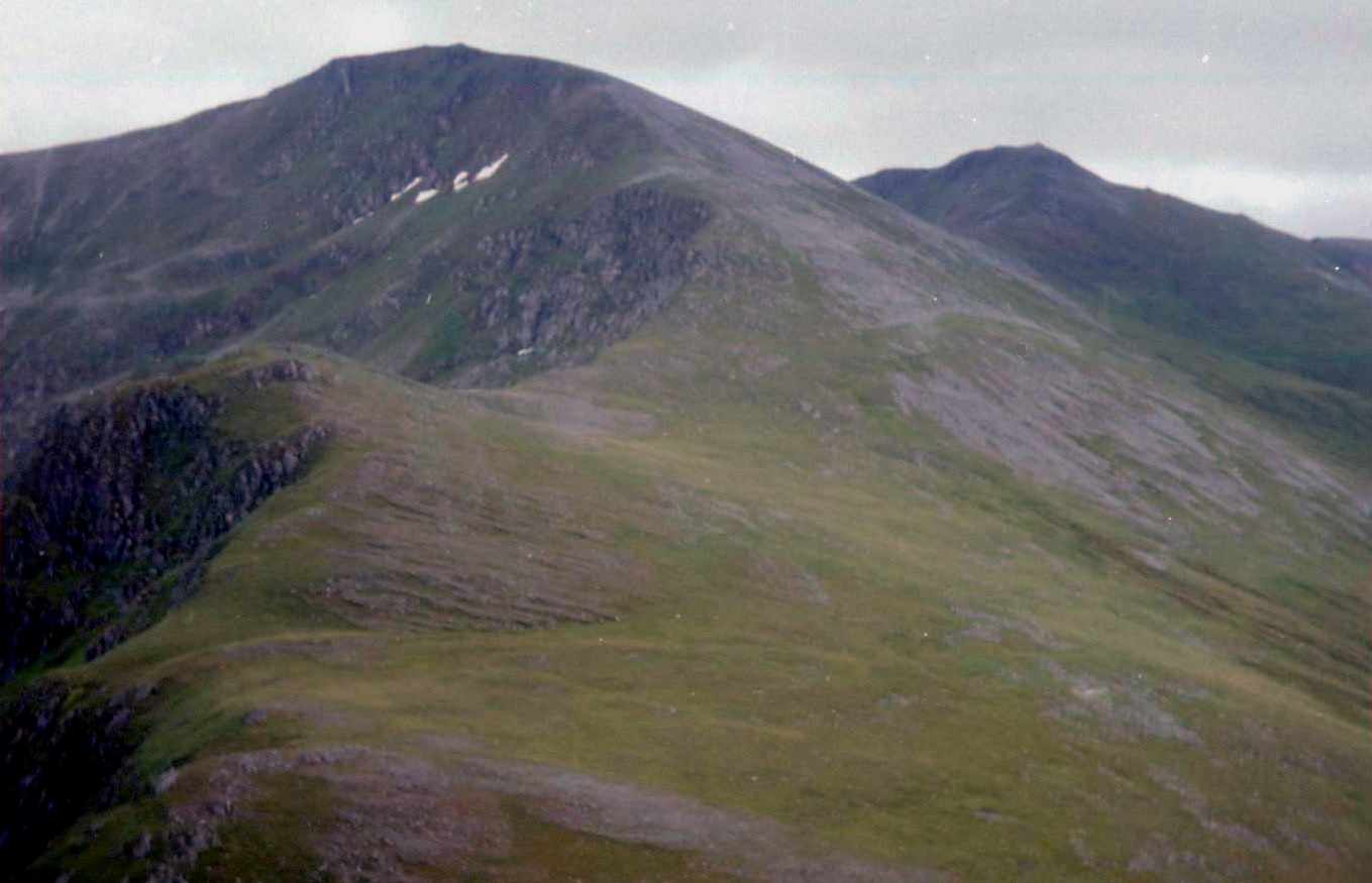
 An
Socath, An Riabhachan and Sgurr na Laipaich
above Loch Mullardoch |
 |
|
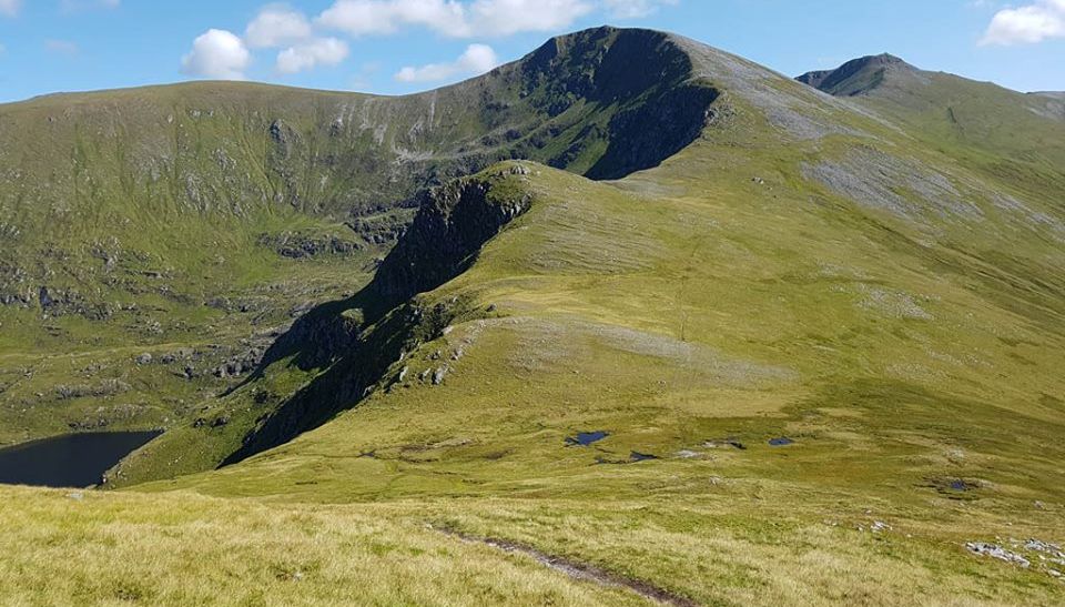
An
Socath, An Riabhachan and Sgurr na Laipaich |
 |
|
An
Socath, An Riabhachan and Sgurr na Laipaich above Loch Mullardoch |
 |
|
Beinn
Fhionnnlaidh, An
Socath and An Riabhachan above Loch Mullardoch |
 |
|
An Socath and An Riabhachan from Toll Creagach above Loch Mullardoch |
 An
Socath and An Riabhachan
from Toll Creagach above Loch Mullardoch |
 An Socath and An Riabhachan from Toll Creagach above Loch Mullardoch |
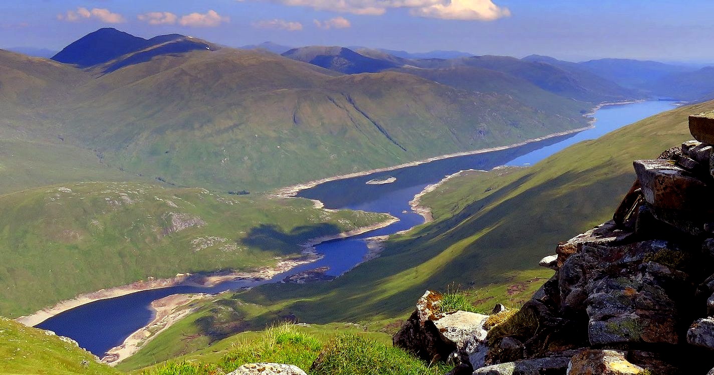
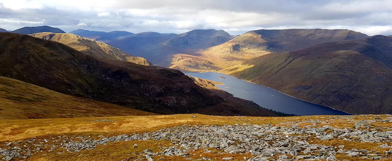
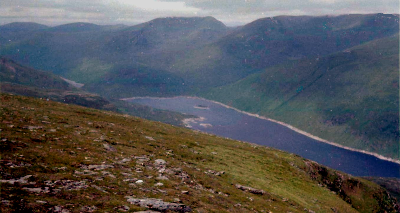
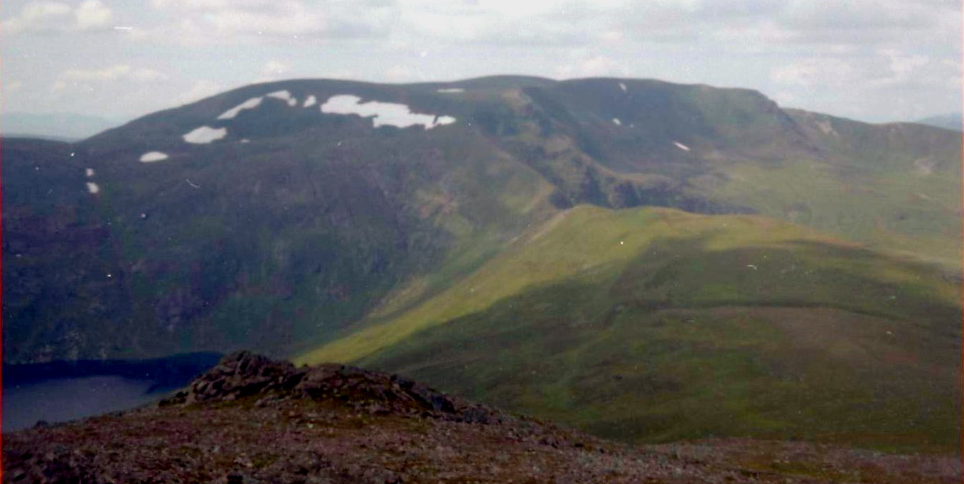
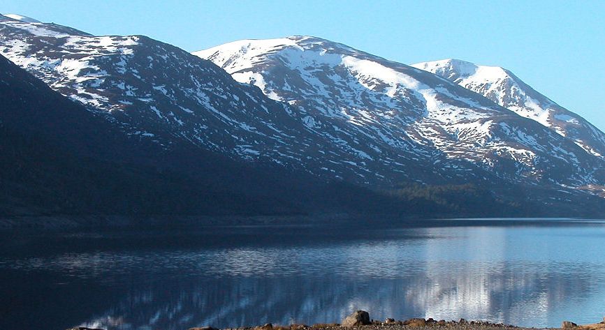
 Loch
Mullardoch
|
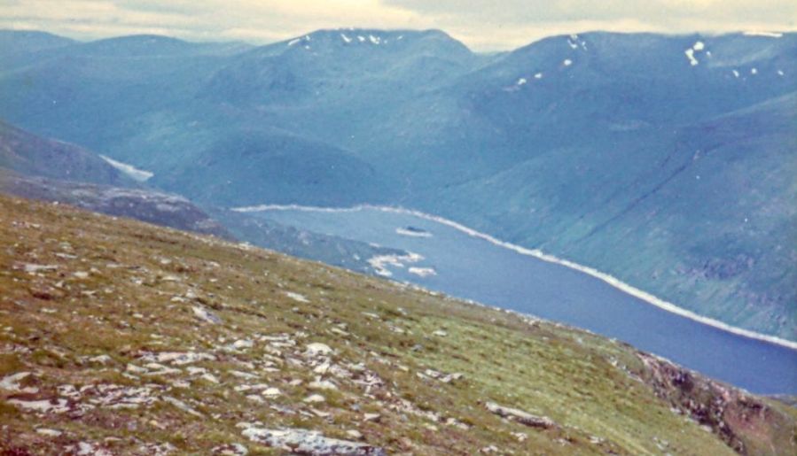
 Loch
Mullardoch
|
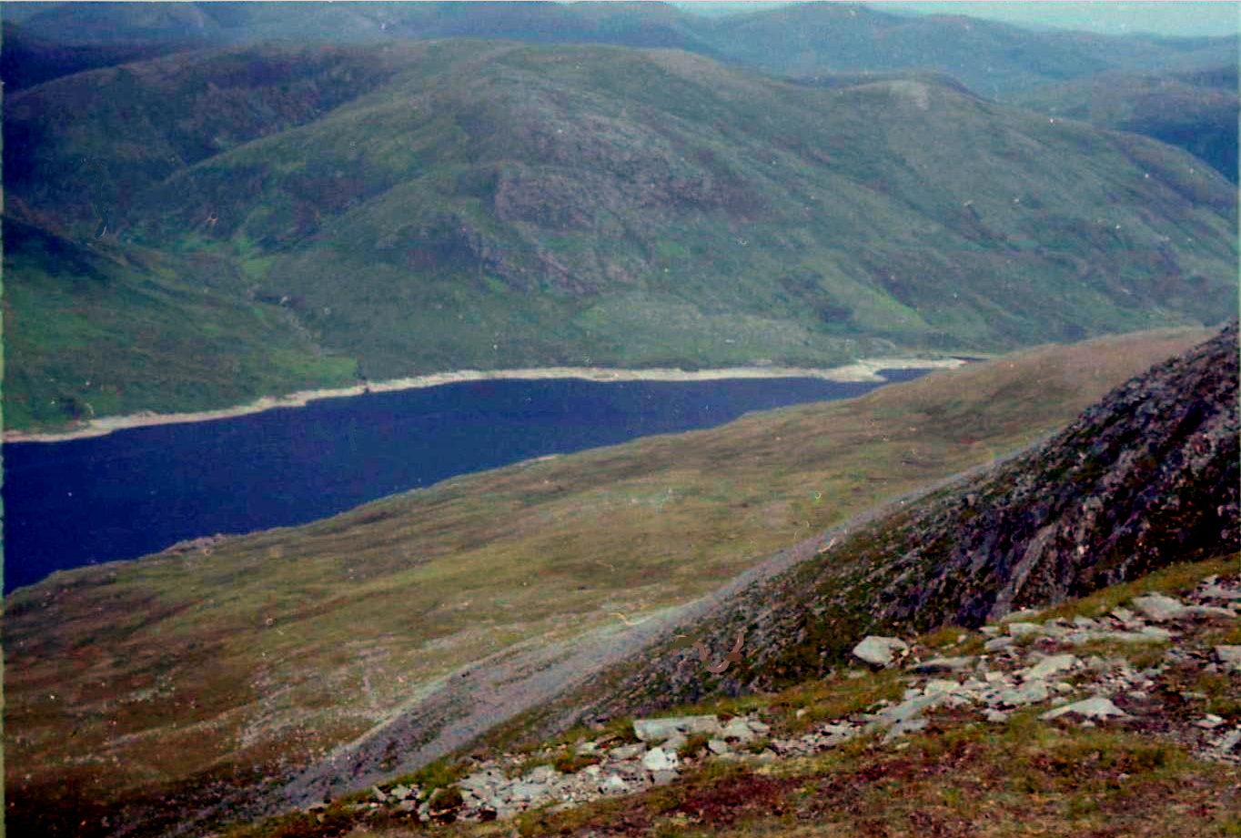
 Loch
Mullardoch
|
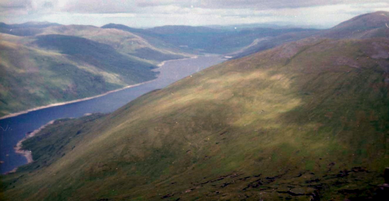
 Loch
Mullardoch
|
 |
|
View from Carn Eighe |
 |
|
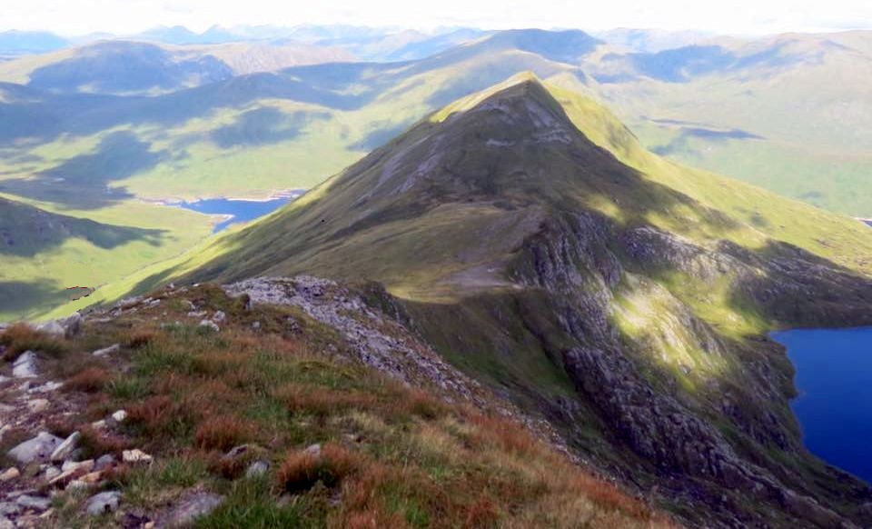
Sgurr na Laipaich from Carn nan Gobhar |
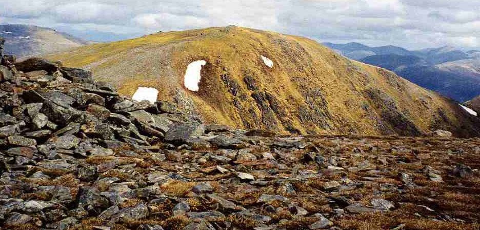
 Beinn
Fhionnlaidh
|
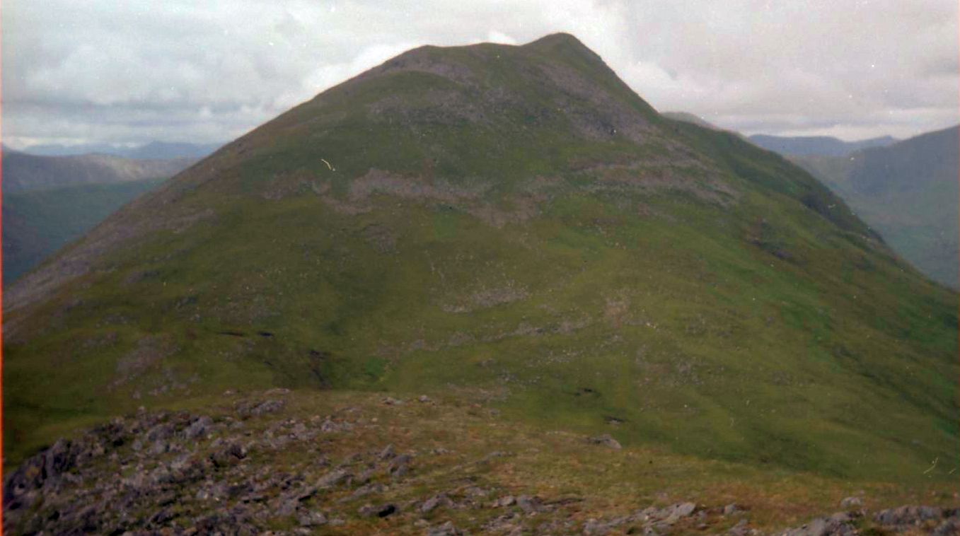 Beinn
Fhionnlaidh
|
 Beinn
Fhionnlaidh
|
 Beinn
Fhionnlaidh
|
 Beinn
Fhionnlaidh
|
 Carn
Eige from Beinn Fhionnlaidh
|
 Ascent
from Beinn Fhionnlaidh
to Carn Eige
|
 Carn
Eige
|
|
|
View from Carn Eighe to Beinn Fhionnlaidh
|
 Mam
Sodhail from Carn Eige
|
 View
from Beinn Fhionnlaidh
|
 |
|
View from Carn Eighe |
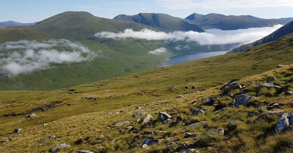
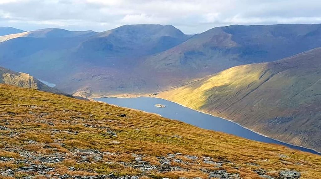
 Loch
Mullardoch
|
 Loch
Mullardoch
|
 |
|
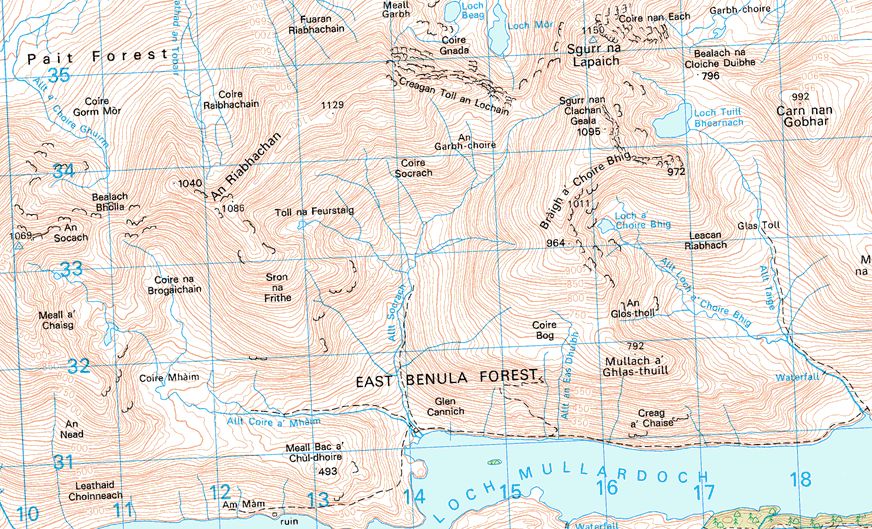
Map of An Socath, An Riabhachan and Sgurr na Laipaich
|
 |
|
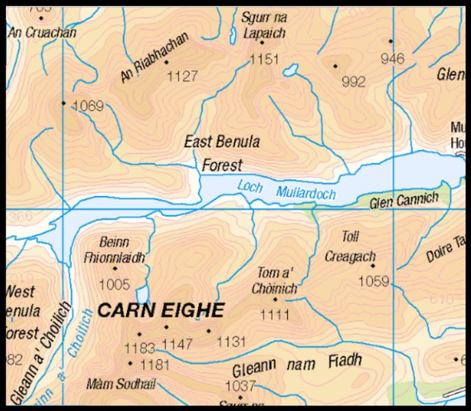
Map of Carn Eighe |
 |
|
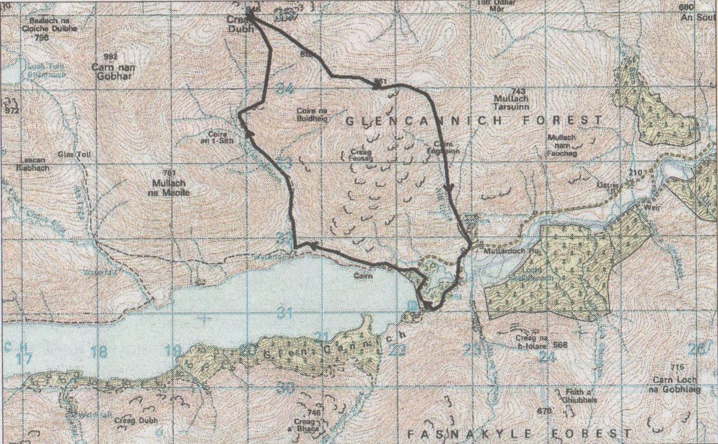
Map of Creag Dubh - a Munro Top |
|
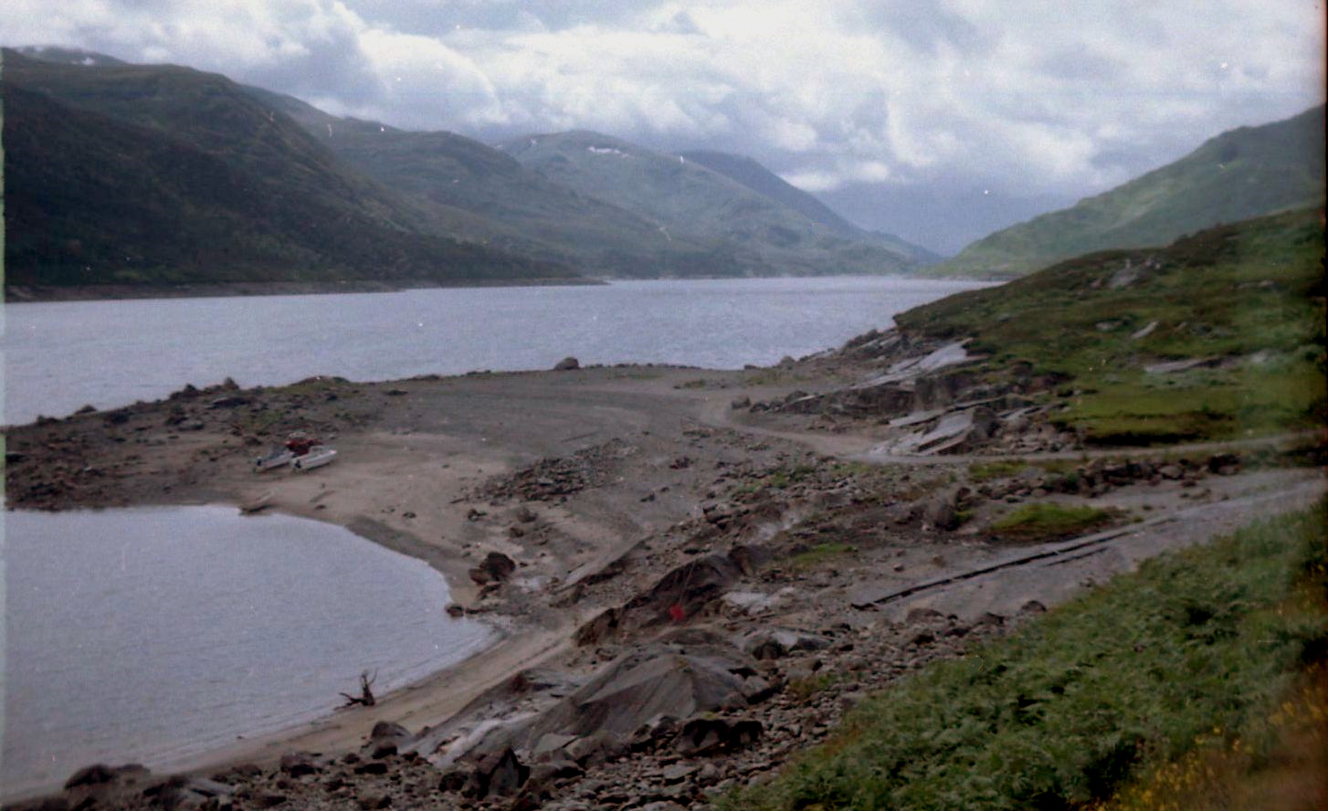
Location: Creag Dubh, Mullardoch, lnverness-shire Grade: Moderate mountain walk Distance: 8 miles/13km Time:
6-7 hours At the head of Glen Cannich, Loch Mullardoch stretches out west with some fine Munros rising from its north shore. Carn nan Gobhar, Sgurr na Lapaich, An Riabhachan and An Socach form a l5km corrie-bitten and wind-scoured ridge that requires a long walk-in along the northern shore of the loch. The ascent of Carn nan Gobhar, high above the source of the Allt Mullardoch, makes a fine circular route of about 14-15km from the Mullardoch dam. I walked this route in spring, when the sun shone on the lower slopes and snow still lay on the tops, and I recalled views of Glen Strathfarrar in the north and beyond to the big hills of the Monar Forest I also remembered the close-up views of Sgurr na Lapaich, the most majestic of all the Mullardoch Munros. Having been robbed of our desired destination for t.he day we set off for a repeat ascent of Cam nan Gobhar instead. As we set off it became apparent we might not get things our own way. It was blowing a gale and the waters of Loch Mullardoch were being whipped up into fiendish squalls. As we left the lochside and followed the oourse of the Allt Mullardoch we were mercifully sheltered from the wind but I knew that once we reached the ridge that runs west to Cam nan Gobhar that wind would hit us head-on. A boggy footpath runs up the Allt Mullardoch into Coire an t-Sith, the fairy corrie, so we made the rnost of it, enjoying the swirl of the peat-brown waters of the burn before climbing the steeper slopes of Cam nan Gobhar’s eastern top, Creag Dubh (946m/3105ft ). It had been a pleasant enough climb, despite the boggy underfoot conditions and the showers of monsoon-type rain. Clad from head to foot in GoreTex we were well protected from most of the elements, but even the best of waterproofs wouldn't stop us being battered and rocked by the wind. On the high ridge the wind was so ferocious it forced us into another unplanned route change. Instead of fighting into the gales we'd go in the opposite direction and allow the wind to blow us along to the stony summit of Creag Dubh, down easy slopes to a high bealach, then over a couple of unnamed subsidiary tops before descending Coire Eoghainn back to the Mullardoch dam. It was a good plan. The wind didn't bother us too much now that it was blowing at our backs and we wandered over some unnamed tops that are visited rarely, if at all, by the baggers. Once we left the main Carn nan Gobhar ridge there was no sign of man-made paths or tracks, only us and the wind and the occasional roaring of red deer stags. Below Creag Dubh we took shelter behind a rather curious 60m-long dry stone wall and tried to figure out what its purpose was. Could it be the remnant of some older dividing wall, separating parishes or communities, or could it have been created by trainee drystanedykers on a high-level training course? We had no idea, but were grateful for the shelter it gave us to enjoy our coffee and piece. Two more caimed summits took us east towards our earlier destination, Sgorr na Diollaid. Easy slopes took us down Cuire Eoghainn then, just as I thought we were almost there, steep slopes of old heather and invisible streams gave a purgatorial final half-hour. It was a bedraggled pair who reached the road but by this time, with the exercise-induced endorphins flowing, we declared it a memorable walk, if only for the uncertainty of it all.
|
|
Route Description for Creag Dubh |
|
ROUTE PLANNER Map: OS 1:50,000 Landranger 25 ( Glen Carron and Glen Attric ) Distance: About 6 miles/13km Time: 6-7 hours Start: Mullardoch Dam ( GR: NH223310 ) Route: From the dam at the end of Loch Mullardoch follow the road on the N side for a short distance to a boat hut. Just beyond the hut the road ends and a rough footpath continues along the N shore of the loch. Follow this path for 1.5km to the bridge over the Allt Mullardoch (NN206318). Follow the E bank of the stream up into Coire an t-Sith At the end of the path continue N up steeper slopes to the summit of Creag Dubh. Descend SE to a high bealach with a curious wall then continue ESE to a large cairn at spot helght 861. Follow the broad ridge E for a short distance before descending the slopes of Coire Eoghainn back to the start. |
|
Route Description for Creag Dubh |
Scottish Peaks : Scotland Index
Isle of Skye :: Isle of Arran :: Knoydart :: Glencoe :: Ben Nevis
NW Highlands :: Southern Highlands :: Central Highlands