Location: Ochil Hills
Map: OS Landranger 58
[GR 898975]
Distance: 6.5 miles [11km]
Time: 4 hours
Terrain: tracks and paths
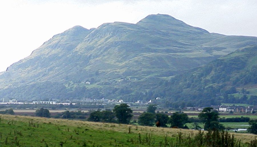
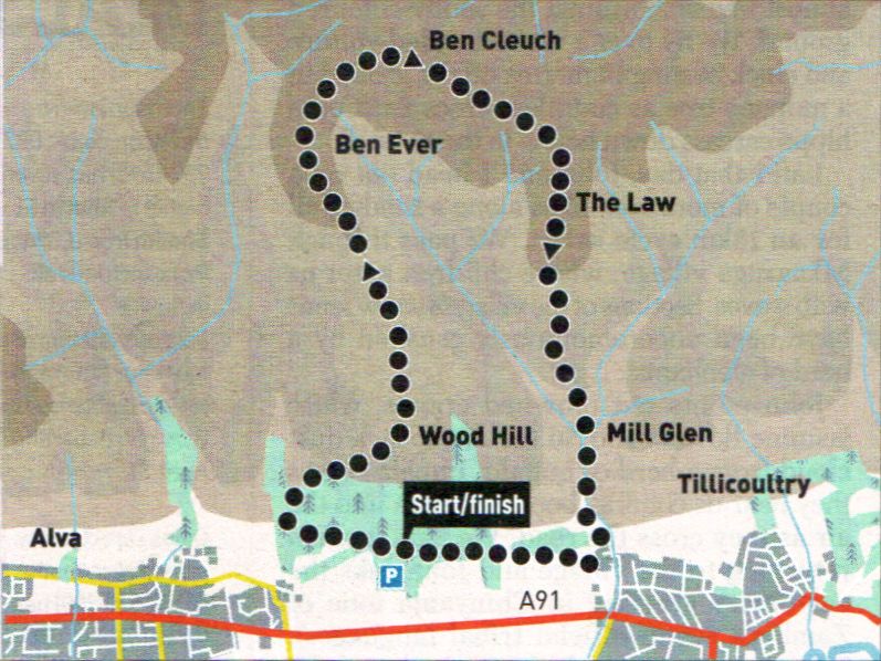
Ben Cleuch, the
highest hill in the
Ochils, is usually climbed from
Tillicoultry but parking here can
be awkward, especially at
weekends. Better parking can be
found at a woodland car park
accessed immediately to the east
of Alva, where it is signposted
from the A91. The circuit from
here is also perhaps a finer way
to appreciate the hill.
Cross the access road to follow
a track uphill through lovely
woodland, then at the point this
track descends to cross a bridge
over the Silver Burn, break off
right and climb a narrow path
steeply through gorse then trees,
out into the open. Climb the path
up the shoulder of the hill past a
stand of Scots pine and continue
uphill alongside the grassy line of
an old wall. Where the path forks,
go left then swing around right on
to the top of Wood Hill, at the
end of the long, outstretched right
arm of Ben Cleuch.
Easy walking now leads across
a curious trench-like landform,
then along the arm and up on to
the shoulder of Ben Ever. After a
short descent, swing around and
climb beside a fence to reach the
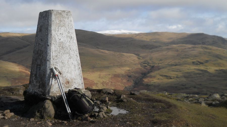
surprisingly rocky summit of Ben
Cleuch (721m), a splendid
panoramic viewpoint.
Descend gently south-east,
then south along Ben Cleuch’s
left arm, on to the top of the Law,
where the slender south ridge
leads steeply down to Tillicoultry.
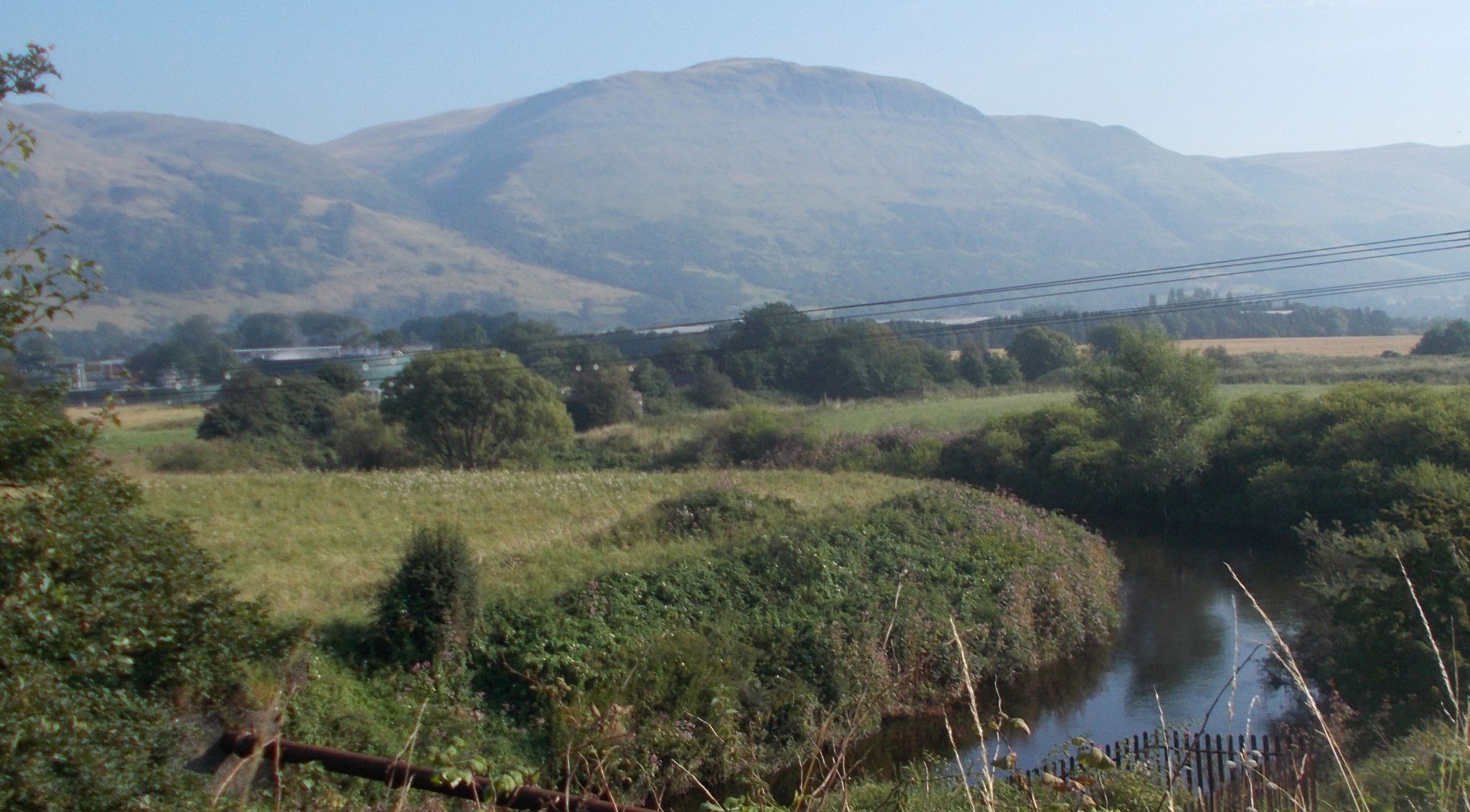
Cross the burn at the bottom and
traverse over into the lovely
gorge of Mill Glen. The path
crosses over the burn a number of
times to emerge at the bottom on
its left side. Cross over once
more, then go over Upper Mill
Street into and down
its continuation lane to reach
Scotland Place. Go right, then left
to gain a walkway and follow this
westwards as it traverses above
the golf course, then through the
woods back to the start.
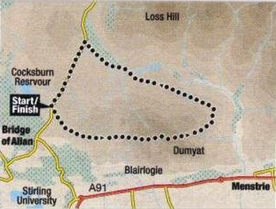
Location:
Stirlingshire
Map: 0S Landranger 57 and58 or the Harvey Maps Ochil Hills Superwalker
Distance: 5.5miles ( 9km )
Time: 3~4 hours
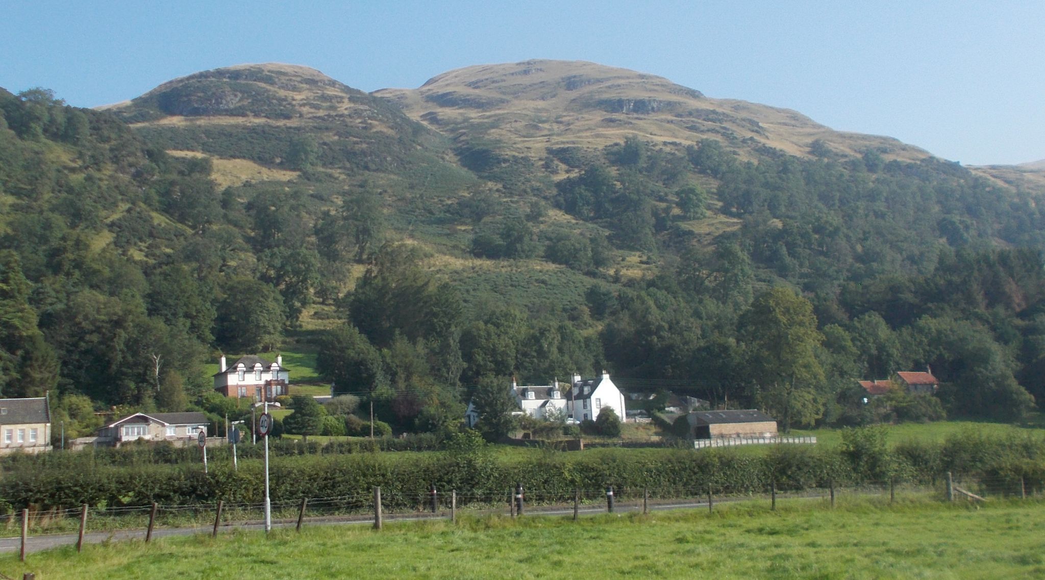
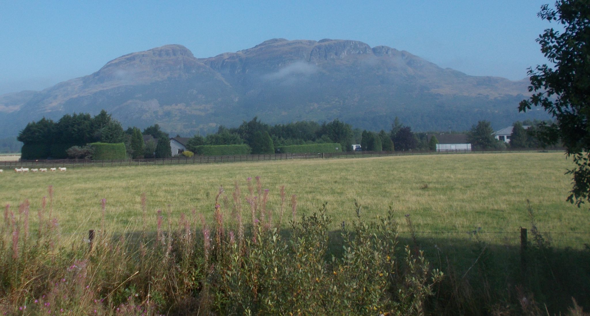
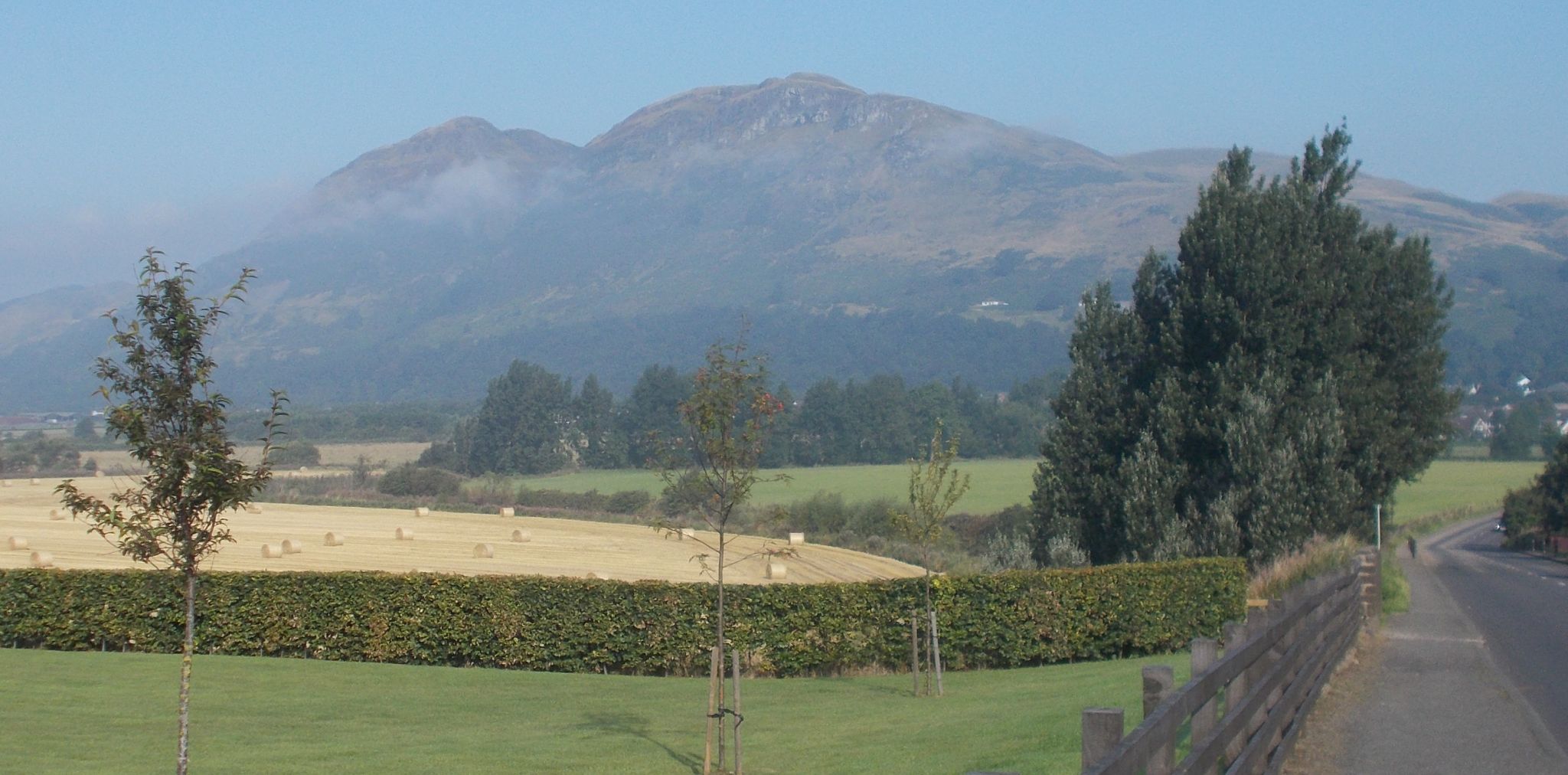
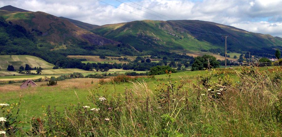
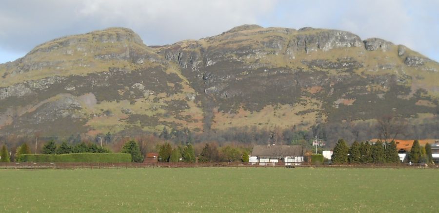
Terrain: hill climb, with road section Dumyet, the
splendidly craggy little hill at the western end of the Ochils, is full of character and offers
excellent views. The hill is often climbed from Blairlogie on the A91,
but the ascent from there is a lung-burster and
the approach from the Sheriffmuir Road is preferable, which apart from
providing good views from the outset, starts from nearly 200m up and
offers a more gradual climb. The hill's name sometimes causes confusion
it is pronounced "Dum-eye-at" not “Dum-yet".
This circuit gives a satisfying walk. It does mean there is a mile and
a bit of road walking, but it comes at the end and has the eompensation
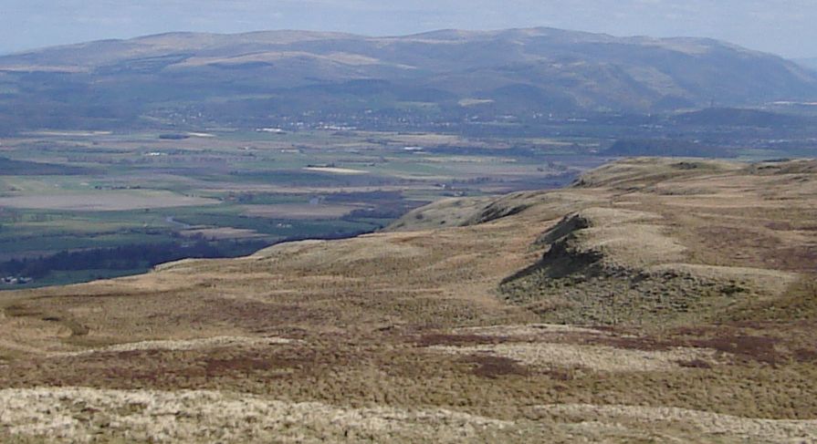
of a lovely view over Cocksburn Reservoir towards Ben Lomond.
As soon as you start to climb towards Dumyat you can see down to the
right the distinctive shape of the Wallace Monument. The view steadily
expands to include Gargunnock Crags,
the Forth and the carse between Stirling University campus is below you.
Dumyat then appears, looking every inch a proper little mountain. ‘The
vista of the Forth now stretches beyond Kincardine Bridge. There are
several lovely little corners along here where you can take a break.
You can see the summit, but the last section always seem to take longer
than it should.
At the top, there are various hits of hill "furniture" including a
large brazier, two memorial plaques to the men of the Argyll &
Sutherland Highlanders and a representation of the regiments badge in a
rather depressing grey colour. Ignore these and concentrate on the
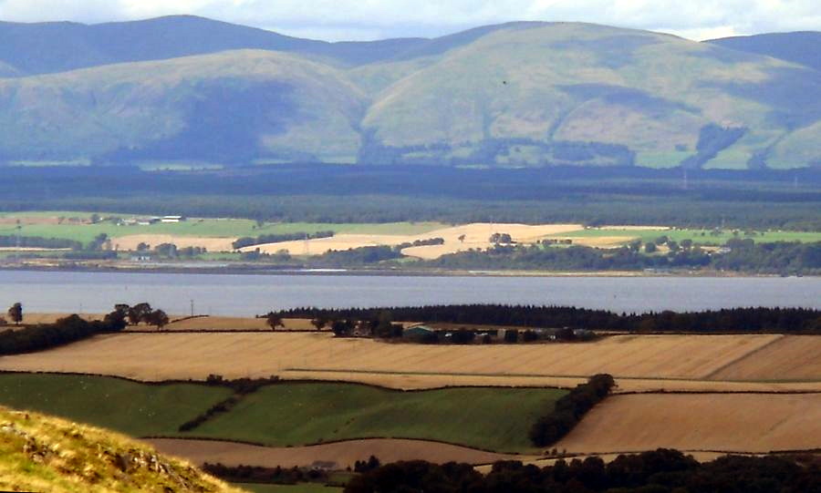
panorama. To the south is the carse, the Forth and Stirling. To the
north are massed ranks of hills including Ben
Ledi, Ben Vorlich, Stuc a’Chroin and many more. Eastward,
the Ochils show as waves of green with Ben Cleuch just above the rest. The hillfoot
towns nestle below.
Dumysat is a volcanic plug of igneous rock, as are Abbey Craig (site of
the Wallace Monument ) and Castle Rock in Stirling.
The steep scarp of the south face of the Ochils
looks like a fault line, but in fact it is just a major geological
uplift. The nature of the rock means that the ground is fertile, hence
the wide range of wild flowers seen in spring and summer.
The second part of the walk, round the back of Dumyat, is a lovely
meander, on generally unfrequented paths in beautiful surroundings
Menstrie Glen ls below you. Grouse are found on these moors and you may
well hear their distinctive rattling call. It is hard to believe that Stirling
is so near. There is a great sense of space here. As the path swings
left, you see ahead across the glen the former in-bye land of the
long-abandoned hill farm of Jetah.
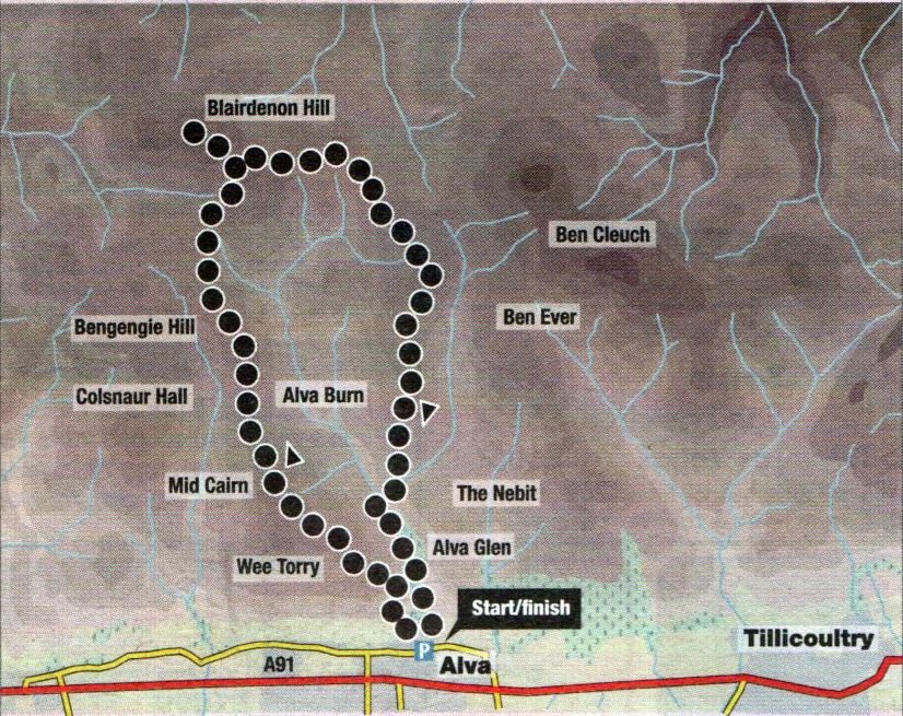
Map of
Alva
Burn Circuit
in the Ochil
Hills
Route
Description of Alva
Burn Circuit
Location: Alva
Map: OS
Landranger 58 (GRB849?5)
Distance: 8
miles (13krn)
Time: 4.5 hours
Terrain: paths,
pathless hillside and hill tracks
This
splendid high level circuit of the Alva Burn takes in the hilltops of
Mid Cairn, Bengengie Hill, Blairdenon Hill and Craighorn.
Start from the
Alva Glen car park, which is signposted off the main road through Alva.
Walk through the gap in the wall at the car park entrance, cross
the road to the water treatment facility, then go over a metal stile
and follow a "narrow path steeply through gorse and bands of
rock on to the hillside. Continue to where the path levels out Where it
meets a fence, then break off left and climb steeply
past a boulder on to the obvious grassy gully which can be seen high
above.
At the top, take
in the viewpoint of Wee Torry on the left, then continue up on to the
rounded ridge to follow a narrow hill path over Mid Cairn (
542111; 1778ft ) and on to Bengengie Hill ( 565m; 1853ft ). Drop off
the back on to a grassy hill track that cuts across Menstrie Moss
and swings up right onto Blairdenon Hill to meet another hill track
which leads left to the summit ( 631111; 2070ft ).
Retrace your
steps and continue east across the high ground, staying on the grassy
track which swings around the head of the glen. Stick with
the track as it cuts right beneath peat hags then left back on to the
high ground before reaching a gate in a fence. Cross the fence by a
stile and continue to the top of Craighorn ( 583111; 1912ft ).
Descend the
hill’s southern spur via a path then a grassy track to gain the main
track below at the point it bends across the Glenwinnel Burn.
Cross the burn, then go up the track for 100m or so before breaking off
right to descend a steep grassy ridge to gain the floor
below. Take great care here, for the slopes closer to the burn drop
sharply over rocks either side of a splendid waterfall.
Going upstream,
cross firstly the burn issuing from the fall, then the main Alva Burn,
then climb up the other side to a narrow path and follow
this to where it splits at the Smugglers Cave viewpoint. Take the
downhill path which leads pleasantly through Alva Glen back
to the car park.
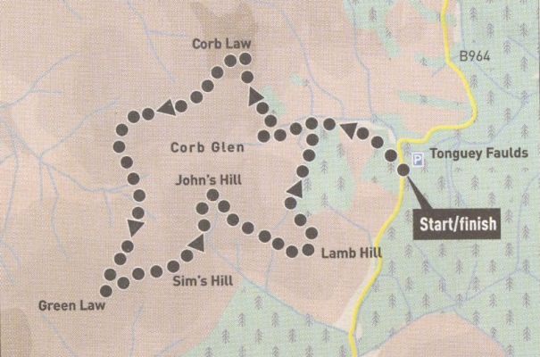
Map of
Corb Glen Circuit
in the Ochil
Hills
CORB GLEN CIRCUIT - ROUTE DESCRIPTION:
Lothian: The Ochil Hills
Map: OS Landranger 58 ( GR 017082 )
Distance: Six miles ( l9km )
Time: Three hours
Terrain: Tracks and hillside
This is a scenic walk over a number of minor hilltops in the lesser known eastern part of the Ochil Hills.
Start from the Forestry Commission car park at Tonguey Faulds, incorrectly signed as Littlerig, which is in fact a
kilometre or so further south and is met first on the B934 from Yetts O’ Muckhart and the entrance to Glen Devon.
Walk north up the road for 50m, then go through a gate on the other side and follow a track through a forestry plantation out
into the open. Continue beneath another plantation and when the deep defile of Corb Glen comes into view and the track starts to
descend. break off left to climb up the right side of the plantation to the top of Lamb Hill ( 422m ).
Swing around and drop down north-west into the dip then ascend a grassy track to the top of John's Hill ( 483m ) a splendid
viewpoint, especially north-west to the Highlands.
Descend south-west to a col then climb steeply to the top of Sim's Hill following a grassy track to the right of a fence, then
continue on to Green Law ( 481m ) with the 18 turbines of the Green
Knowes wind farm ahead and the main mass of the Ochils beyond.
Now descend north, aiming for the right side of Craig Mead, a small
outcrop of rock just above the track in the glen. On reaching
this, climb the slope on to Little Law then swing around north-east to
pick up a grassy track which leads to the summit of Corb Law ( 475m ).
Cross the fence and descend southwards to a small plantation, then down its right side on to a track. Traverse this track
rightwards across the hillside to join the main track through Corb Glen
and follow this back to the start. The final hill can be omitted and a
shorter retum
made along the track through Corb Glen itself.