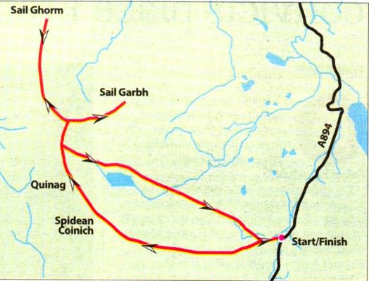
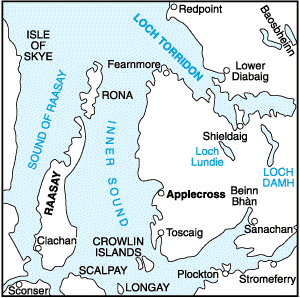
Munros Tables SMC Gairloch, Ullapool & Loch Maree OS Map

 The Scottish Highlands


Quinaig
The High Mountains of Britain & Ireland Guide to Walks in NW Highlands


Spidean Coinich on Quinaig in Sutherland

Spidean Coinich ( 764m, 2546ft )

- one of the three Corbetts

on Quinaig in Sutherland

Quinag presents a formidable sight

 with its two huge buttresses

 of Sàil Gharbh and Sàil Ghorm

 dominating the skyline.


Spidean Coinich from Sail Gharbh on Quinaig in Sutherland

Spidean Coinich from Sail Gharbh

( 808m, 2651ft )

- the highest of the three Corbetts )

on Quinaig


Spidean Coinich from Sail Gharbh on Quinaig in Sutherland

Spidean Coinich from Sail Gharbh

( 808m, 2651ft )

- the highest of the three Corbetts )

on Quinaig


Summit Ridge on Quinaig in Sutherland

Summit Ridge

on Quinaig

in Sutherland


Spidean Coinich on Quinaig in Sutherland

Spidean Coinich ( 764m, 2546ft )

on Quinaig

in Sutherland


Spidean Coinich on Quinaig in Sutherland

Spidean Coinich ( 764m, 2546ft )

on Quinaig

in Sutherland


Spidean Coinich on Quinaig in Sutherland

Spidean Coinich ( 764m, 2546ft )

on Quinaig

in Sutherland


Spidean Coinich on Quinaig in Sutherland

Spidean Coinich ( 764m, 2546ft )

on Quinaig

in Sutherland


Spidean Coinich on Quinaig in Sutherland

Spidean Coinich ( 764m, 2546ft )

on Quinaig

in Sutherland


Spidean Coinich on Quinaig in Sutherland

Spidean Coinich ( 764m, 2546ft )

on Quinaig

in Sutherland


Spidean Coinich on Quinaig in Sutherland

Spidean Coinich ( 764m, 2546ft )

on Quinaig

in Sutherland


Spidean Coinich on Quinaig in Sutherland

Spidean Coinich ( 764m, 2546ft )

on Quinaig

in Sutherland


Spidean Coinich on Quinaig in Sutherland

Buttress on Quinaig


in Sutherland


Summits of Quinaig in Sutherland

Summits of Quinaig


in Sutherland


Summit ridge of Quinaig in Sutherland

Summit ridge of Quinaig


in Sutherland


Precipice Edge on Quinaig in Sutherland

Precipice Edge


on Quinaig


View from Quinaig in Sutherland

View from Quinaig


View from Quinaig in Sutherland

View from Quinaig


Quinaig in Sutherland

Quinaig


Quinaig above Loch Assynt in Sutherland

Quinaig


above Loch Assynt


Quinaig above Loch Assynt in Sutherland

Quinaig

above Loch Assynt


Quinaig above Loch Assynt in Sutherland

Quinaig

above Loch Assynt


Quinaig above Loch Assynt in Sutherland

Quinaig


Quinaig in Sutherland

Quinaig


Quinaig in Sutherland

Quinaig


Quinaig in Sutherland

Quinaig


Quinaig in Sutherland

Quinaig


View from Quinaig in Sutherland

View from Quinaig


View from Quinaig in Sutherland

View from Quinaig


Quinaig in Sutherland

Quinaig


Quinaig in winter

Quinaig in winter


Sunset in Sutherland

Sunset in Sutherland

Sunsets & Sunrises Gallery


Sunset in Sutherland

Sunset in Sutherland

Sunsets & Sunrises Gallery


Map of Quinaig

Map of Quinaig


Route Map of Quinaig

Route Map of Quinaig


QUINAIG - ROUTE DESCRIPTION:

Location: Sutherland
Map: OS Landranger 15
Distance: 9 miles ( 15km )
Time: 6-8 hours
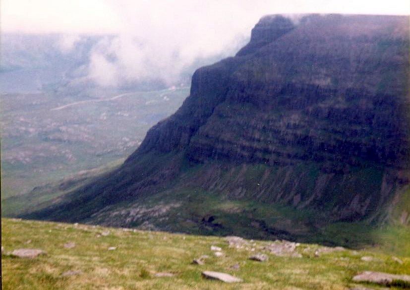
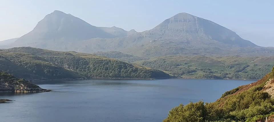
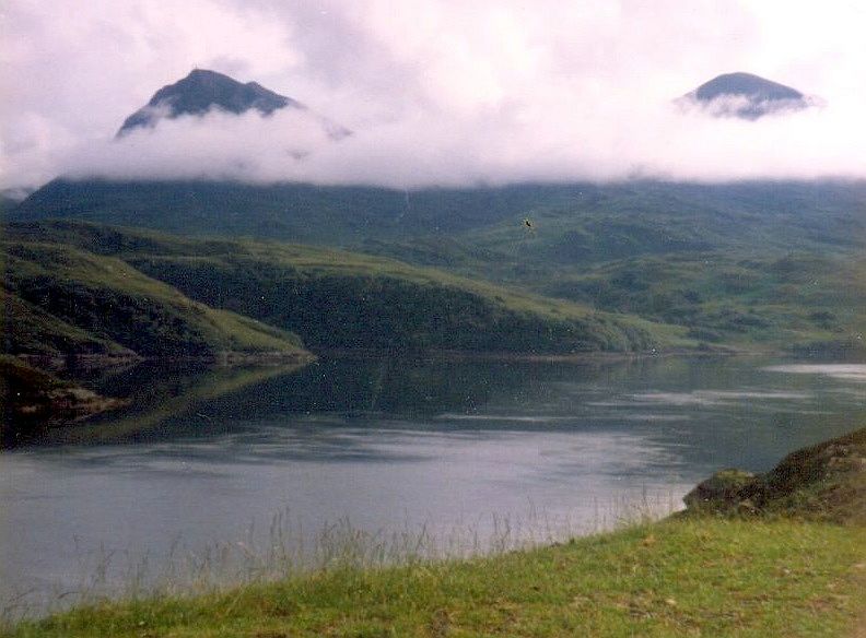
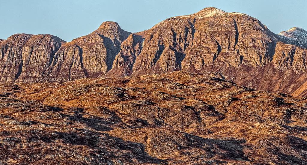
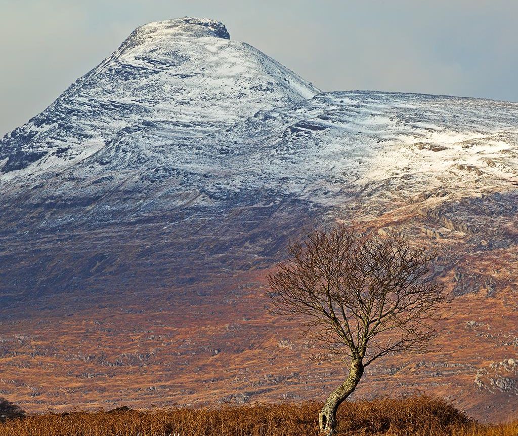
Terrain: Paths, grass and rock

Approaching Kylesku from the north the first glimpse of Quinag can be intimidating. On dour days it can look distinctly menacing, the main backbone of the mountain shy and retiring, hidden by the perspective of the land behind steep, barrel-shaped buttresses of terraced rock.
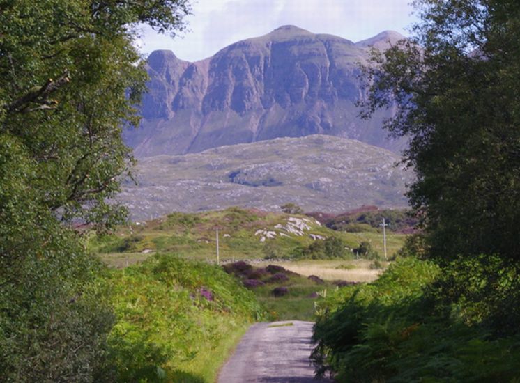
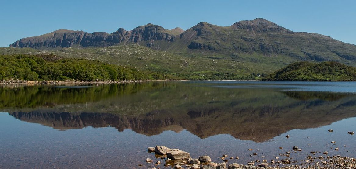
From the Lochinvar road, in the west, that ridge becomes the dominant feature, a 5km wall of Torridonian sandstone with a splintered 
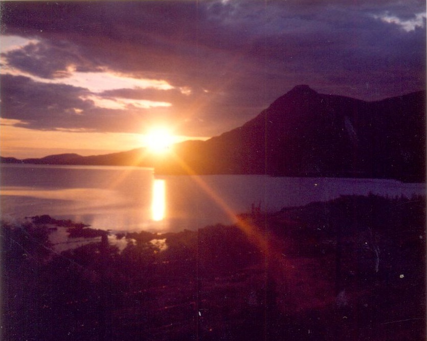
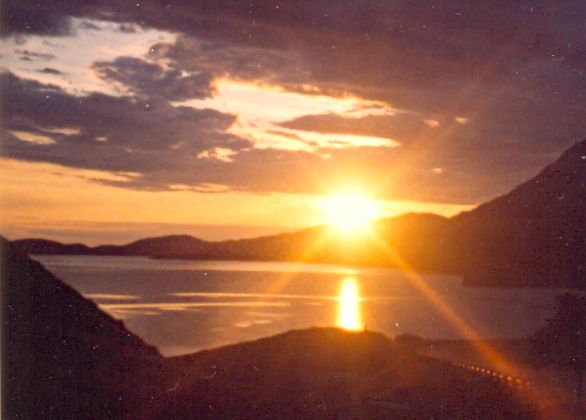
quartzite crest. In the light of a winter sunset it can look fierce, while on a summer’s day all threats melt away. With a high-level start, obvious paths and wide-ranging views the ridge walks to the three summits make one of the best high-level excursions in the north.
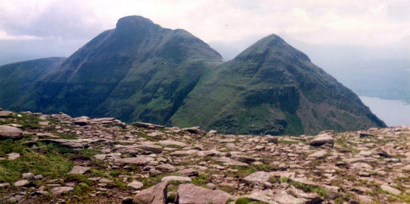
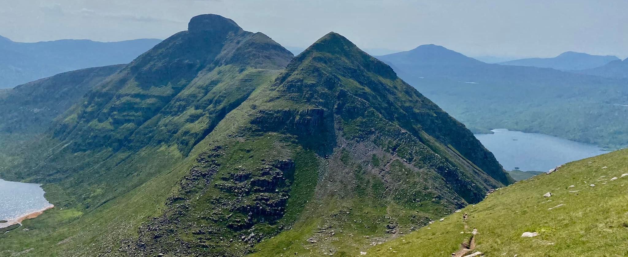
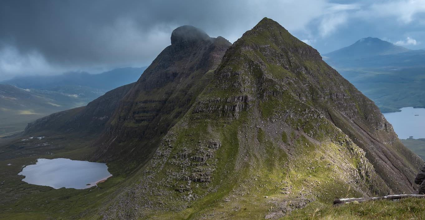
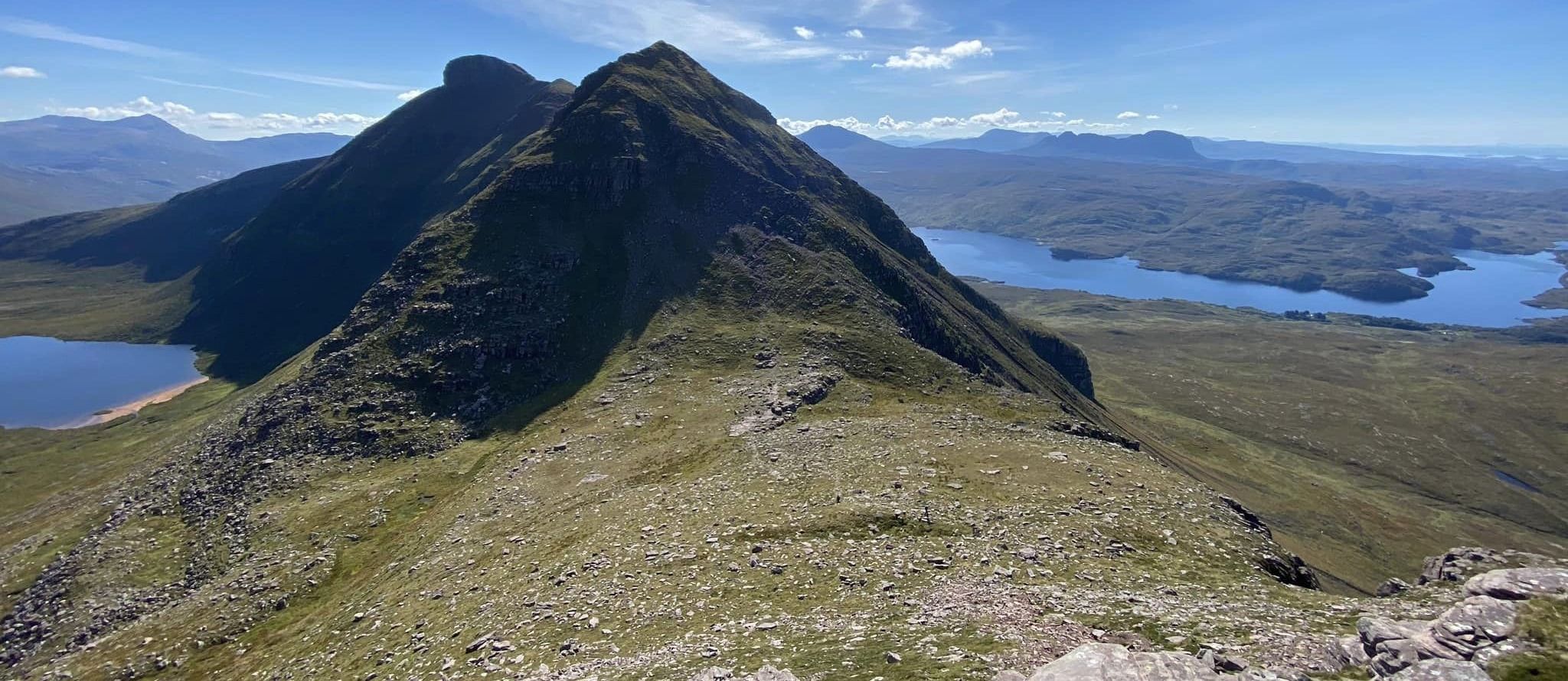
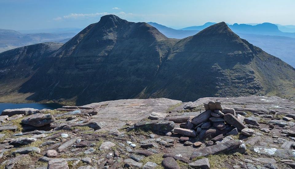
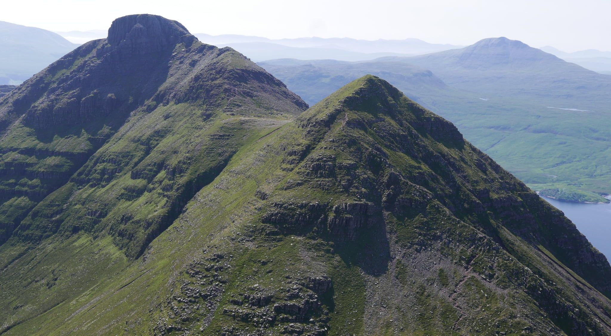
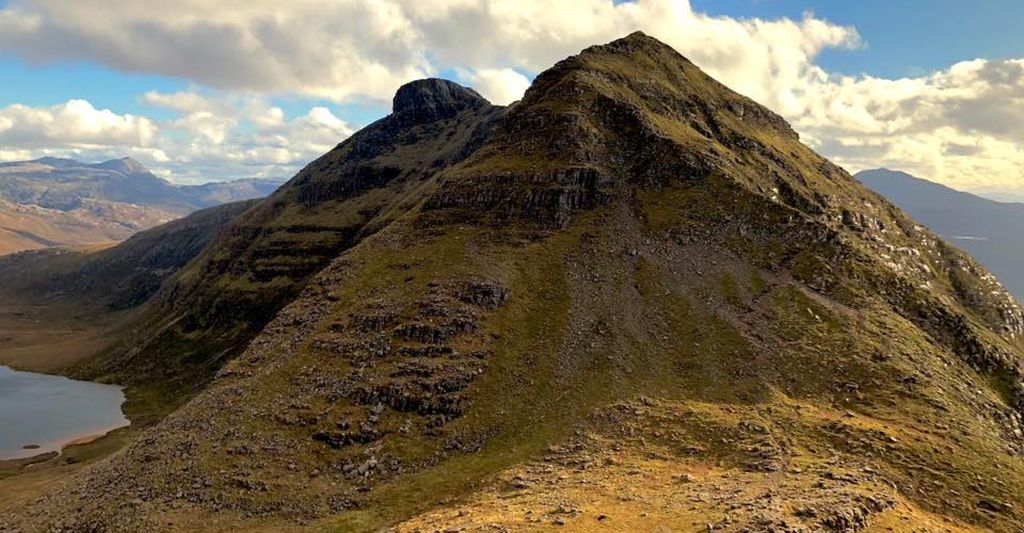
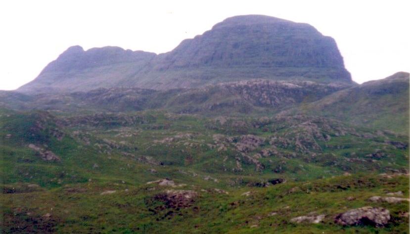
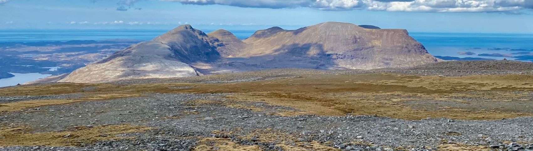
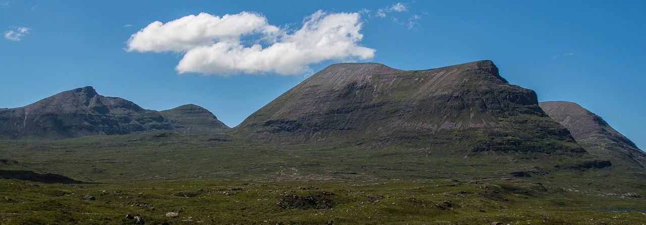
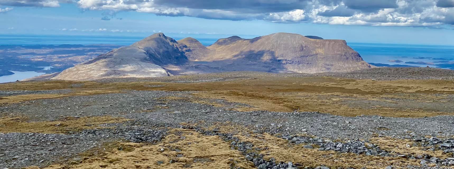
Unusually for a Corbett, Quinag has three summits - Sail Ghorm ( 776m / 
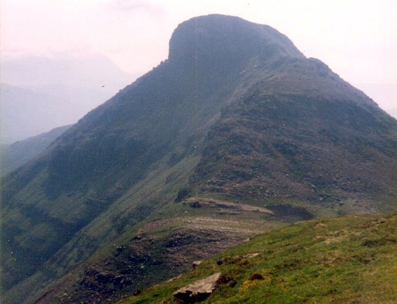
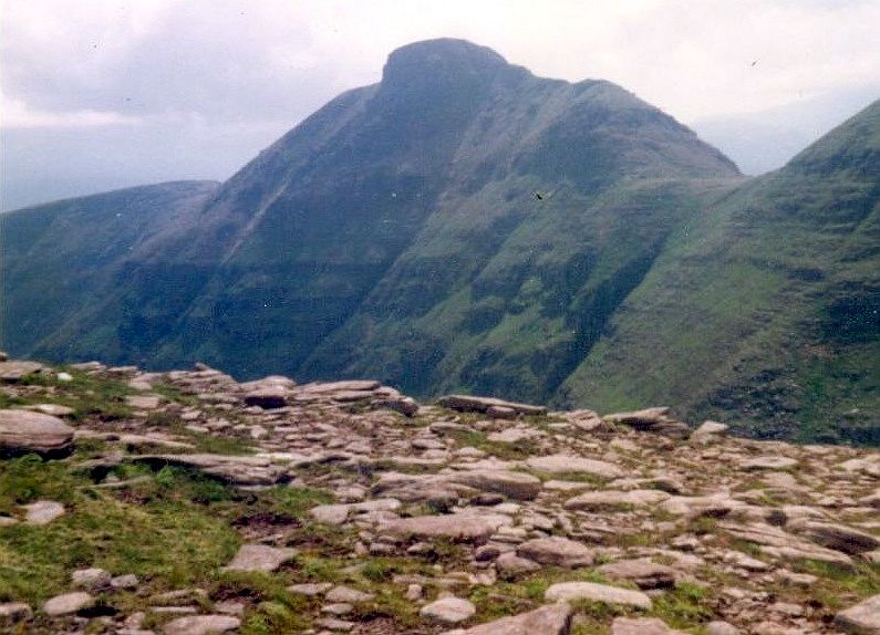
2,546ft ), Sail Gharbh ( 808m / 2,651ft ) and Spidean Coinich ( 764m / 2,507ft).
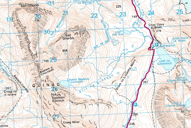
A parking space on the A894, at an elevation of almost 250m, makes a good starting point but don’t be tempted by the footpath that appears to run up into the Coire Chornaidh. A far better way to reach Spidean Coinich is to follow the east ridge over grass and quartzy slabs to a small rocky top. Beyond this, steeper rocky slopes lead to the summit.
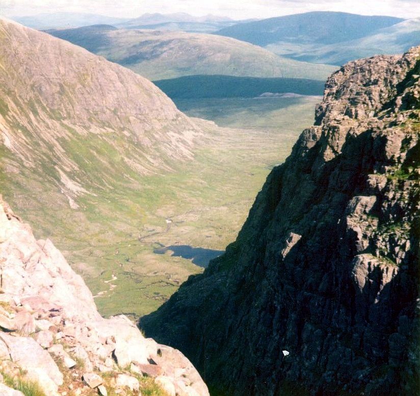
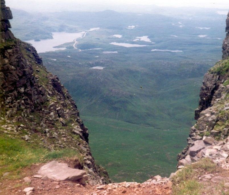
 A steep descent down a narrow ridge is the highlight of the day, high above the watery wastes that form the hinterland of the Eddrachillis Bay coast. 
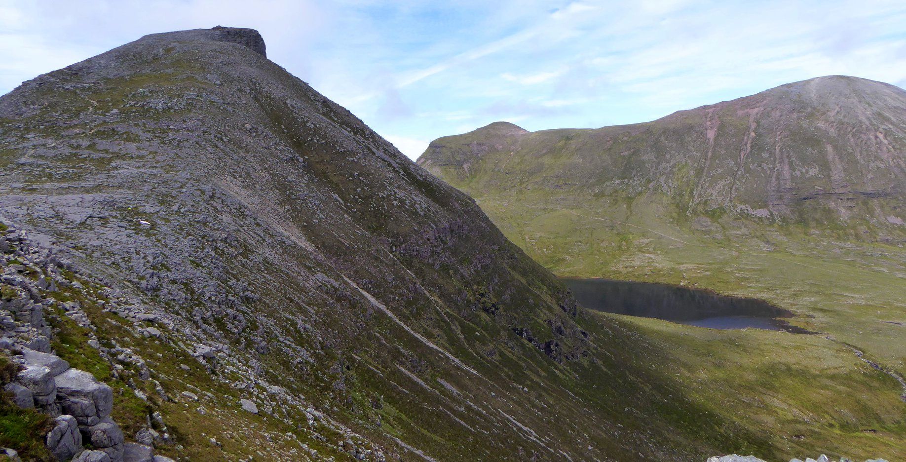
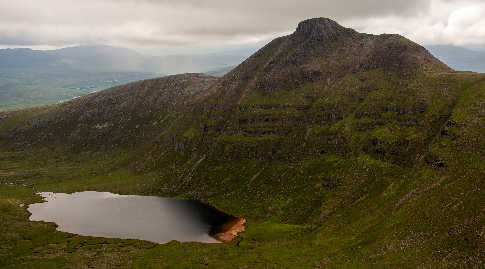
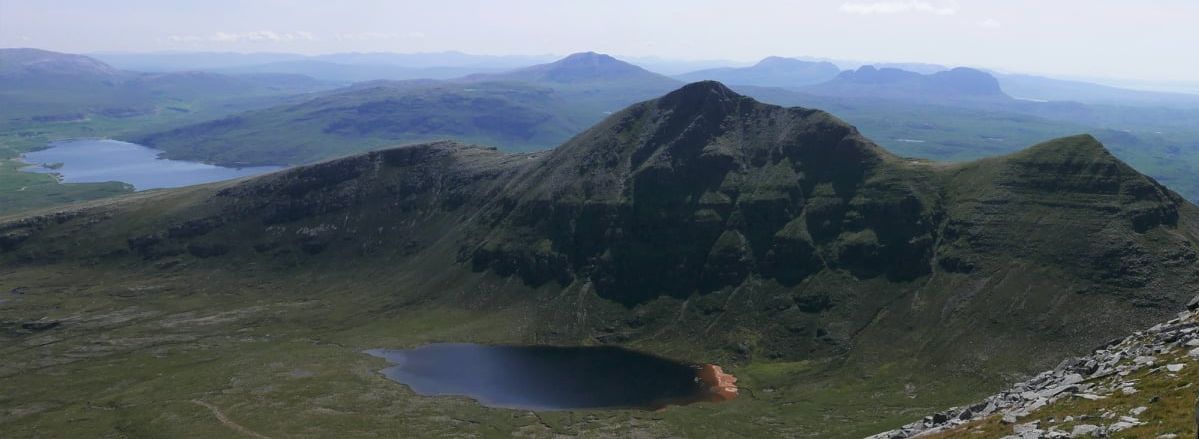
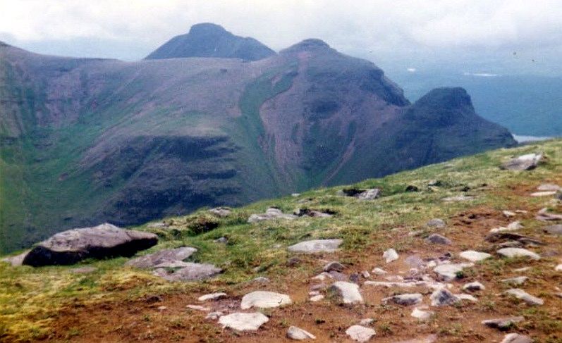
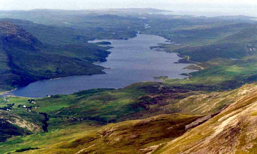
On the other side of the ridge the dark waters of Lochan Bealach Cornaidh reflect the steep slopes of Sail Gharbh, which, in a few hours, will be your final top of the day.
The ridge drops to the broad Bealach a’ Chornaidh from where a path zig-zags up to the ridge just east of a knobbly top. Skirting the top itself, the path traverses its north- east slopes and descends to 
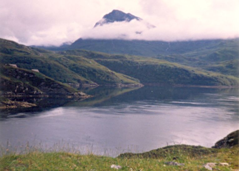
another bealach before climbing the long ridge out to Sail Ghorm, the second summit of the day. With Loch a‘ Chairn Bhain and Kylesku below, the whole of 
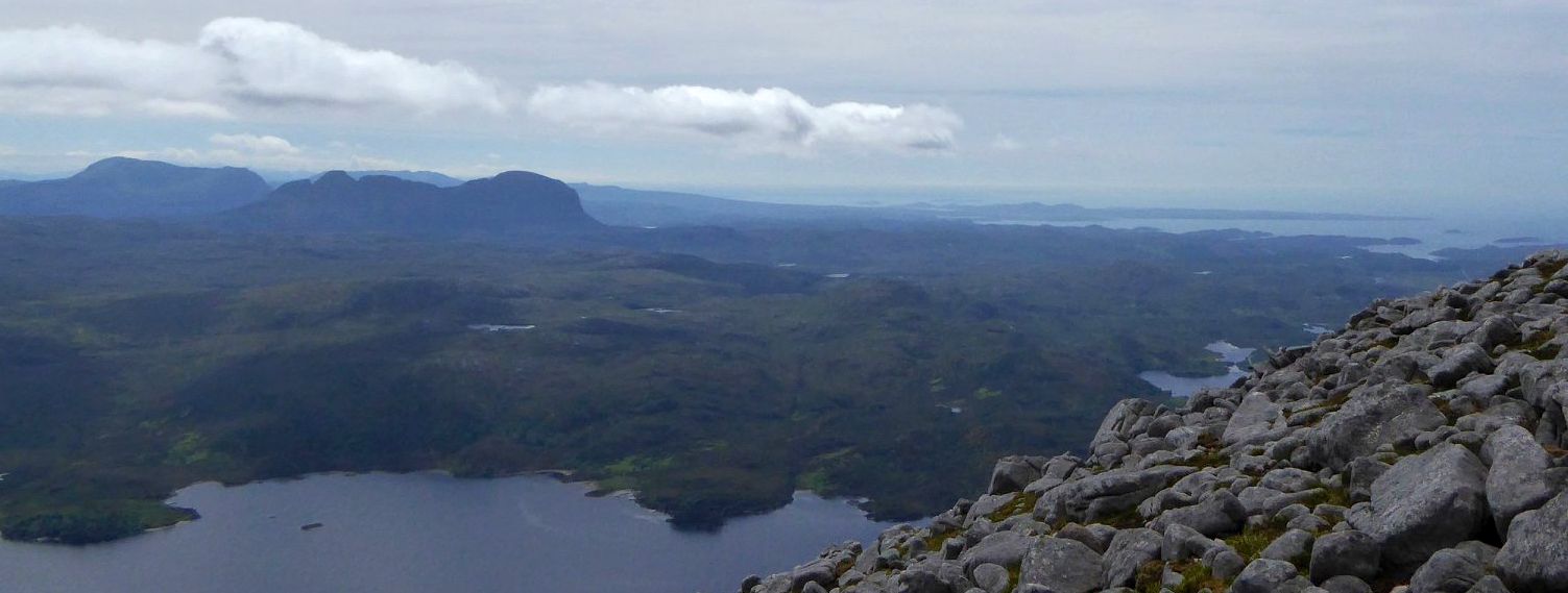
the north stretches before you, on past Ben Stack to Arkle and Foinaven and distant Cranstackie.
From Sail Gorm you have to retrace your steps to the Sail Gharbh ridge but it’s no hardship, with views of Suilven and the lnverpollaidh hills illustrating why this is a landscape without equal. It's an easy stroll out to Sail Gharbh before descending back to the low point on the ridge where the best route of descent is to drop down the steep slopes to Lochan Bealach Cornaidh. A rough path down the corrie makes a grand end to the day.


Route:
Start/finish at the parking space on the A894 between Kylesku and Inchnadamph ( GR NC233274 ).
Cross the road and follow a sta|ker's path over a footbridge.
Leave the path and head due W to gain the prominent E ridge of Spidean Coinich.
Follow the ridge to a rocky top which is crossed before a steeper climb to the summit of Spidean Coinich.
Descend steeply N to a high col then climb over the bump marked on the map as pt713.
Follow the path down to the Bealach a‘ Chornaidh then continue N up steep slopes to the ridge just E of pt745.
Continue NW to gain the ridge that runs out to Sail Ghorm.
Return to the point just E of pt745 and follow the ridge E then ENE to the summit of Sail Gharbh.
From the summit return to the low point of the ridge and descend loose E-facing slopes towards Lochan Bealach Cornaidh where a rough footpath drops E down the corrie towards the starting point.


Loch Assynt in Sutherland

Loch Assynt


Sunset in Sutherland

Sunset in Sutherland

Sunsets & Sunrises Gallery

<< BackNW Highlands Index :: Next >>


Scotland Index :: Scottish Peaks :: Scotland Walks

Ben Nevis | Glencoe | Knoydart | Isle of Skye | Isle of Arran | The West Highland Way

The Eastern Highlands | The Central Highlands | The Southern Highlands | The NW Highlands


Adventure Travel : Worldwide Mountaineering : Site Index

fb icon  google+ icon Linkedin icon  twitter


Travel & Guide Books & Maps:-


Torridon - Ben Eighe & Liathach - OS Explorer MapLandranger Map 0024: Raasay, Applecross & Loch Torridon & Plockton


The Munros Map Torridon Map Kintail, Glen Shiel - Map Torridon - Beinn Eighe & Liathach An Teallach & Slioch - OS Explorer Map Applecross & Loch Torridon - OS Landranger Map Gairloch, Ullapool & Loch Maree OS Map Western Scotland & the Western Isles OS Road Map Northern Scotland OS Road Map Southern Scotland OS Road Map


The High Mountains of Britain & Ireland  Munros Tables SMC  The Munros - Scotland's Highest Mountains  Scotland - Lonely Planet  NW Highlands - SMC Guide  Exploring the Far NW of Scotland  Guide to Walks in NW Highlands

Walking in Scotland - Lonely Planet Mountain: Exploring Britain's High Places  National 3 Peaks Walk Scottish Highlands Hillwalking Guide The Scottish Islands Bouldering in Scotland

Pathfinder Guide: Skye and NW Highlands WalksNW Highlands SMC Torridon: A Walkers Guide The Munros: Scottish Mountaineering Club Northern Highlands Northern Highlands, Volume 1 - SMC Northern Highlands, Volume 2 - SMC Highland Outcrops Scottish Winter Climbs

Knoydart to Morven West Highlands The Munros and Tops The Corbetts - SMC Munros & Corbetts Chart The High Mountains of Britain and Ireland Pathfinder Guide: Skye and NW Highlands Walks

Ben Nevis - Scotland's Highest Mountain Ben Nevis: Rock & Ice ClimbsThe High Mountains of Britain and Ireland Rambler's Guide: Ben Nevis and Glen CoeWinter Climbs: Ben Nevis and Glencoe Ben Nevis Rock & Ice Climbs Great Snow & Ice Climbs of the British IslesPathfinder Guide: Fort William and Glen Coe Walks Scrambles in Lochaber

Scottish Winter ClimbsMunros & Corbetts Chart Call of the Corbetts Wilderness Walks 2 - Video

Rock Climbing in Scotland Classic Mountain Scrambles in Scotland Scotland - Lonely PlanetScotland's Highlands & Islands - Lonley Planet Scotland's Highlands & Islands - Rough Guide Highlands & Islands of Scotland - Hidden Places Scotlands 100 Best WalksCentral Highlands: Six Long Distance Walks Rough Guide Scotland

Scottish Highlands & Islands - Rough Guide The Munros - Scotland's highest mountains My Scotland by Hamish MacInnes Scottish Mountains - 50 Classic RoutesThe CuillinsScottish Mountains - 100 Best Routes

Munro Almanac The Munros Map The Munros: Scottish Mountaineering Club The Isle of Skye The Isle of Arran Wilderness Walks Ski Mountaineering in Scotland Classic Walks in Britain & Ireland

More Wilderness Walks 50 Best Routes on Skye and Raasay Skye - W.A.PoucherMagic of the Munros Mountaineering in Scotland and Undiscovered Scotland by W.H.MurrayA Long Walk on the Isle of Skye

Classic Climbs - Central & Southern Highlands The Isle of Arran Lonely Planet, Walking in ScotlandPathfinder Guide: Skye and NW Highlands Walks50 Best Routes on Skye and Raasay - Chris Townsend 100 Best Routes on Scottish Mountains Scrambles in Skye Mountain Days & Bothy Nights

Walking in the Hebrides Torridon: A Walkers Guide Ski Touring in ScotlandRough Guide: Scotland A Mountaineer's Tale - W.H.MurrayDougal Haston: Philosophy of RiskOne Man's Mountains - Tom Patey Big Walks of Great Britain

The Glens of Rannoch Cairngorm Glens Glens of Trossach Knoydart to Morven Scottish Glens: The Atholl GlensSouthern Highlands - Map Northern Highlands The Munro Show 1 & 2 - Muriel Gray

The Cairngorms Cairngorms Walks Cairngorm - Map Walks in the Cairngorms Lochnagar & Glenshee - Map The Cairngorms of Scotland Cairngorms - Mountain Bike GuideWinter Climbs in the Caingorms

West Highland Way: Official GuideWest Highland Way: Rucksac ReadersWest Highland Way: TrailblazerThe West Highland WayWest Highland Way: Footprint MapWest Highland Way - Map West Highland Way - Map 100 Hillwalks around Glasgow

50 Walks in Glasgow & SW Scotland 50 Walks in the Scottish Highlands & Islands 50 Walks in Edinburgh & Eastern Scotland 100 Walks in ScotlandVisit Scotland - Touring Guide Scotland: Where to Stay - Hotels & Guest Houses Scotland: Where to Stay - Bed & Breakfast Walking the Munros Vol 2: Northern Highlands & CairngormsWalking the Munros Vol 1: Southern, Central & Western Highlands

Hillwalker: The MunrosHillwalker: The CorbettsWeather for Hillwakers & Climbers Mountain Weather Guide to the Weather Weather: Collins Gem Hillwalking Handbook for Mountain Leaders First Aid on Mountains

All Mountain Skier Off Piste World's most significant ClimbsMountain Travellers HandbookMountaineering: The Freedom of the HillsHillwalkers Guide to Mountaineering 200 Challenging Walks in Britain & Ireland

Ice & Mixed Climbing How to Ice Climb Complete Climbers Handbook Mountain Skills Training Handbook Autumn Road to the IslesDiscovering Scotland - Atlas & Guide Scotland Travel Guide Lonely Planet Scotland - The Wild Places - Colin Prior


Google Analytics


Google Analytics

extremetracking
 eXTReMe Tracker


extremetracking
Sitelock caingram.com
SiteLock
Sitelock
Sitelock caingram.info
SiteLock
Sitelock