  |
Bearsden WalksBlackness to Queensferry
|
 
|
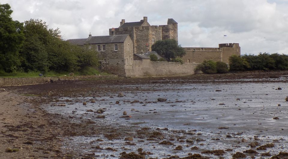
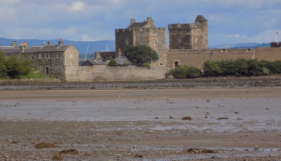
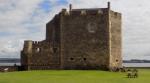
Blackness
Castle is a 15th-century fortress,
near the village of Blackness on the south shore of the Firth of Forth. |
 Forth Bridges from Blackness Castle |
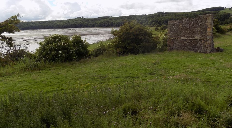
Ruins
of Dovecot |
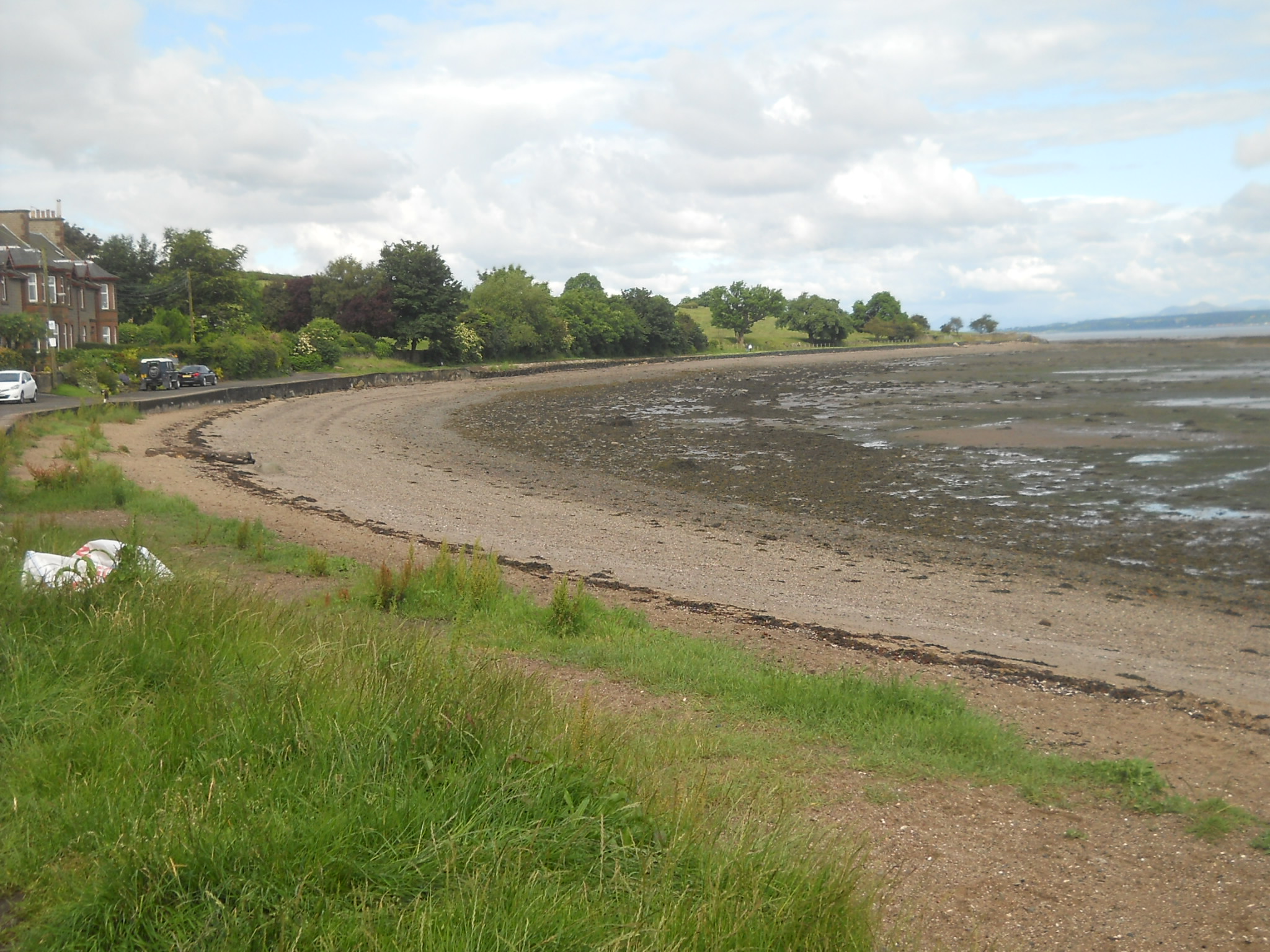
Shore of Firth
of Forth |
 Forth Bridges
|
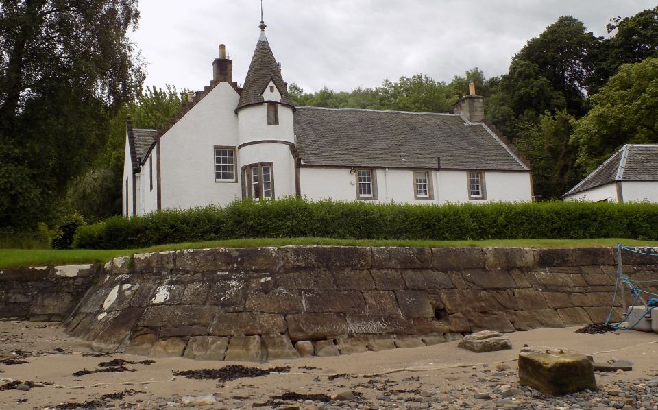 House
at Society Point
|
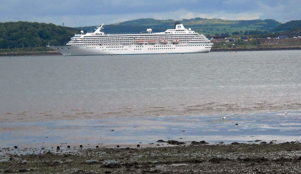 Cruise
Ship in Firth of Forth
|
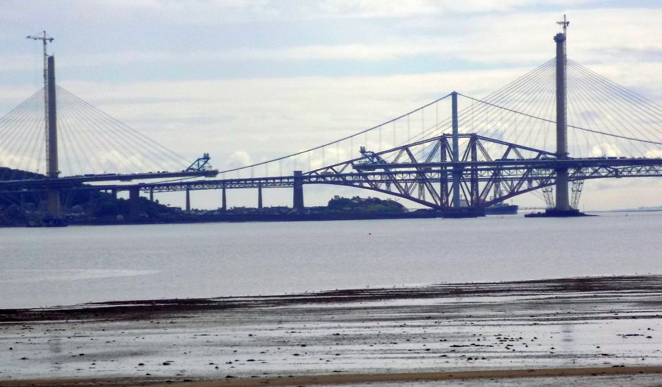
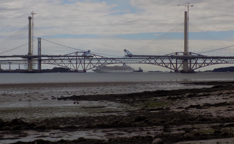
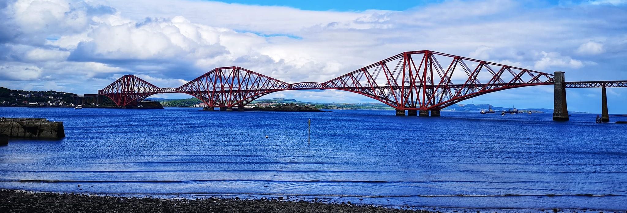
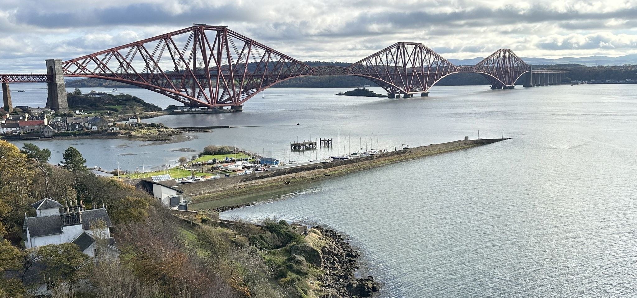
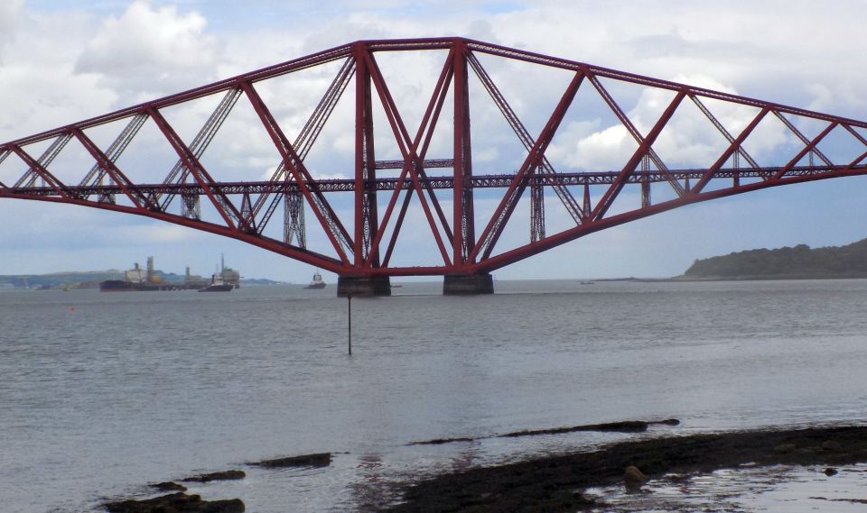 Forth
Railway Bridge at Queensferry
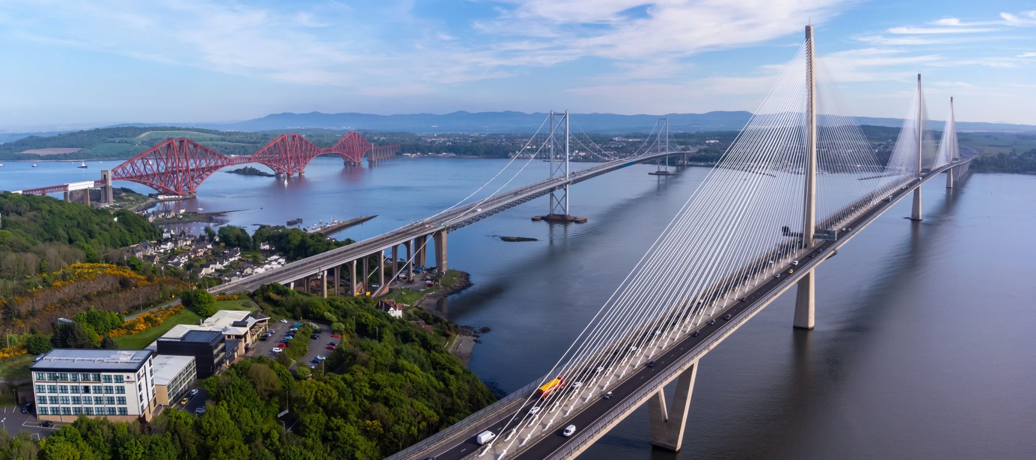
The
Forth Railway Bridge is a cantilever type
bridge
over the Firth of Forth in the east of Scotland. It is an internationally recognised Scottish landmark. It is located to the east of the Forth Road Bridge and 14Km ( 9 miles ) west of central Edinburgh. |
 Forth
Railway Bridge at Queensferry
|
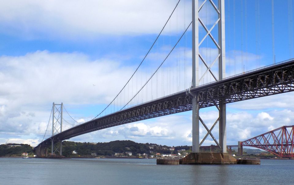 Forth
Road Bridge at Queensferry
The Forth Road Bridge is a suspension bridge in east central Scotland. The bridge was built in 1964 and spans the Firth of Forth. It connects Edinburgh at South Queensferry to Fife at North Queensferry. It is located to the west of the Forth Railway Bridge. |
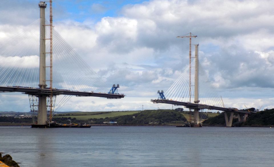 New
Forth
Road Bridge ( the Queensferry Crossing )
under construction at Queensferry |
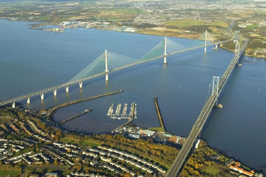 |
 Aerial
view of Forth Bridges
|
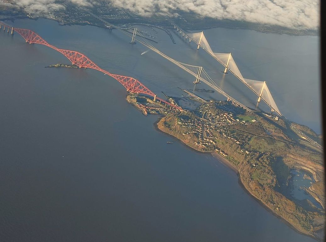
 Aerial
view of Forth Bridges
|
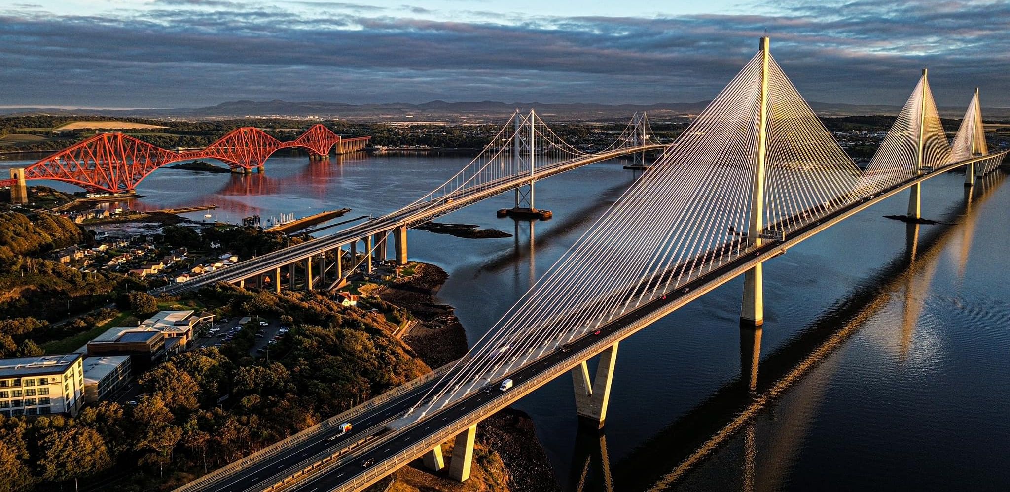 Aerial
view of Forth Bridges
|
 Forth
Railway Bridge
|
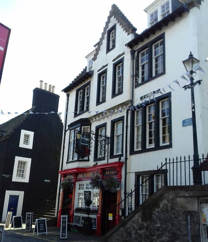 South
Queensferry
|
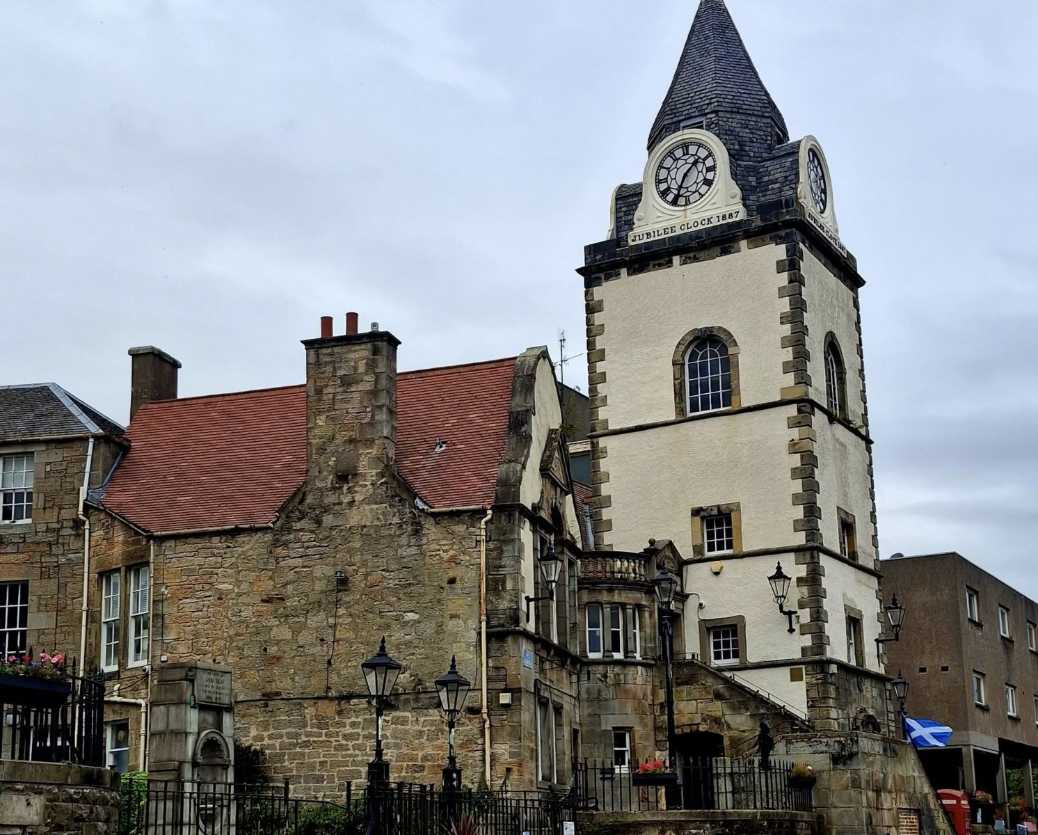
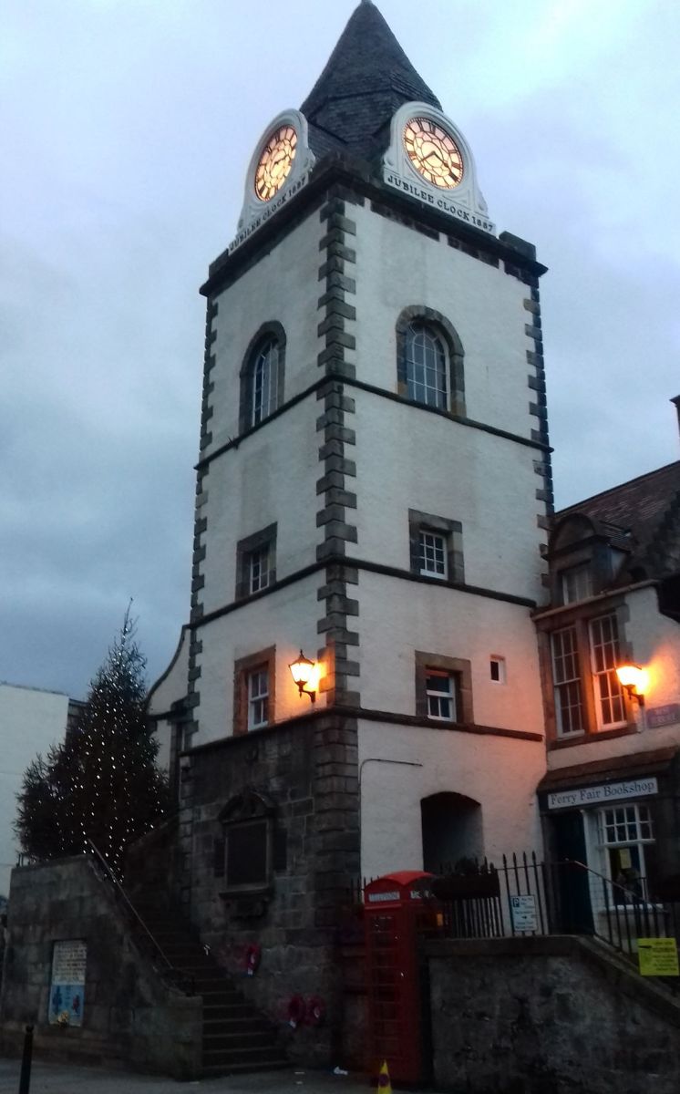 Jubilee
Clock
commemorating the golden jubilee of Queen Victoria on the former Tolbooth in High Street of South Queensferry |
 |
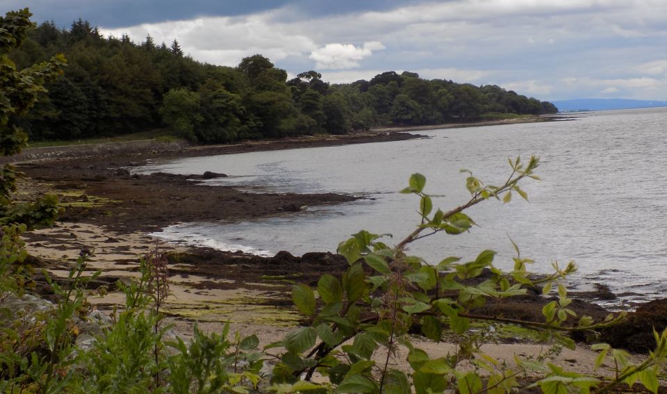 Shore of Firth
of Forth
|
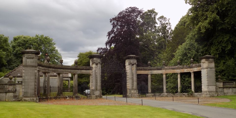 Entrance
Gates to Hopetoun House
|
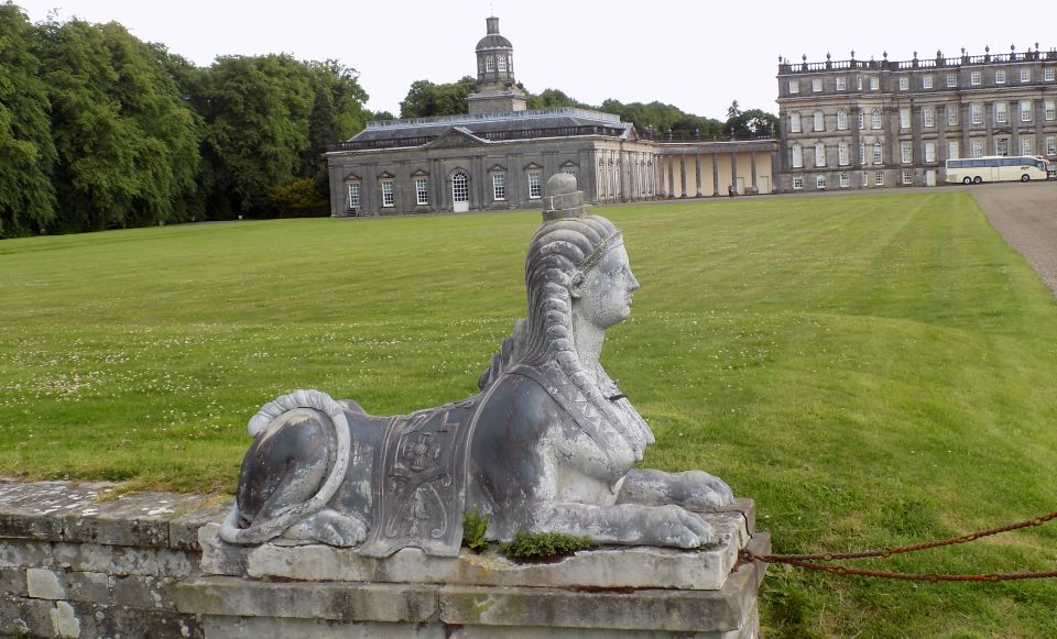
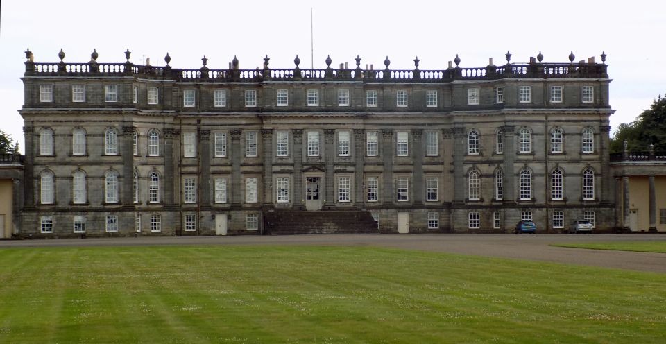 Hopetoun
House
The country house was built between 1699-1701 and then hugely extended from 1721 It is owned by the Hopetoun House Preservation Trust, a charity established in 1974 to preserve the House and Grounds as a national monument. |
 Hopetoun
House
|
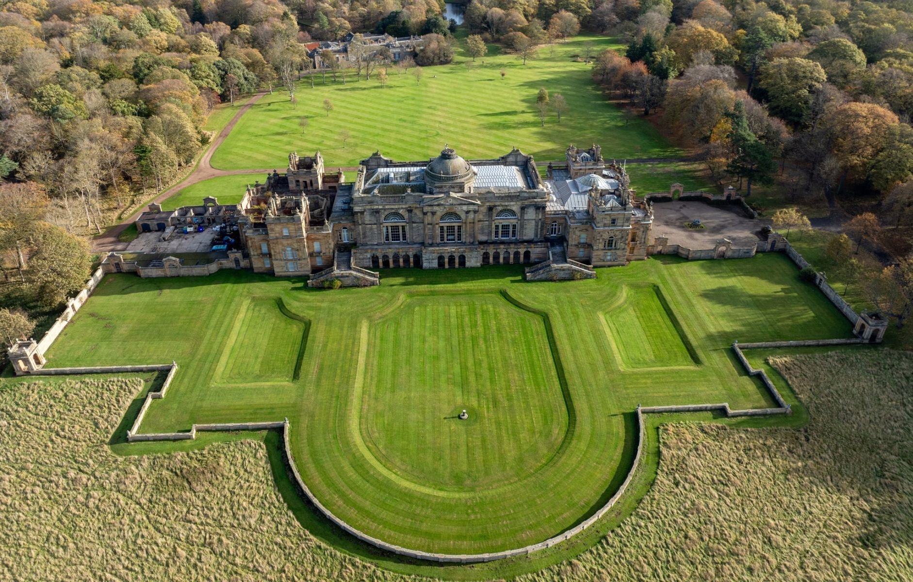 Aerial
view of Hopetoun
House
|
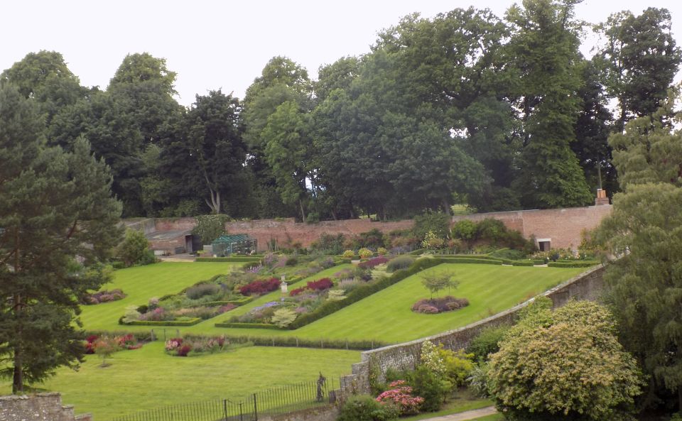 Gardens
at Hopetoun House
|
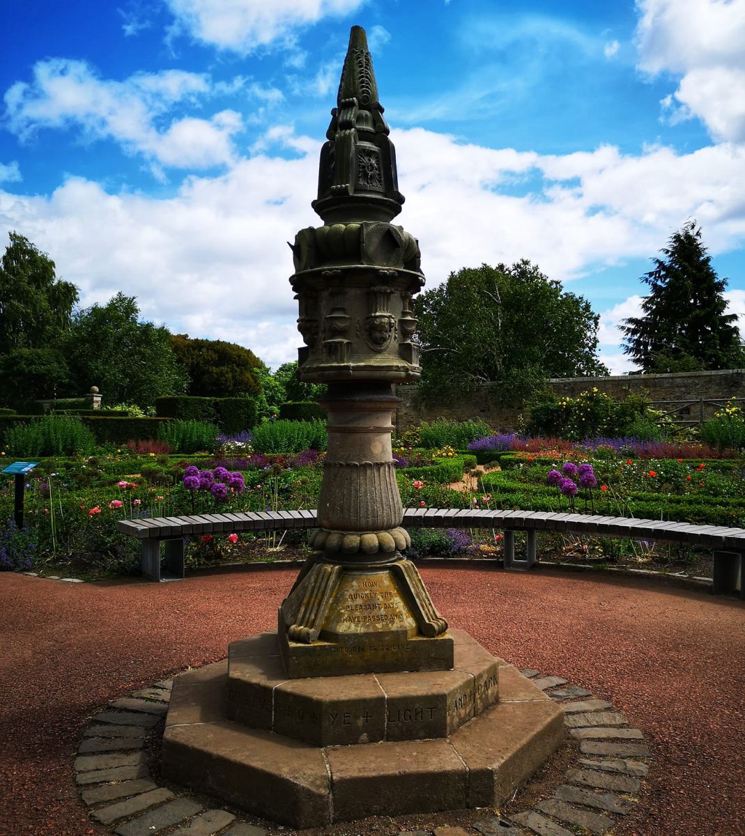 Gardens
at Hopetoun House
|
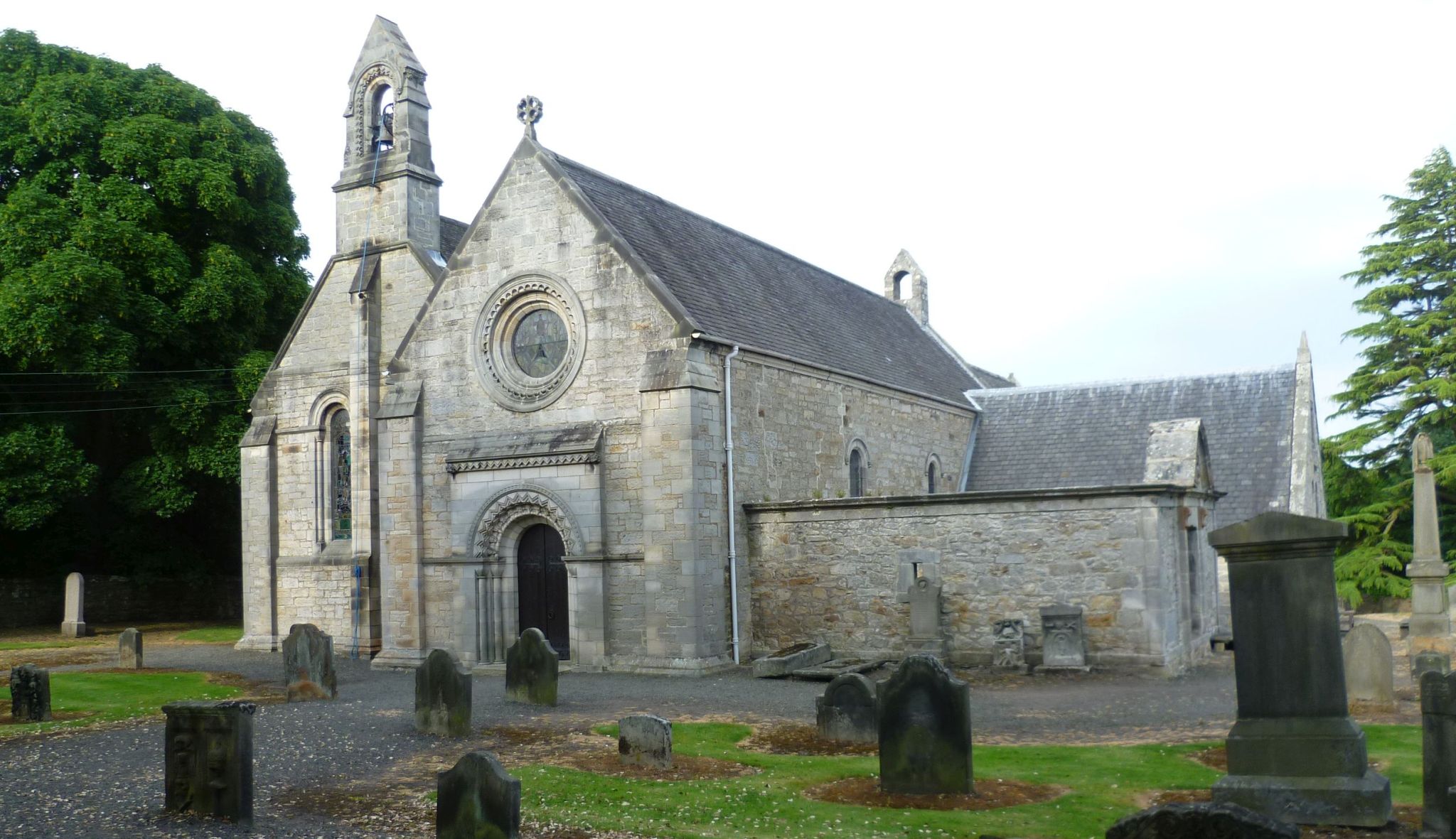
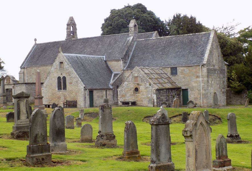 Abercorn
Church
|
 Abercorn
Church
|
 Abercorn
Church
|
 Abercorn
Church
|
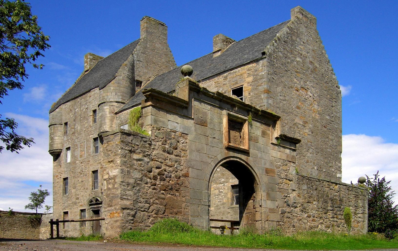 Midhope
Castle at Abercorn
a 16th-century tower house. It is a Category A listed building and a scheduled ancient monument |
 |
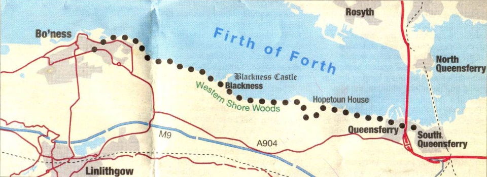 Route
map for Blackness
to Queensferry
|
BLACKNESS TO QUEENSFERRY - ROUTE DESCRIPTION:
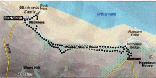 Route
Map for Blackness to Abercorn Church
|
BLACKNESS TO ABERCORN CHURCH - ROUTE DESCRIPTION:
This fine coastal walk links Blackness Castle on the Firth of Forth with Abercorn Church and its ancient graveyard.
Much of the walk is in woodland and while this will provide shelter from the Forth's winds there may be tree debris from recent storms so care is needed.
From the village follow the road north towards Blackness Castle, which occupies a commanding position on a promontory jutting into the Firth of Forth.
Built to defend Blackness, the seaport for Linlithgow's Royal Palace, the original 14th-century keep was fortified into an impressive
artillery fortification that saw considerable action. The castle is open to the public.
Turn right before the entrance to the castle courtyard and follow a path beside the outer wall to steps, which lead to the grassy frontage of the bay.
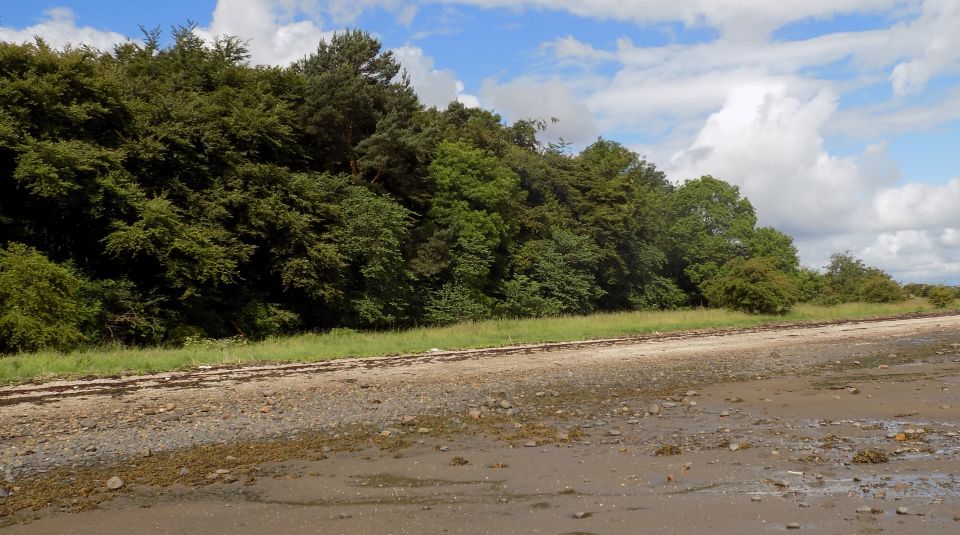
From here a path leads round the bay to a gate at the entrance to Wester Shore Wood.
The track through the woodland to Abercom is part of a national cycle route.
The track gives a straightforward route to Nethermill Bridge over the Midhope Burn at the western end of Hopetoun Estate with
glimpses through the trees to the Firth of Forth and Fife.
Turn right after the bridge and over a subsidiary burn on to a section of new track up to Abercorn Church. It dates mostly from
the late 1800s though a blocked doorway on the south side is from the 12th century.
An exit can be made from the south-west corner of the graveyard to regain the track, which is descended back to Nethermill Bridge.
Here a variation return can be made via the upper path in Wester Shore Wood. This follows paths and tracks, and is a little wilder than the prepared cycle route.
Cross the bridge, turn left and follow the track beside the burn to a junction, turn right and follow the path and track beside the southern boundary of the woodland.
It is best to descend via the first or second obvious path on the right as the last section of the path has a tricky rock-step across a burn.
If you get to this point and don't fancy the crossing then it is only a short distance back to a path leading down to the cycle route.
Back on the cycle route follow it to the woodland gate and turn left up the path to Blackness.
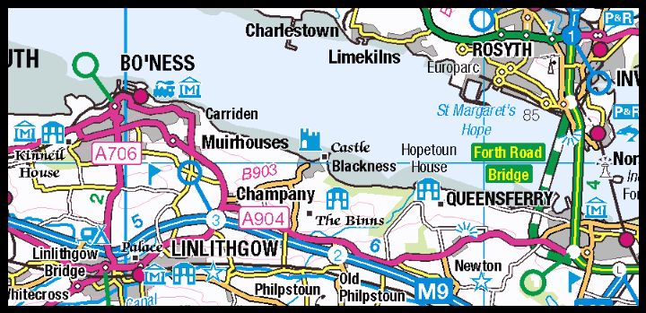 Location
map for Blackness
and Queensferry
|
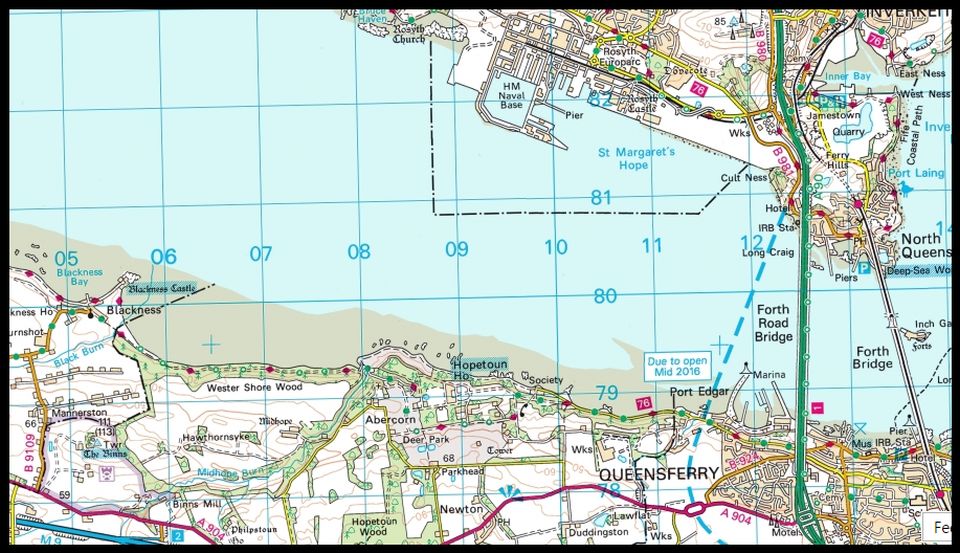 Map
for Blackness to South Queensferry
|
Glencoe | Ben Nevis | Knoydart | Isle of Skye | Isle of Arran | The West Highland Way
The Eastern Highlands | The Central Highlands | The Southern Highlands | The NW Highlands