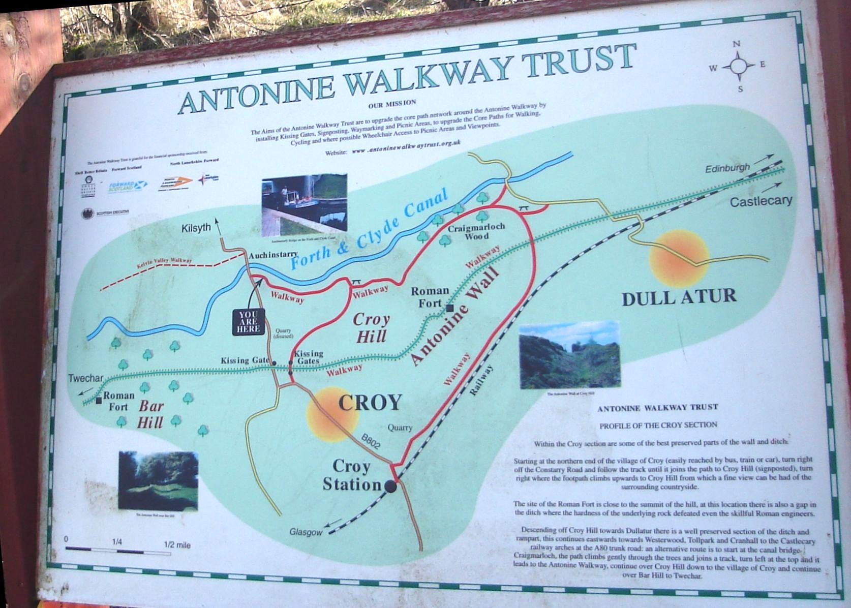
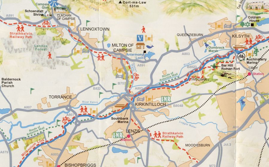
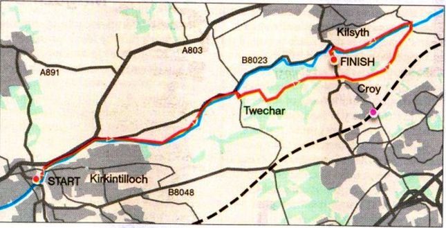
The Antonine Wall Antonine Wall - Map

Antonine Wall


 Tollpark to Croy
Edge of Empire - Scotland's Roman Frontier Lonely Planet, Walking in Scotland

Photographs of a walk from Tollpark

on the Antonine Wall at Cumbernauld

to Croy Village


Antonine Wall information board at Tollpark

Antonine Wall information board at Tollpark


Wardpark Studios at Cumbernauld

Wardpark Studios at Cumbernauld


Airport at Cumbernauld

Airport at Cumbernauld 


Ochil Hills from airport at Cumbernauld

Ochil Hills from airport at Cumbernauld


Signpost on route from Cumbernauld to Croy

Signpost on route from Cumbernauld to Croy


Kilsyth Hills from site of Westerwood Fort on the Antonine Wall

Kilsyth Hills from site of Westerwood Fort

on the Antonine Wall


Golf course at Westerwood

Golf course at Westerwood


Trees along the route of the Dullatar Ditch on the Antonine Wall

Trees along the route of the Dullatar Ditch

on the Antonine Wall


Cottage at Dullatar

Cottage at Dullatar


Signpost between Dullatar and Croy

Signpost between Dullatar and Croy


Rock face on Croy Hill

Rock face on Croy Hill


Golf course at Croy

Golf course at Croy


Railway Station at Croy

Railway Station at Croy


Church at Croy

Church at Croy


Playing field at Croy

Playing field at Croy


Map of Antonine Wall around Croy Hill

Map of the Antonine Wall around Croy Hill


Map of Antonine Wall from Croy Hill to Tollpark at Cumbernauld

Map of the Antonine Wall

from Croy Hill to Tollpark at Cumbernauld


Map of Antonine Wall from Croy Hill to Tollpark at Cumbernauld

Map of the Antonine Wall

from Croy Hill to Tollpark at Cumbernauld


Location Map of Roman Fort on Barr Hill at Kilsyth

Location Map of Roman Fort on Barr Hill at Kilsyth


Map of Roman Forts on the Antonine Wall

Map of Roman Forts on the Antonine Wall


Route Map - Kirkintilloch to Kilsyth

Route Map - Kirkintilloch to  Kilsyth


ANTONINE WALL WALK - ROUTE DESCRIPTION:

This 
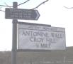
walk is a long the Antonine Way 
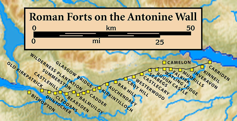
from Twechar to Bar Hill and Croy Hill running by the Forth and Clyde Canal.
It is a six mile walk with the first half having some steep climbs, but the second part is easy with much of it on the
towpath beside the canal. On the main access road into Twechar look for a signpost to the Antonine Way beside the War Memorial on the left and just opposite a small industrial estate.
Start at this signpost. It is a steady climb before you reach a sign to Bar Hill Roman Fort.
These way marks bear the John Muir Way logo. This is because the newly opened John Muir Way follows this part of the Antonine Way.
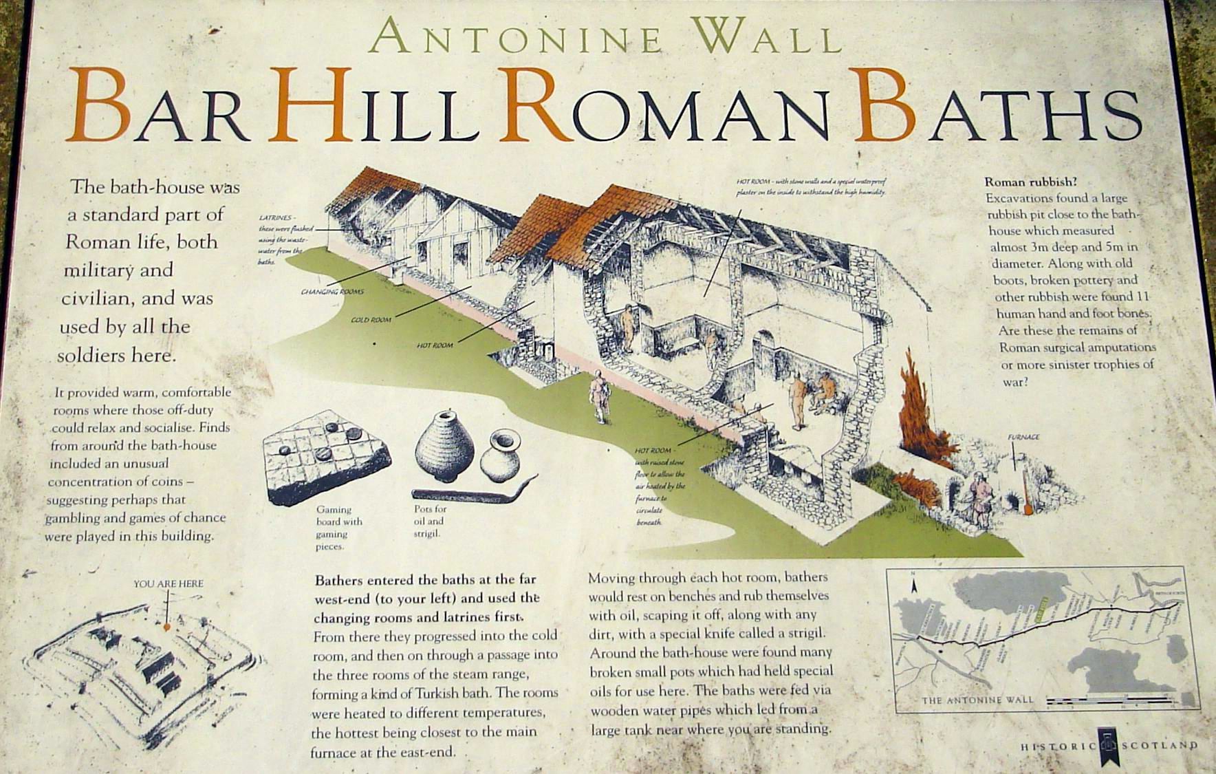
There is an information panel when you arrive at the outer edge of the Roman Fort which was built. in the 140s AD. lt housed 480 soldiers drawn from many parts of the Roman Empire. How the recruits from the Mediterranean must have felt the cold. The Antonine Wall was abandoned after 20 years and the troops were withdrawn to Hadrian's Wall.
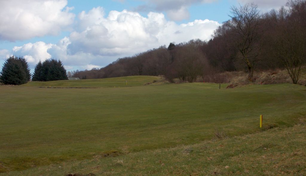
The foundations of the Fort’s buildings can be seen and each is 
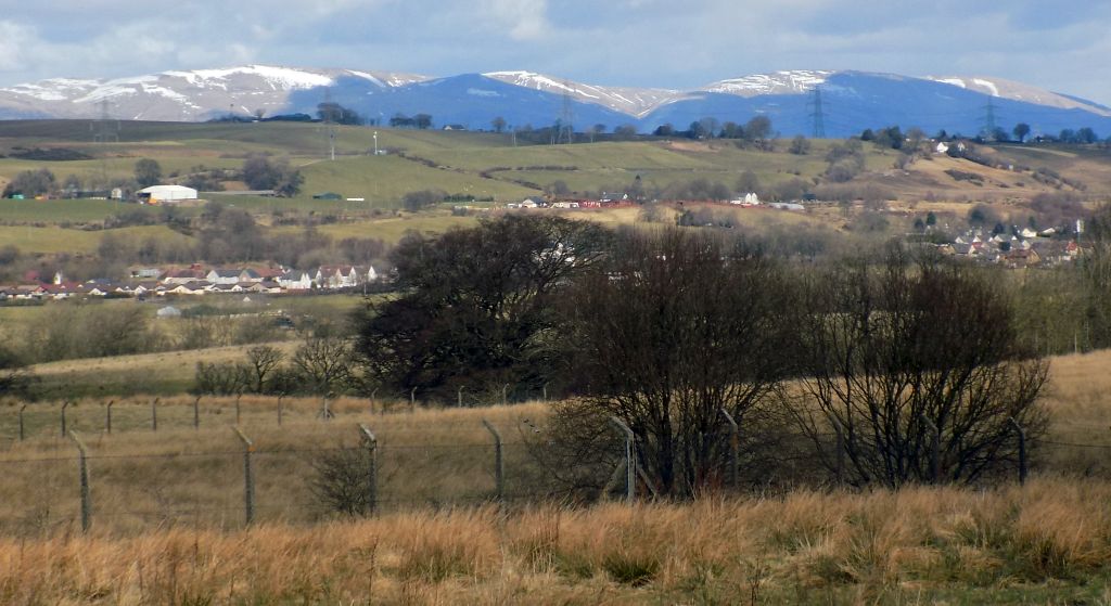
labelled. There are clear views to the north but in other directions the view is blocked by huge deciduous trees.
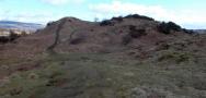
The signs now point to a high hill nearby where an Iron Age fort was situated.
The view from this vantage point eastwards along the wall would be spectacular if the conifers were removed.
The walk continues along the edge of the huge ditch which the Romans dug in front of the Wall to impede attackers.
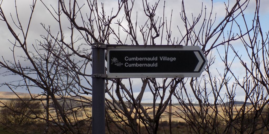
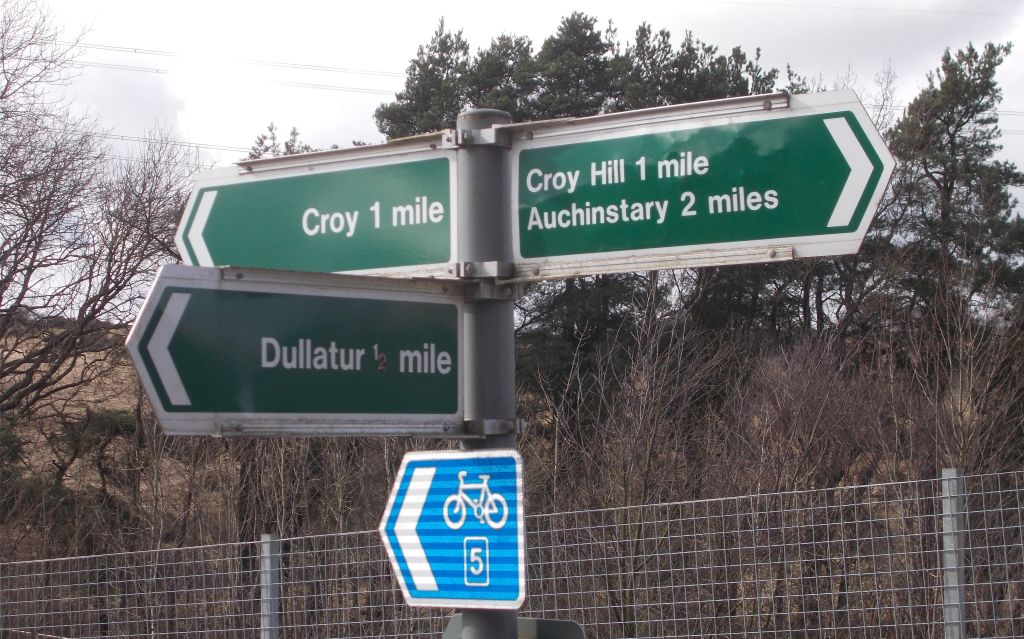
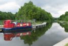
Eventually you cross the road to the Auchinstarry Marina and continue to follow the John Muir signs to Croy Hill.
From this point on you are on a continuous long climb to the plateau summit of the hill. It's quite a slog.
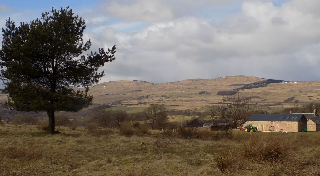
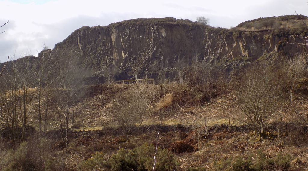
Pass a ruined brick building on your right ( not Roman ). About 600 yards further on, on the left of the track, is a low rock with a panel on it which describes the Roman Croy Hill Fort which was built here—but there are now no obvious signs of it. On the descent you soon come to a surfaced path. Take the one signposted to Auchenstarry and at one point there is a choice between a broad track going downhill and a narrower one to the left — both take you to Auchenstarry.
You eventually arrive at the Forth and Clyde Canal. Turn left to arrive shortly at the Auchenstarry Marina with the
Boathouse available for food and drink. Afterwards, cross the canal by the roadbridge and head west towards Twechar.
 It's a delightful walk by the canal. Water lilies and yellow irises line the canal.
After nearly a couple of miles you reach the bridge that takes you across the canal and back to the start.


  Croy - Tollpark Gallery Thumbnail Gallery :: Antonine Wall Gallery Thumbnail Gallery :: Forth & Clyde Canal Gallery Photo Gallery

<< BackAntonine Wall Index : Next >>


References:


Scotland Index :: Scotland Walks

Glencoe | Ben Nevis | Knoydart | Isle of Skye | Isle of Arran | The West Highland Way

The Eastern Highlands | The Central Highlands | The Southern Highlands | The NW Highlands


Adventure Travel : Worldwide Mountaineering : Site Index

fb icon  google+ icon Linkedin icon  twitter


Guide Books & Maps - Scotland:-


Western Scotland & the Western Isles OS Road Map Northern Scotland OS Road MapSouthern Scotland OS Road Map Glasgow Popular Hills - Map


Edge of Empire - Scotland's Roman Frontier  The Antonine Wall  Antonine Wall - Map

Glasgow Visitor Guide - Colin Baxter Itchy Insider's Guide to Glasgow Glasgow Footprint Pocket Guide Glasgow Insight Pocket Guide Glasgow Guide Pub Companion Glasgow Scotland's Highlands & Islands - Rough Guide Scotland - Rough Guide

Glasgow Insight Pocket GuideCollins Street Map of GlasgowGlasgow: Then & NowThey belonged to Glasgow Phillips Street Atlas of Glasgow & West Central Scotland Glasgow: The Photographic Atlas100 Hillwalks around Glasgow 50 Walks in Glasgow & SW Scotland

Visit Scotland - Touring Guide Scotland: Where to Stay - Hotels & Guest Houses Scotland: Where to Stay - Bed & Breakfast Rough Guide ScotlandScottish Highlands & Islands - Rough Guide Scotland - Lonely PlanetScotland's Highlands & Islands - Lonley Planet Great Glasgow StoriesGlasgow & Surroundings - Insight Guide

West Highland Way: Official GuideWest Highland Way: Rucksac ReadersWest Highland Way: TrailblazerThe West Highland WayWest Highland Way: Footprint MapWest Highland Way - Map West Highland Way - Map West Highland Way Wet Highland Way - Official Guide

Munro Almanac The High Mountains of Britain and Ireland The Munros: Scottish Mountaineering Club The Isle of Skye The Isle of Arran Wilderness Walks Ski Mountaineering in Scotland

More Wilderness Walks 50 Best Routes on Skye and Raasay Skye - W.A.PoucherMagic of the Munros Mountaineering in Scotland and Undiscovered Scotland by W.H.MurrayA Long Walk on the Isle of Skye

Classic Climbs - Central & Southern Highlands The Isle of Arran Lonely Planet, Walking in ScotlandPathfinder Guide: Skye and NW Highlands WalksPathfinder Guide: Fort William and Glen Coe Walks Rambler's Guide: Ben Nevis and Glen Coe50 Best Routes on Skye and Raasay - Chris Townsend


extremetracking
 eXTReMe Tracker


extremetracking
Sitelock caingram.com
SiteLock
Sitelock
Sitelock caingram.info
SiteLock
Sitelock