  |
Darvel Loudoun Hill
|
 
|

Town Hall in Darvel |
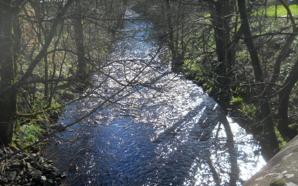
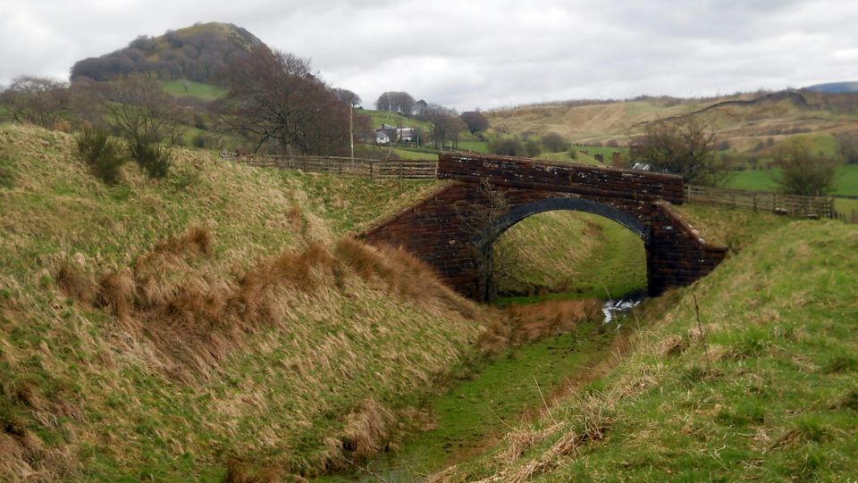
River Irvine at Darvel |
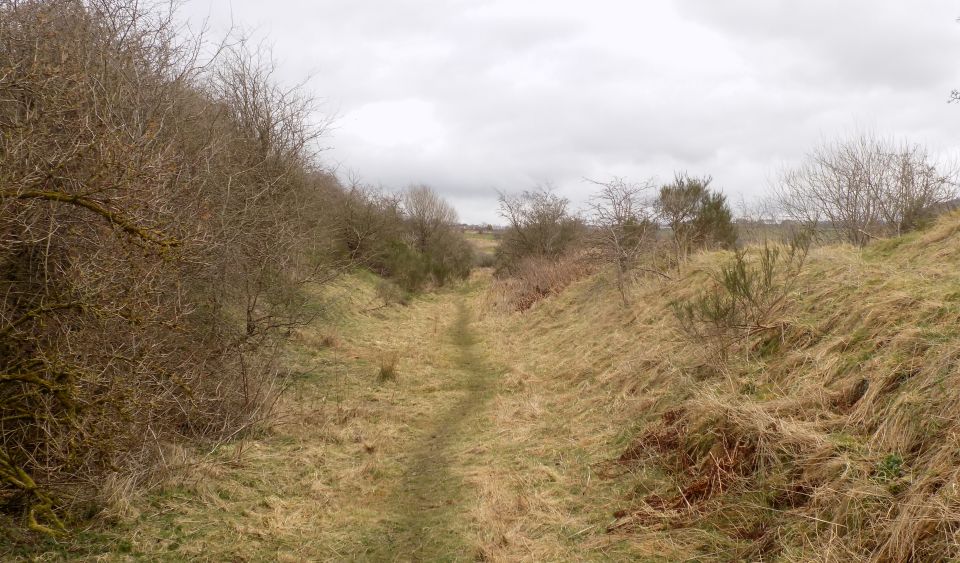 Path along the former railway track |
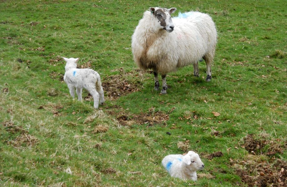
Spring lambs |
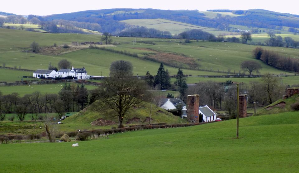
Countryside in Ayrshire |
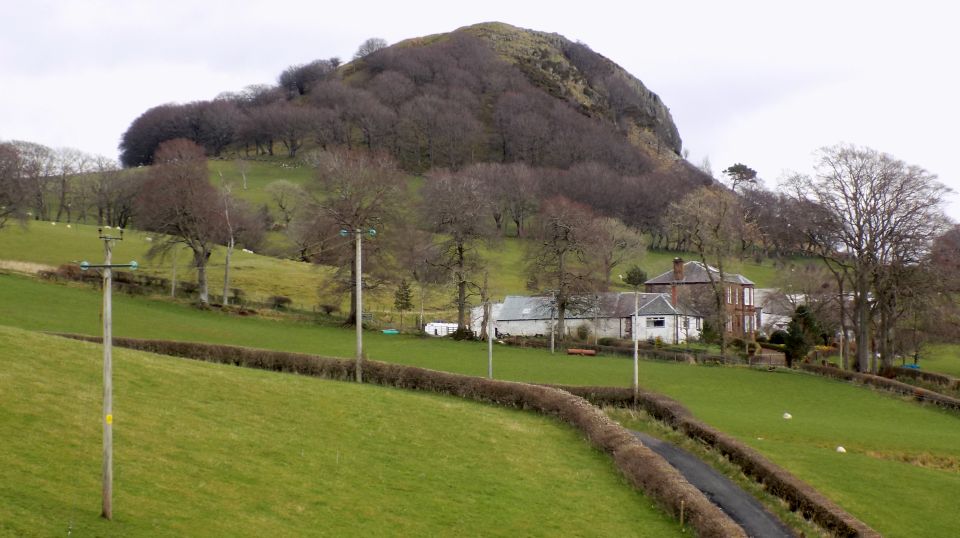
Loudoun
Hill from railway track |
 Approach
to Loudoun Hill
The Battle of Loudoun Hill was fought in May 1307 between a Scots force led by Robert the Bruce and the English ending in victory for Bruce - his first major military victory. |
 |
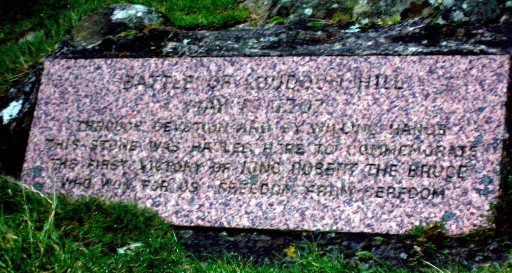 Memorial
stone on Loudoun Hill
The Battle of Loudoun Hill was fought in May 1307 between a Scots force led by Robert the Bruce and the English ending in victory for Bruce - his first major military victory. |
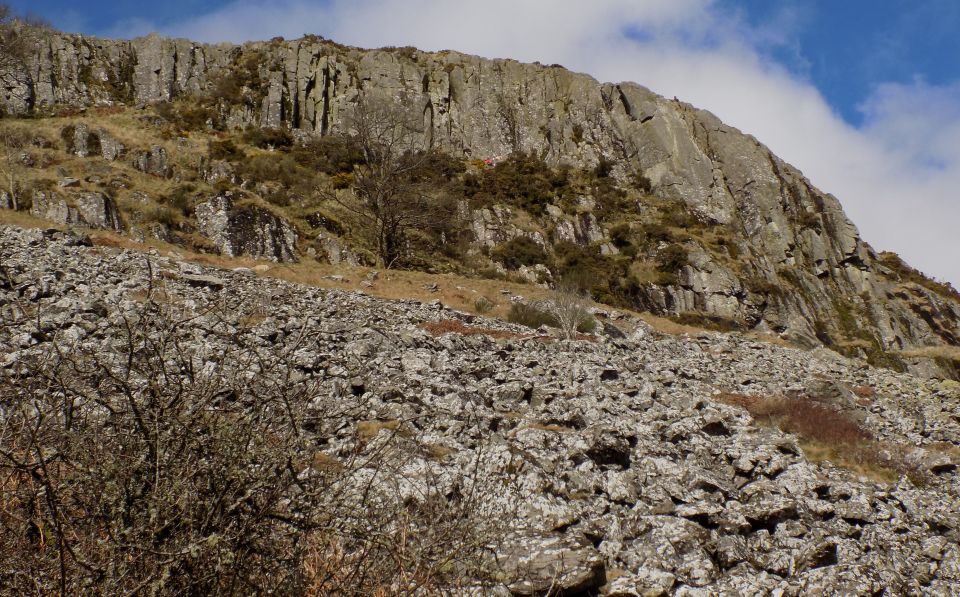 Rock
Faces on Loudoun Hill
The hill is a popular rock climbing venue. |
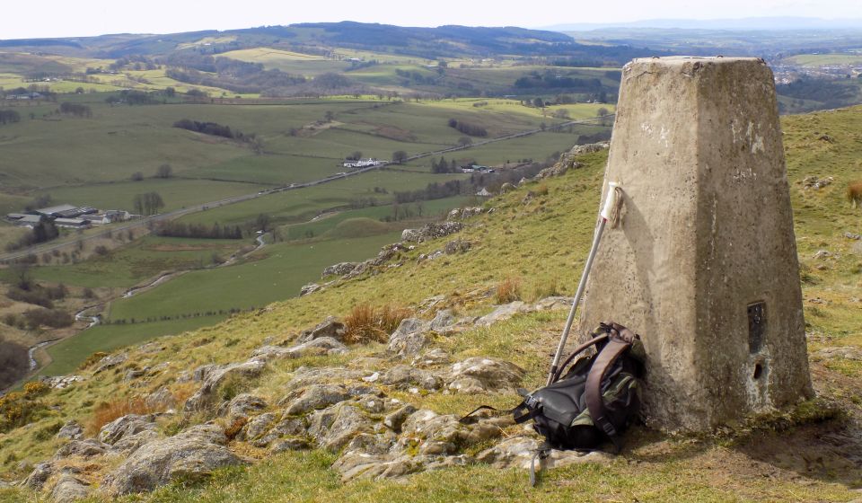
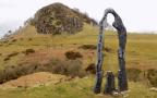
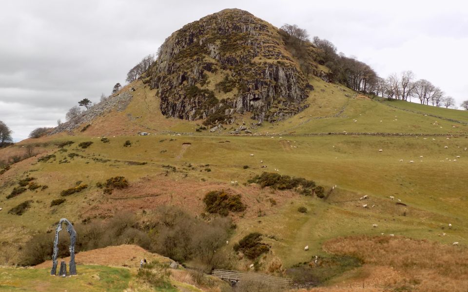 Loudoun
Hill
from "Spirit of Scotland" monument Loudoun Hill is a volcanic plug in East Ayrshire near the head of the River Irvine. Loudoun Hill has long been a site of human occupation. An iron age settlement is located at the foot of the south east slope. |
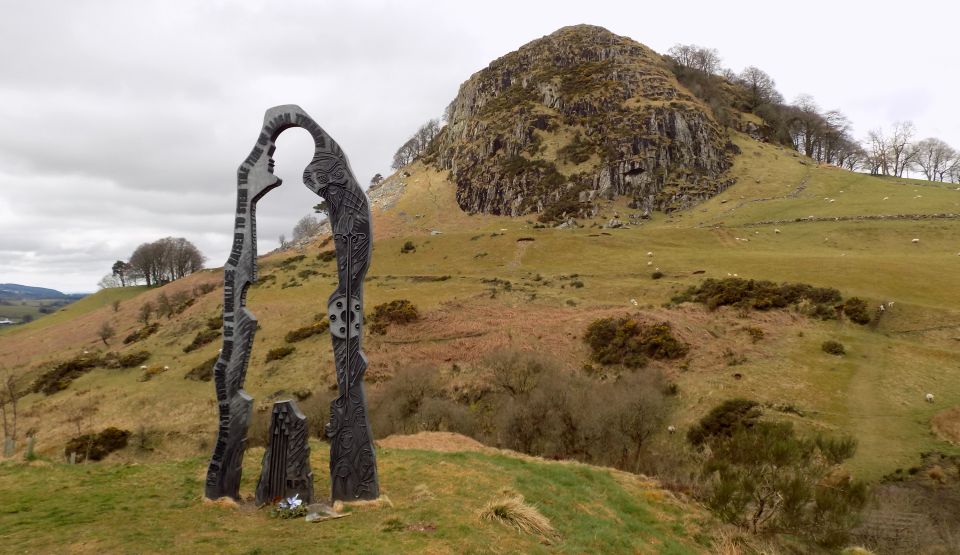 Loudon
Hill
from "Spirit of Scotland" monument to the Scottish hero William Wallace |
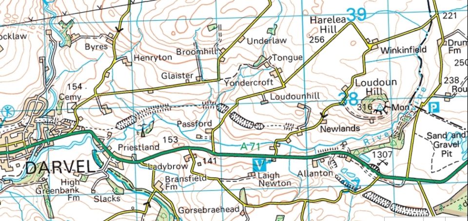
Map
of Darvel and Loudoun Hill |
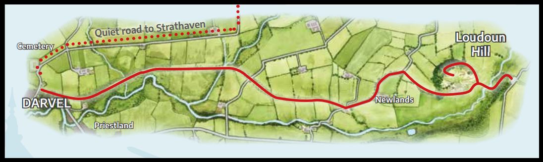
Route Map
of Darvel and Loudoun Hill |
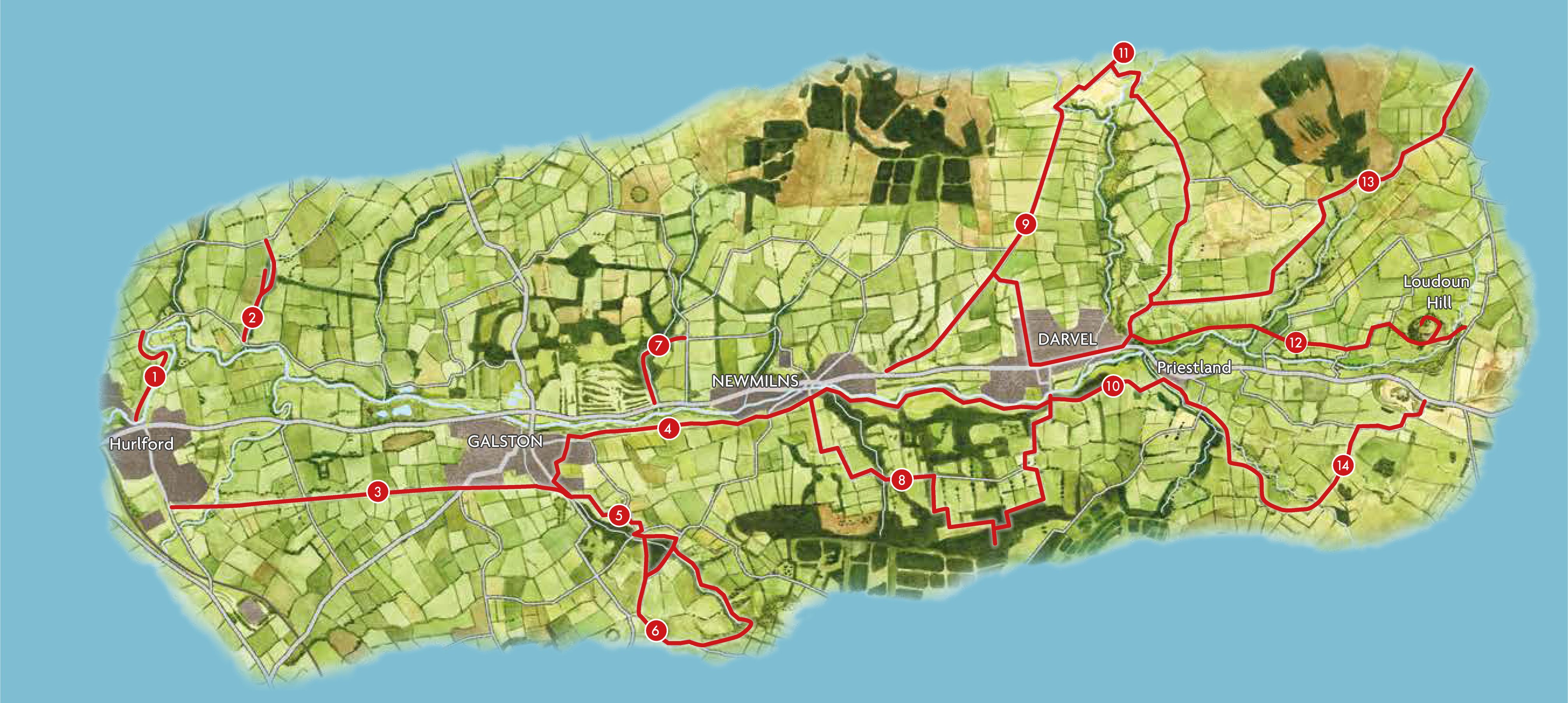
Map of Routes in Irvine Valley |
THE COVENANTERS TRAIL - ROUTE DESCRIPTION:
Ayrshire can boast glorious countryside with stunning views across the River Clyde to Arran and Ailsa Craig but the bucolic peace belies its bloody history.
The area suffered badly in the “killing times” of the 17th century during the fight for religious freedom in Scotland.
This began with resistance to changes imposed on the Church of Scotland by King Charles I who wanted itto align with the Church of England with him as its head.
The discontent turned to armed resistance under King Charles II who tried to crackdown on dissenters. Ministers who refused to kowtow were dismissed from
their charges but, rather than give up, they began holding services or “conventicles” for their faithful in the countryside.
These Covenanters were hunted down by government troops who killed those who resisted and the graveyard of Fenwick Church contains the bodies of more
Covenanters than any other graveyard in Scotland.
A new walking trail is now planned from the church to the Covenanters’ Museum seven miles away to make sure this important part of Scottish history is not forgotten.
The plan is being driven by the Lochgoin & Fenwick Covenanters Trust, chaired by Lord Rowallan, who is keen to make the history of the area better known. “It is a
very exciting project and we have worked on it for a long time,” he said. “It will be interesting for everyone, no matter their religion.”
Using forest tracks and existing public byways, the trail will begin at the museum on Lochgoin Farm on the edge of the Whitelees Windfarm. “There are
wonderful walks for everybody there and all we are wanting to do is create a bit more,” said Lord Rowallan.
Among other interesting artefacts, the museum contains the Bible belonging to the Covenanter Captain John Paton who handed it to his wife just before he was
hanged for his dissent. His farm is on the route of the proposed trail, along with the farm where Covenanter James White once lived before he was captured and had his
head chopped off.
There are also the notebooks of John Howie of Lochgoin who is commemorated by a large obelisk in a field near the museum.
Many conventicles were held on Fenwick Moor, the deepest peat bog in the world, as the Covenanters could easily spot any soldiers from this vantage point and the
rough terrain slowed down any pursuers.
Lord Rowallan, however, is quick to point out that the new route will not cross any bogs and will be suitable for walkers, cyclists and horseriders.
An app is being created to help people follow the route and find points of interest along the way.
The Trust is Working with East Ayrshire Council to finalise the route and East Ayrshire Leisure has also just created new routes in the Irvine Valley.
The new leaflet, Irvine Valley Trails, shows 14 different routes through Hurlford, Galston, Newmilns and Darvel with the most easterly of these from Darvel
to Loudon Hill, another iconic place with Covenanting links. There will also be a new circular path at The Afton waterworks in New Cumnock.
The path has been in disrepair and unpassable in one section but new signage and infrastructure is to be carried out through a collaboration between the
NC Path Warriors, the New Cumnock Development Trust, Community Windpower and Scottish Water to complete a 5km route around one of the town’s iconic places.
As it is on the edge of the Dumfries and Gallow and Southern Ayrshire Biosphere and close to the Southern Upland Way, the route will allow people to enjoy the views
and wildlife and find out more about the Covenanters, Robert the Bruce and William Wallace who all have links to the area.
The Gilllian’s Walks website also promotes interesting walks in Ayrshire, including Peden’s Cove at Failford.
This two mile walk is hidden inside Ayr Gorge Woodland, a Scottish Wildlife Trust reserve. Here a beautiful and ancient woodland is formed around a red sandstone
canyon, which gives the water of the River Ayr a vibrant red appearance when the sun shines directly onto it.
Peden’s Cove, a set of steps carved into the red sandstone cliffs, is reached a mile along the footpath and makes an enjoyable walk for the whole family.
Glencoe | Ben Nevis | Knoydart | Isle of Skye | Isle of Arran | The West Highland Way
The Eastern Highlands | The Central Highlands | The Southern Highlands | The NW Highlands