This
walk is a short forest walk of three miles, less than two hours
duration, and it's all within the Trossachs National Park.
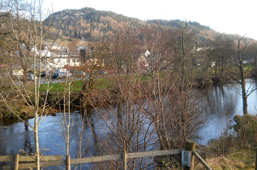
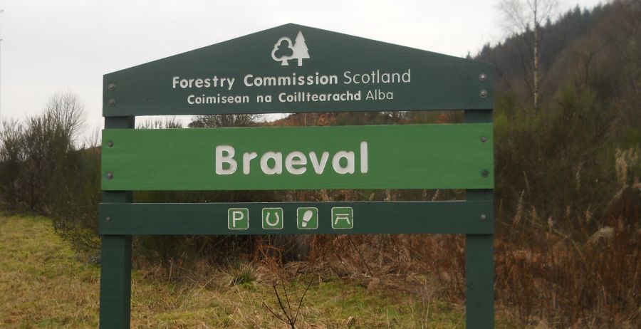
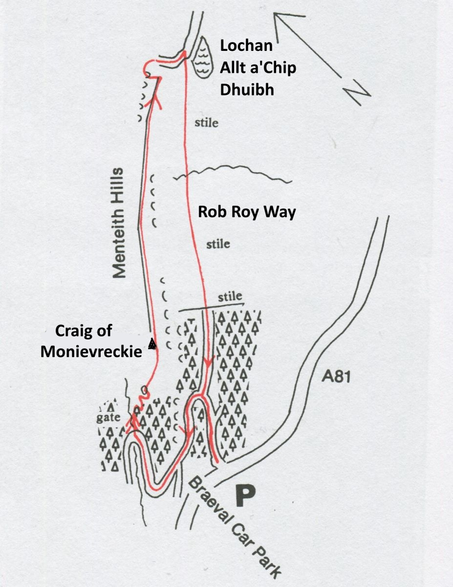
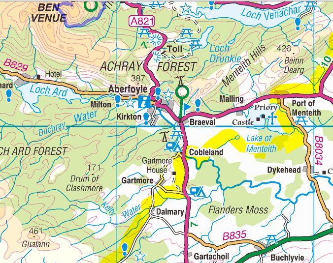
It starts from Braeval Car Park in Aberfoyle
which is about 400 metres on the left along the A81 towards Stirling from the Rob Roy Motel roundabout and
can be reached by car or, albeit
infrequently, by the Glasgow to Aberfoyle and Stirling
bus service.
Please note there are some steep sections in this walk as one might
expect as being part of the Menteith Hills.
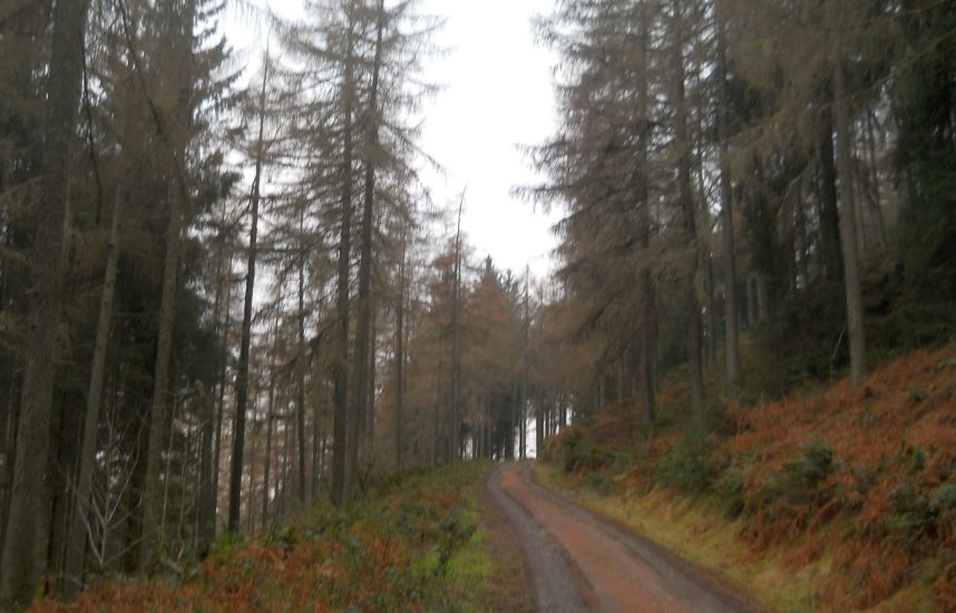
The
walk leaves the car park and follows the two green post markers on
the narrow track ( ignoring the path on the right ) which winds its way
uphill through the forest to emerge onto the forest track, now part of
the Rob Roy Way ( RRW ).
This is the first level track on the hillside and for this walk it is
recommended that it turns left, the reverse of the RRW northerly
direction.
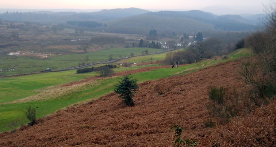
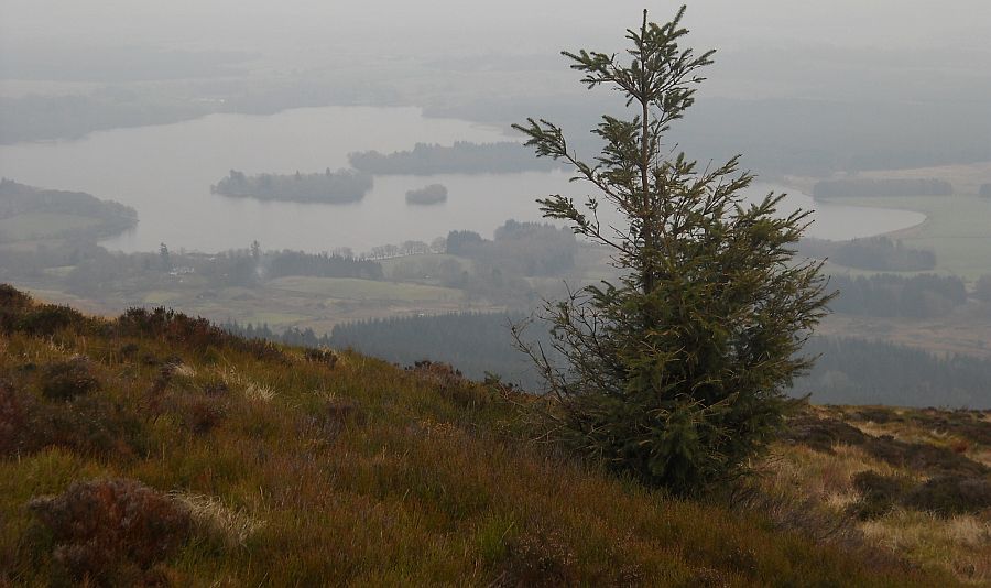
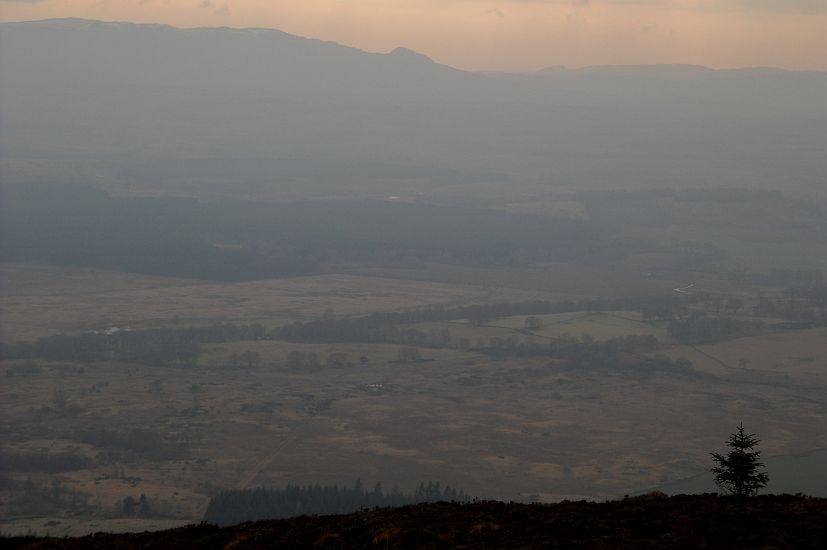
Soon the forest ahead is opened up to reveal the impressive mountain
view of Ben Lomond and below on
the left the fairways of Aberfoyle Golf Course and the countryside over
to the Campsie Fells.
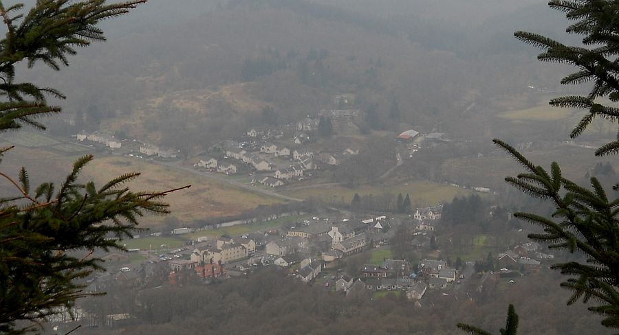
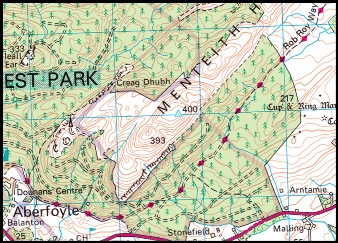
Continuing on this track will lead to the rear entrance to Dounans Camp
Centre in Aberfoyle
and to the paths leading up to David Marshall Lodge.
Well before the Camp and shortly before a red post marker, look out for
an uphill steep vehicle track on the right at a concrete T-marker.
The walk takes this path into a wood and passes to the left of the East
of Scotland Water Service Reservoir before emerging onto a higher level
forest track. It is best to take plenty of time on climbing up this
fairly steep path.
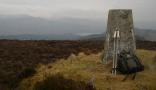
This is the highest point of the walk.
On turning right the walk soon gradually descends to pass first of all a
sharp left turn (track to the aerial mast and Lime Craigs ) and then
another left turn ( track to the Lake of
Menteith
viewpoint ).
On further descent, the walk reaches the RRW and continues ahead to
either a t-junction or to a narruw path on the right before the
t-junction.
If proceeding to the T-junction, the walk turns right to take the
forest track downhill and ignores the RRW track to the left towards Callander.
It passes the track to the left and at the end of the main track steps
round a green gate back to the car park.
If taking the narrow path, look carefully to the right for this path
after joining the RRW. It is an interesting alternative to take as it
leaves the wide forest track and winds its way downhill through the
forest to exit at the green marker posts in the car park.
MENTEITH LAKE
VIEWPOINT WALK - ROUTE DESCRIPTION:
This
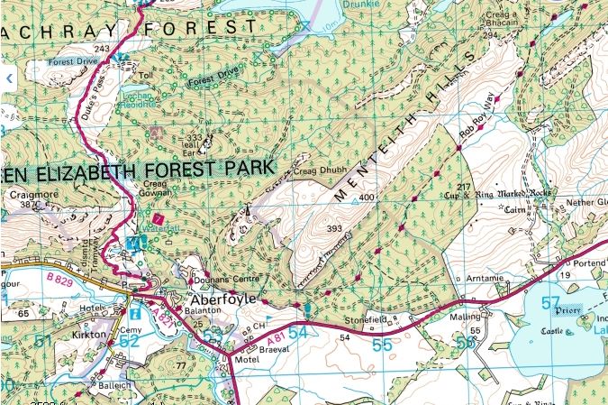
walk from Braeval Car Park at Aberfoyle is
a circular one of five miles and three hours’ duration.
Although mostly within the forest area there are also lovely
picturesque views to be seen on reaching the Lake of Menteith viewpoint.
The car park is located a short distance on the left along the A81 to Callander from the Rob Roy Motel roundabout
at Aberfoyle.
The walk leaves the car park onto a wide forest track and follows the
blue and green marker post uphill.
It passes round the green swing gate onto a track, usually of good
walking condition, but has become softer with tree harvesting and
vehicle traffic.
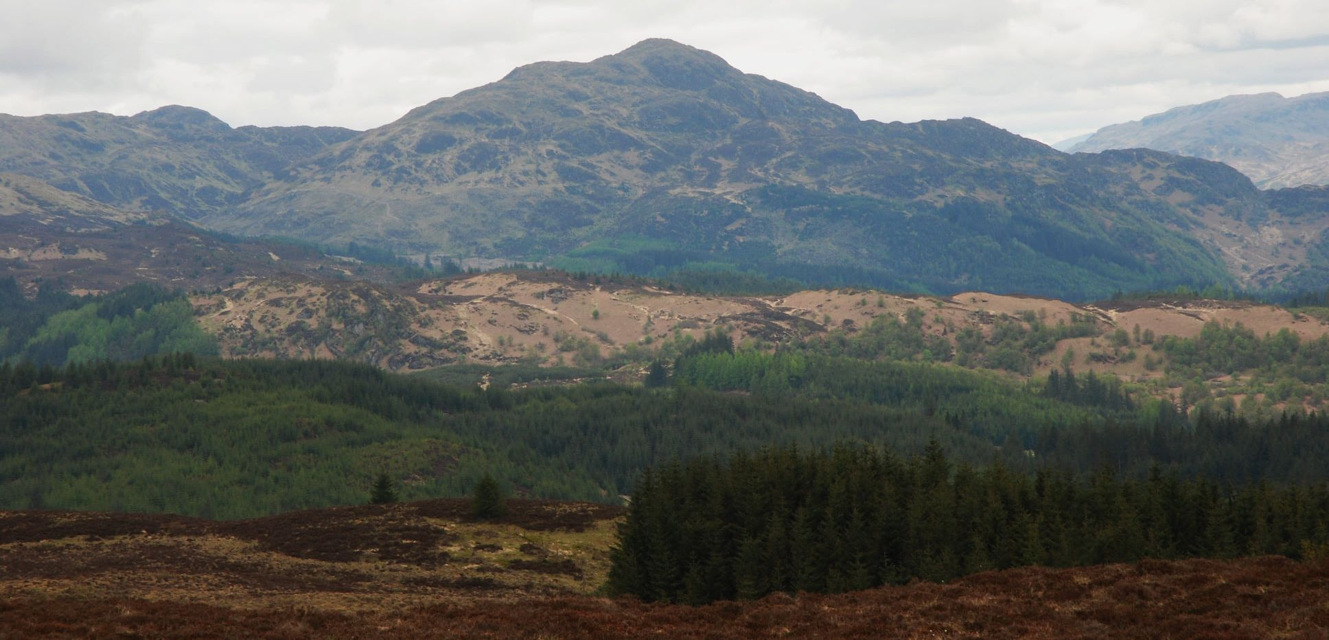
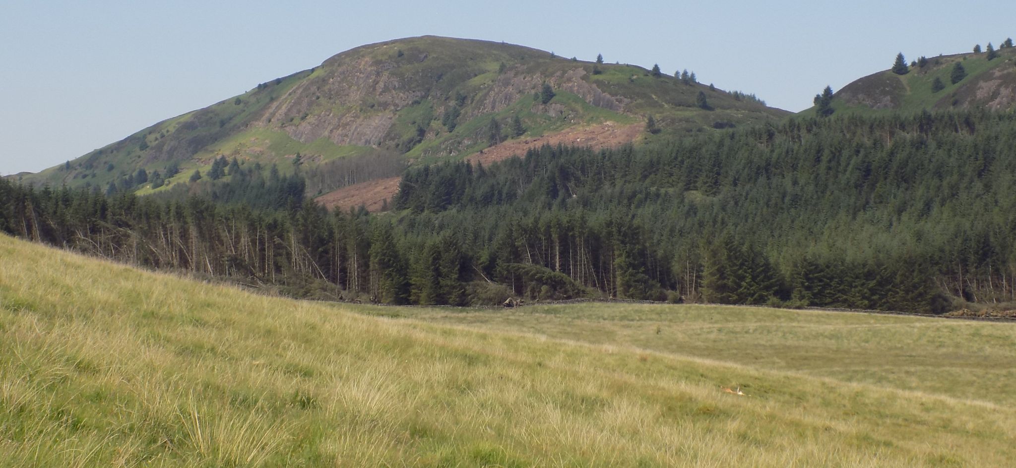
Views of the Gargunnock Hills are
to the right.
At the fork junction, the walk takes the left track and shortly joins
up with the Rob Roy Way track from the left.
It continues straight ahead and starts to climb gradually uphill.
Take plenty of rests and time to look around on the uphill stretches as
deer are to be spotted in the surrounding forest.
it is also worth pausing at the pond reservoir onthe right created from
the many inlet mountain streams.
The walk ignores the blue marker post on the right - look out for a
clearing on the left where it is possible to
locate the position on the hillside above the lower fir tree line as
the viewpoint and the return downward track from the viewpoint.
Having spotted this, the path to the viewpoint is only a short distance
ahead on the left and opposite the vehicle turning point.
It is a narrow path which veers backwards initially and then turns
round to wind its way up the hillside.
The climb, although fairly steep, is assisted with wood and rock steps
and also a wooden railing.
At one time there were signed markers to the viewpoint and also a seat
bench and picnic table but these have all been removed.
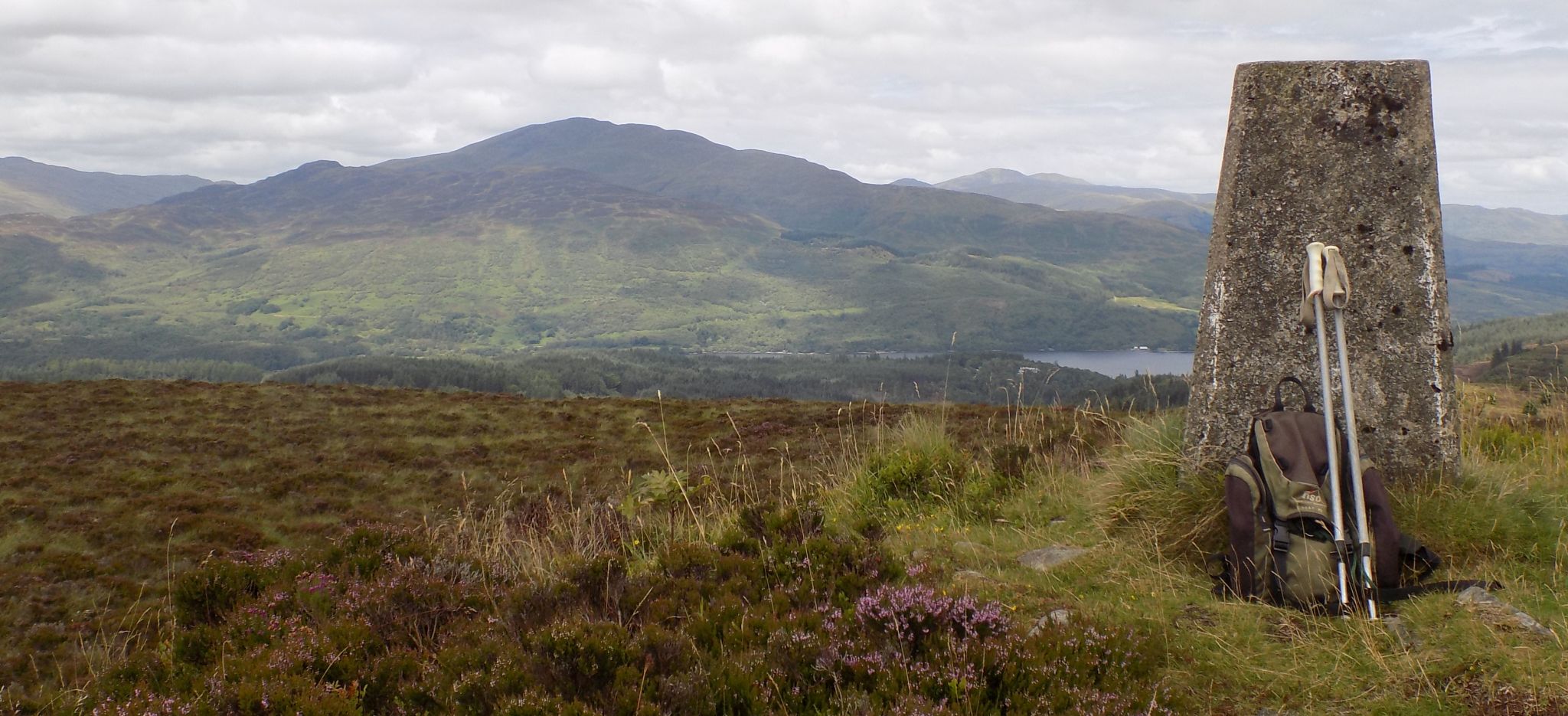
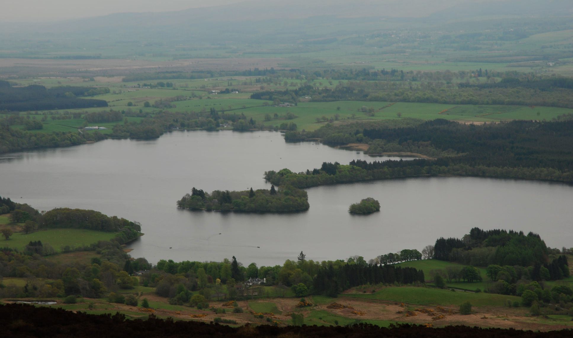
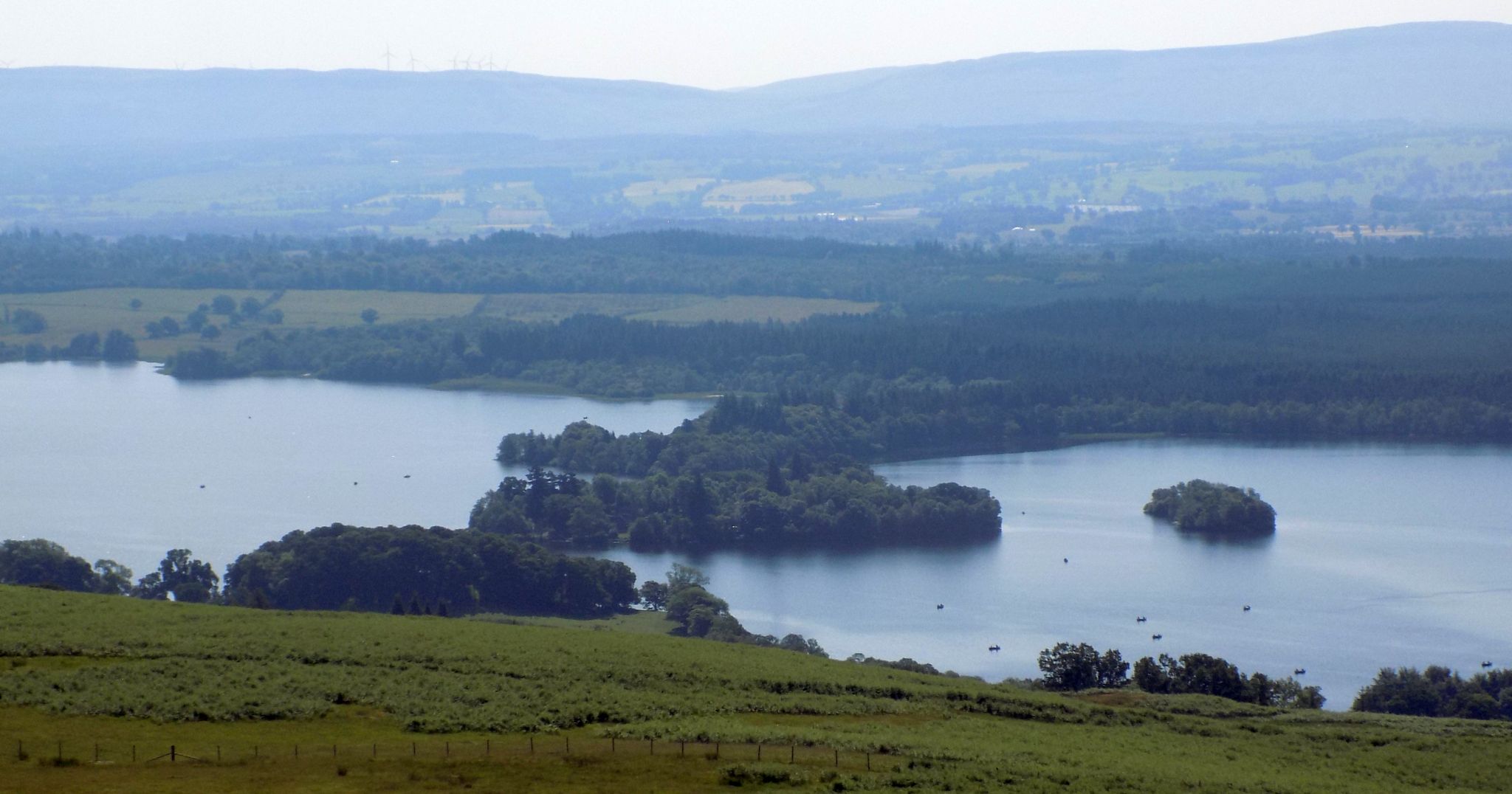
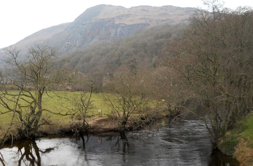
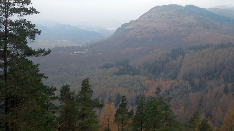
The view from the top is, however, worth the climb as on a clear day in
addition to the Lake of Menteith in the foreground it is possibleto see
the Wallace Monumént, Stirling
Castle, Dumyat, Ben
Cleuch, Grangemouth and the Gargunnock Hills.
At the top, the walk turns left onto a forest track and gradually
descends through the forest.
It turns sharp left at the first junction and at the next T-junction it
turns right onto the southerly direction of the RRW with views over to
the Campsie
Fells and Dumgoyne.
Shortly, opposite a right hand bend on the track, the walk is completed
on taking the narrow path on the left which winds its way down the
hillside to exit at the green marker posts in the car park.
The
Lake of Menteith
The Lake of Menteith is a loch located on the Carse of
Stirling, the flood plain of the upper reaches
of the rivers Forth and Teith.
Until the early 19th century, the more usual Scottish name
of Loch of Menteith was used.
The only settlement of any size on the Lake of Menteith is Port
of Menteith.
Situated on the largest island, Inchmahome, is Inchmahome
Priory, an ancient monastery.