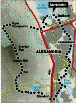
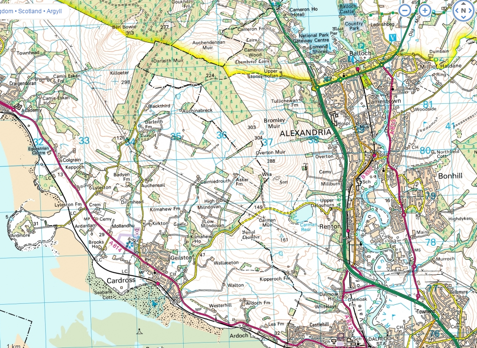
Glasgow Visitor Guide - Colin Baxter Glasgow Insight Pocket Guide

 River Clyde Walkway

Renton to Balloch
Rough Guide Scotland Lonely Planet, Walking in Scotland


Photographs of a walk from Renton

alongside the River Leven

 via Alexandria to Balloch

and Loch Lomond

for view of Ben Lomond


Pedestrian bridge over the River Leven at Renton

Pedestrian footbridge

 over the River Leven

 at Renton


Milton Crags from the River Leven

Milton Crags

from
the River Leven


Bromley Muir from the River Leven at Renton

Bromley Muir

from
the River Leven

 at Renton


Bonhill Parish Church across River Leven from Alexandria

Bonhill Parish Church

 across River Leven

 from Alexandria


Bonhill Bridge over River Leven at Alexandria

Bonhill Bridge

 over River Leven

 at Alexandria


Whisky distiller warehouse at Alexandria from River Leven

Whisky distiller warehouse

 at Alexandria

from River Leven


Marina on River Leven at Balloch

Marina on River Leven

 at Balloch


Boats in Marina on River Leven at Balloch

Boats in Marina

 on River Leven

 at Balloch


Boats in River Leven at Balloch

Boats in River Leven

 at Balloch


Balloch Castle Country Park across the River Leven

Balloch Castle Country Park

across the River Leven


"Maid of the Loch" paddle steamer on Loch Lomond at Balloch


Ben Lomond across Loch Lomond from Balloch


Luss Hills across Loch Lomond from Balloch


Route Map for River Leven, Carman Reservoir and Bromley Muir

Route Map for River Leven,

 Carman Reservoir
& Bromley Muir


RENTON TO BALLOCH - ROUTE DESCRIPTION:


Location: Vale of Leven, West Dunbartonshire
Map: 0S Landranger 63 ( 56 includes parking )
Distance: 10miles ( 16km )
Time: 4hours 30minutes
Terrain: tracks and paths

If snow or bad weather is keeping you off the high hills, this is an excellent 
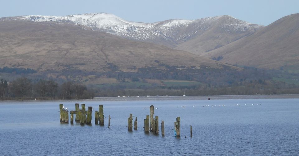
lower-level walk offering fine views across Loch Lomond and over the Vale of Leven to the Clyde. A word of warning, though: it is quite long and the descent from the trig point to the Stoneymullan track is very marshy in places. Walking boots and gaiters or wellies are highly recommended.
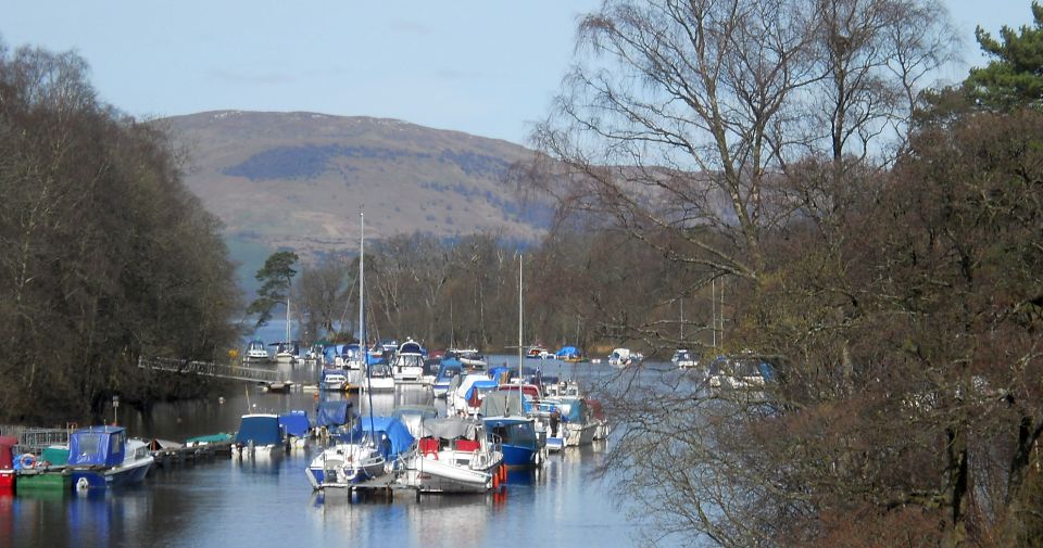
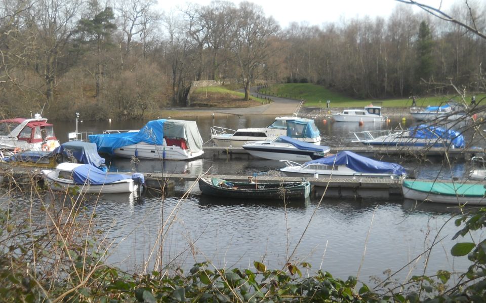
From the large car park at Lomond Shores at the southern end of
Loch Lomond, easily accessed from Balloch station, skirt the loch shore past shops and Drumkinnon Bay. Continue straight ahead over an access road to the 
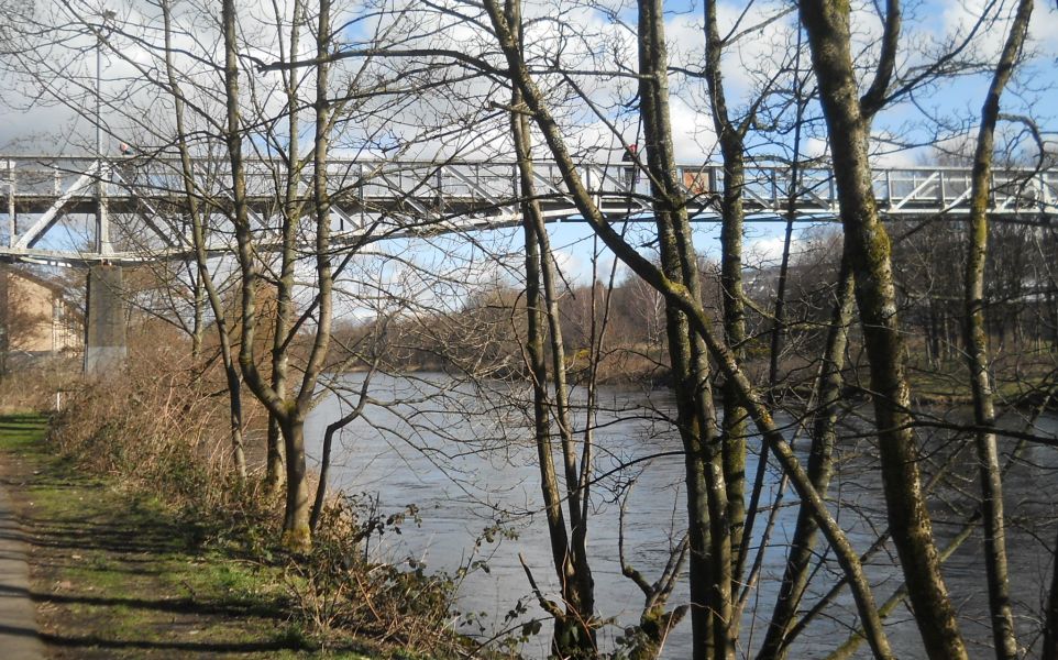
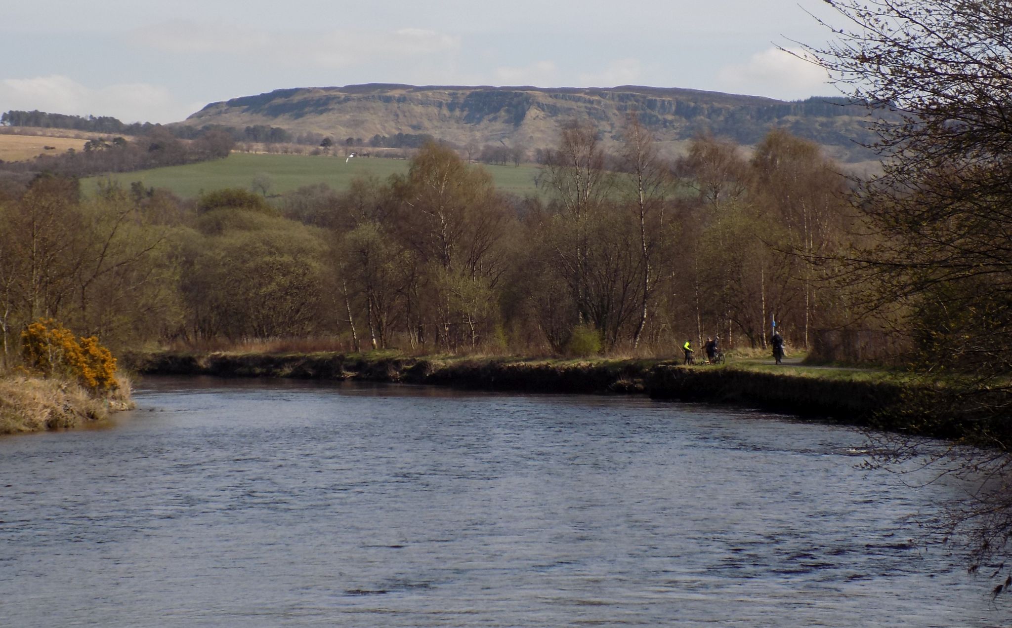
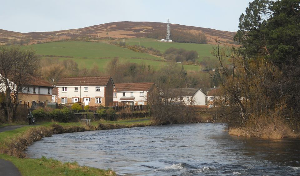
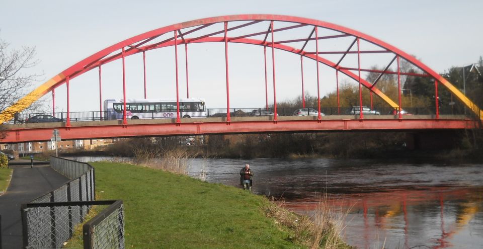
tarmac cyclepath alongside the River Leven and follow it south.
The cycle route is surprisingly rural — the banks of the broad fast-flowing River Leven are flanked by trees and surrounded by wildlife. A short distance before Renton, just after the route cuts inland to avoid a loop in the river, a signpost points right to
Renton and the railway station.
Don't turn here, but continue past the houses and ascend a path to a footbridge over the river. Continue rightwards to the main road, cross over and left. then right into Station Road Before the station, turn left down Back Street past Renton Primary, then right over the railway. Keep right, signposted Cardross, and ascend to a footbridge over the A82. After this, turn right past houses then left, signposted again, up a track to a path through a tree-lined corridor between fields and a stile leading to Carman Muir. The moor is boggy in places, but avoid the worst by sticking to
embedded rocks and a turfed wall on the left. Follow the path round Carman reservoir and turn left ( Cardross ) at the signpost, ascending to lone trees on the skyline with pylons beyond. The path sticks to the high ground then turns right and descends to the main road and an access road, the Right of Way to Cardross. A short distance along, head off right on a track to the back of the disused sandstone quarry and ascend the open hillside to the rocky hill topped by Carman fort, a Dark Ages citadel with 12 stone houses.
From the top follow the grassy track down then up over Overton Muir, veering left to a fence and gate, from where a more distinct track leads to the trig point above Bromley Muir. You can avoid the worst of the marsh as you descend the
Stoneymullan track to an access road and footbridge over the A82. Continue down to Balloch and follow the main road left, then right to the car park.


Map of Dumbarton, Alexandria and Balloch area

Map of Dumbarton, Renton, Alexandria and Balloch area

 Renton - Balloch Gallery
Photo Gallery

<< BackBearsden Walks IndexNext >>


Scotland Index :: Scottish Peaks :: Scotland Walks

Glencoe | Ben Nevis | Knoydart | Isle of Skye | Isle of Arran | The West Highland Way

The Eastern Highlands | The Central Highlands | The Southern Highlands | The NW Highlands


Adventure Travel : Worldwide Mountaineering : Site Index

fb icon  google+ icon Linkedin icon  twitter


Guide Books & Maps - Scotland:-


Western Scotland & the Western Isles OS Road Map Northern Scotland OS Road MapSouthern Scotland OS Road Map Glasgow Popular Hills - Map


Old Bearsden Glasgow - A Portrait  Glasgow from the Air  Glasgow - No Mean City  Lost Glasgow  Glasgow - The Real Gorbals Story  

Glasgow Visitor Guide - Colin Baxter Itchy Insider's Guide to Glasgow Glasgow Footprint Pocket Guide Glasgow Insight Pocket Guide Glasgow Guide Pub Companion Glasgow Scotland's Highlands & Islands - Rough Guide Scotland - Rough Guide

Glasgow Insight Pocket GuideCollins Street Map of GlasgowGlasgow: Then & NowThey belonged to Glasgow Phillips Street Atlas of Glasgow & West Central Scotland Glasgow: The Photographic Atlas100 Hillwalks around Glasgow 50 Walks in Glasgow & SW Scotland

Visit Scotland - Touring Guide Scotland: Where to Stay - Hotels & Guest Houses Scotland: Where to Stay - Bed & Breakfast Rough Guide ScotlandScottish Highlands & Islands - Rough Guide Scotland - Lonely PlanetScotland's Highlands & Islands - Lonley Planet Great Glasgow StoriesGlasgow & Surroundings - Insight Guide

West Highland Way: Official GuideWest Highland Way: Rucksac ReadersWest Highland Way: TrailblazerThe West Highland WayWest Highland Way: Footprint MapWest Highland Way - Map West Highland Way - Map West Highland Way Wet Highland Way - Official Guide

Munro Almanac The High Mountains of Britain and Ireland The Munros: Scottish Mountaineering Club The Isle of Skye The Isle of Arran Wilderness Walks Ski Mountaineering in Scotland

More Wilderness Walks 50 Best Routes on Skye and Raasay Skye - W.A.PoucherMagic of the Munros Mountaineering in Scotland and Undiscovered Scotland by W.H.MurrayA Long Walk on the Isle of Skye

Classic Climbs - Central & Southern Highlands The Isle of Arran Lonely Planet, Walking in ScotlandPathfinder Guide: Skye and NW Highlands WalksPathfinder Guide: Fort William and Glen Coe Walks Rambler's Guide: Ben Nevis and Glen Coe50 Best Routes on Skye and Raasay - Chris Townsend


Google Analytics


Google Analytics

extremetracking
 eXTReMe Tracker


extremetracking
Sitelock caingram.com
SiteLock
Sitelock
Sitelock caingram.info
SiteLock
Sitelock