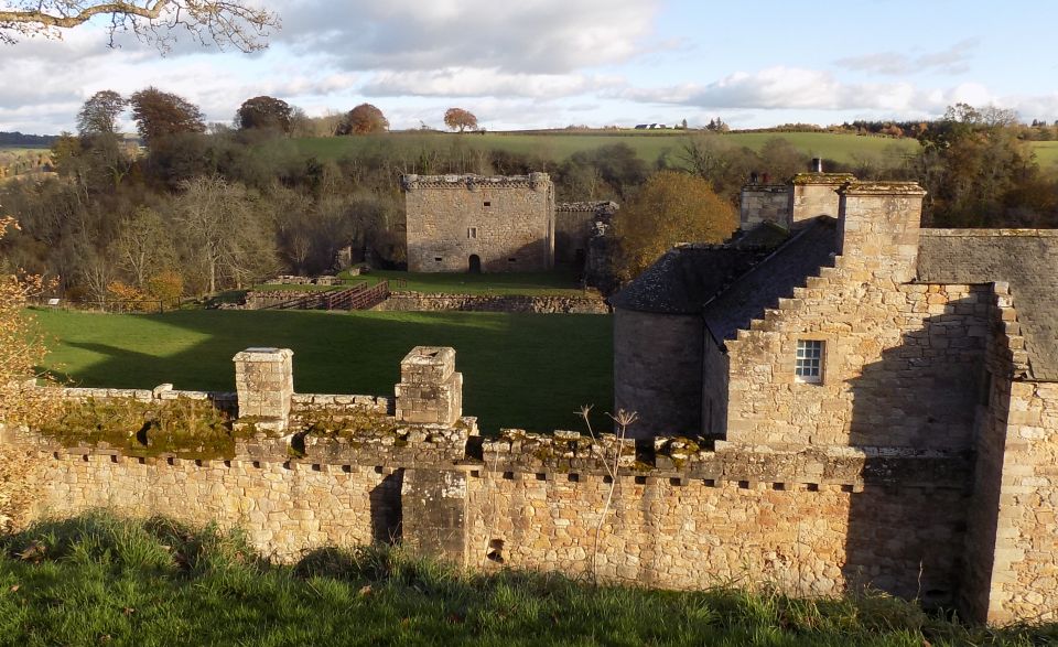
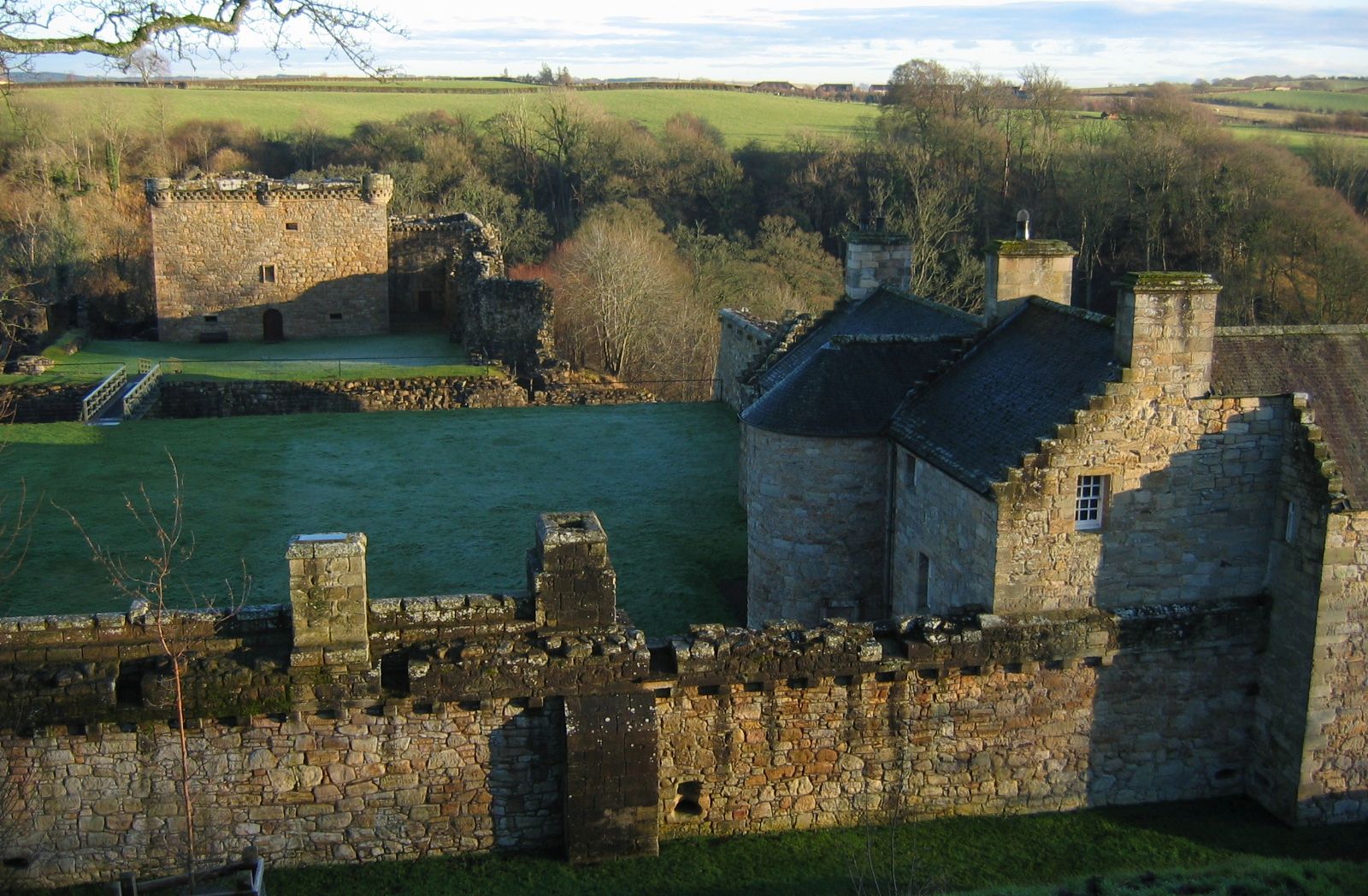
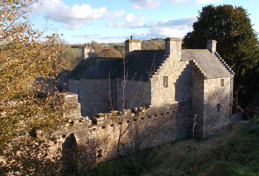
Craignethan
Castleis located
above theRiver
Nethan,
a tributary of theRiver
Clyde .
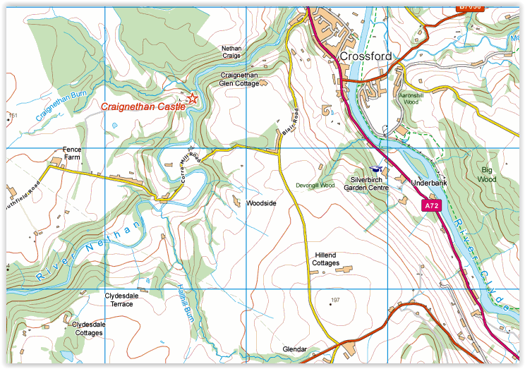
The castle is two miles west of the village ofCrossford, Built
in the first half of the 16th century, Craignethan
is an excellent early example
of a sophisticated artillery
fortification.
Location: South
Lanarkshire
Maps : OS
Landranger 72
Distance: 4
miles (6.5km)
Time: 2 hours
Grade: short
walk but with steep climbs
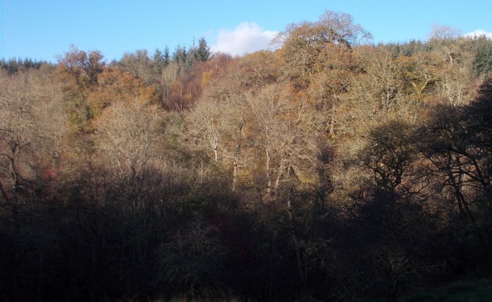
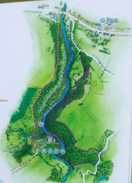
This walk takes in a
fascinating but little-known castle, a fine nature reserve in a gorge
and great views
from several
points along the way. The Lower Nethan Gorge is -part of the scattered
woods that make up
the Clyde Valley
Woodlands National Nature Reserve. The entry sign features a badger and
although these
animals are
found here you Will be lucky to see one as they mainly come out at dawn
and dusk, and keep well
away from
people. From the starting point the path climbs steadily with quite a
few steps, so take your time and enjoy the mature trees,
which include birches. Views into the gorge are restricted due to the
tree cover but you will hear the river flowing
below. The slope eases and the path, now more level, runs next to a
fence before descending to a bridge over a burn.
There is a
viewing platform on the left from which you can see dowm the gorse and
get your first glimpse of
the castle up
ahead. At an open grass area, fork left, up steps to the entrance to
the castle at a gate. The way in to
the castle is
just ahead and to the right. Craignethan is a superb place which played
an important role in a
turbulent period
of Scottish history. The castle was started in the 1530s by Sir Iames
Hamilton of Finnart
and later held
by the Earl of Arran, Regent to Mary, Queen of Scots. After the queen’s
defeat at the Battle
of Langside in
1568 the Hamiltons surrendered Craignethan and nearby Cadzow but took
them back the
following year.
The queen then left Scotland, never to return, and in 1579 the
Hamiltons themselves were forced
into exile and
the castle was taken over by Protestant forces.
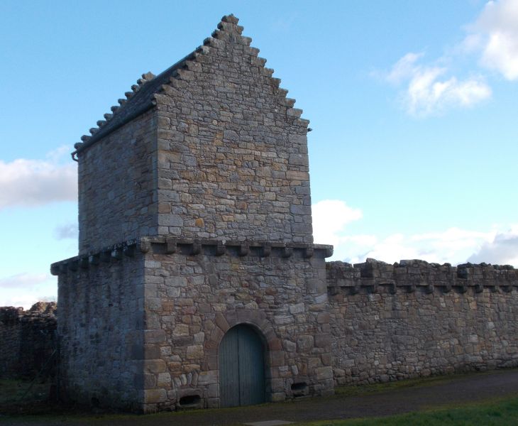
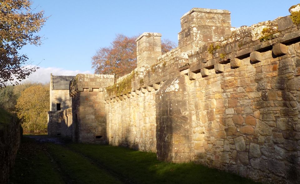
The castle is
sturdy and cleverly sited, and excavation in recent times revealed a
rare example of a defensive
fortification
known as a caponier, intended to provide protection from artillery
bombardment. It is well
worth looking
round and you can buy an excellent guidebook to help you.
When you are
ready to leave, take the access road away from the castle.
At a T-junction,
go left and continue on the road, passing a group of houses at
Tillietudlem then a development
called Nethan
Lodge. The name Tillietudlem was used by Sir Walter Scott in his novel
Old Mortality and
a tradition grew
that associated this name with Craignethan Castle.
The road
descends steeply round a couple of sharp bends and crosses the Nethan.
Keep a
careful eye out for traffic.
Pass Corra Mill
( the same name as the waterfall on the Clyde above New Lanark ) and
then tackle the tough little climb back up out of the valley.
Continue to a
T-junction and turn left for the final descent back to Crossford.
There are
beautiful views across the Clyde Valley on this stretch, and looking
back you can see Tinto
standing proud
above the surrounding countryside.
This part of the
Clyde Valley used to be famous for its tomatoes but the main focus now
is on garden centres
selling a vast
array of consumer goods. At least they also have excellent cafes where
you can enjoy a break after
your walk.
Pass a few
houses and then look carefully for a narrow path on the right. This is
a local right of Way. Walk
down the very
narrow path between well-kept beech hedges, passing glasshouses on the
left.
Continue down to
the main road and turn left, back to the car park at the end of a short
but satisfying walk.
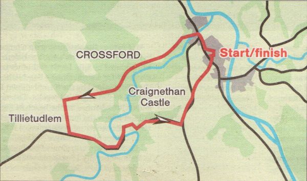
Route:
Start and finish at Crossford car park, behind the
Community Hall (GR: NS826467).
Walk to the main road and TR.
Pass the Tillietudlem lnn.
Cross the road
and after crossing the Nethan, TL on the signposted
path. The path climbs
quite steeply
with several flights of steps then descends
another stepped section.
Cross a small
burn and at an open grass area go lelt up
steps to the castle gate.
Leave the castle
by the access road.
At a
T-junction go L and follow this narrow, twisty road down to
cross the Nethan and
then steeply up
again.
At a T-junction TL, pass houses and in a
further 300m look tor a narrow path
between hedges on the R.
Follow this path down to the main road and TL back to the
car park.


 ::
Clyde River
Walkway
::
Clyde River
Walkway